
LesHamilton


Visited: June 5, 2017
Across the estuary of the River Naver from Bettyhill stands a steep 80 metre tall hill bearing the broch Baile Mhargaite on its summit.
It’s a walk of around 1.5 kilometres from the bridge over the River Naver at Invernaver, across grass then sand to the broch, following a rough path to the south of Baile Mhargaite beside a steep stream. It is best to continue a little past the broch as the easiest ascent is from the west.
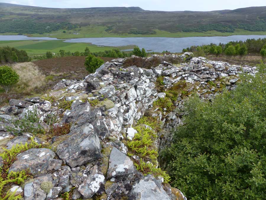
From the outside, this broch is little more than a tumbled mass of stones, but the interior wall is well preserved all the way round the structure, to a visible height approaching two metres. In reality, the true height of these walls is probably as great as five metres as the interior of the broch is deeply infilled by blown sand (hence this sometimes being dubbed the ‘Sandy Broch‘).
You can read more about this site at Canmore, who also provide an aerial colour photograph of the area.

The steep crag bearing Baile Mhargaite as viewed from the shore below.
Image credit: Les Hamilton


Overlooking the broch from the neighbouring height.
Image credit: Les Hamilton


The shapeless profile of Baile Mhargaite from the west.
Image credit: Les Hamilton

A stretch of neat interior walling courses at Baile Mhargaite.
Image credit: Les Hamilton


Stitched panorama of the interior of Bale Mhargaite broch. The true height of the walls is concealed by up to 2 metres of wind-blown sand.
Image credit: Les Hamilton

Dùn Maraig, seen from the summit of Dùn View to its north.
Image credit: Les Hamilton

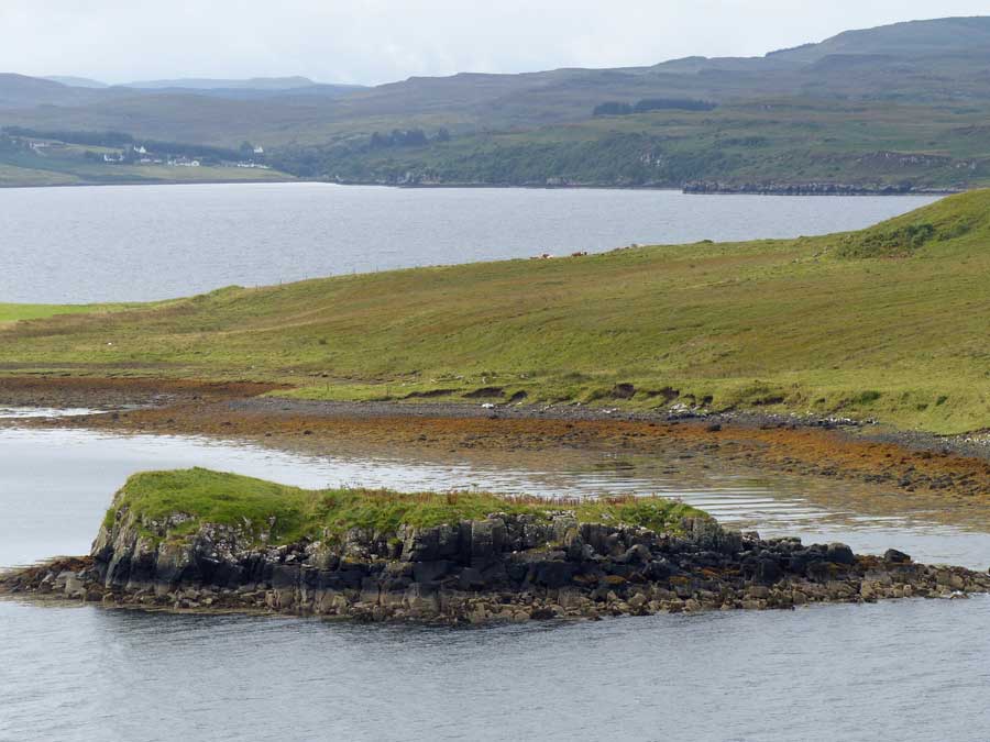
Dùn Maraig viewed from the mainland to the east at low tide.
Image credit: Les Hamilton

The former causeway shows as a slightly curving line among the weed-encrusted boulders to right of centre in this photograph.
Image credit: Les Hamilton

Looking along the line of the former causeway from the shore.
Image credit: Les Hamilton

Walling courses at the northwest of Dùn Maraig.
Image credit: Les Hamilton

Impenetrable seaweed-covered boulders below the walling courses at the northwest of Dùn Maraig.
Image credit: Les Hamilton

Seen from below, the only evidence of an entrance passage to Dùn Maraig is this slight dip on the skyline above the jumble of displaced foundation blocks.
Image credit: Les Hamilton

The outline of the remains of a rectangular structure are just discernable beneath a thick carpet of grass and bluebells.
Image credit: Les Hamilton

A tumble of huge defensive blocks to the east of the entrance to Dun Maraig.
Image credit: Les Hamilton

The causeway stretches away from Dun Maraig in a slight curve, marked by a scattering of large boulders.
Image credit: Les Hamilton
Visited: May 25, 2017
I parked in a disused quarry half way along the Cuidrach road as the occupants of two mobile homes sat in the sunshine enjoying breakfast on this fantastic morning. The walk down to the shore then round to the neck of land to the southeast of Dùn Maraig is a pleasant two kilometres.
As luck would have it, my visit to Skye coincided with New Moon (on this actual day), which meant that neap tides were the lowest of the month. And to be sure, the islet of Dun Maraig lay absolutely high and dry—the perfect opportunity to make the short crossing and investigate the site. So, armed with two walking poles, I set out across the seaweed-encrusted boulders towards the dùn, taking what looked to be the shortest distance. The poles were a great help in keeping upright on the slippery weed, but the crossing was not difficult at all (stout boots advised, though).
Arriving at the northwest of Dùn Maraig, huge foundation blocks with the remains of four walling courses of smaller stones above them rose above me. But further progress was impossible on account of the seaweed-covered boulders that would have had to be climbed. I continued round the islet, to the southeast along a fairly easy terrace until a dip in the grassy surface above signified what was presumably the entrance to the dùn. Here it proved easy to ascend to the top of the islet’s defences. Interestingly, there is no evidence of a ‘built’ entrance passage, just the slight grassy dip through the boulders. To the east of the entrance, defences resumed in the shape of some particularly large walling blocks, now largely collapsed, hinting that this must have been an impressive fort in its heyday.
The summit of Dùn Maraig is mainly grass-covered, with a splendid bloom of bluebells at the time of my visit. Walking round the islet, it was found to be defended by cliffs the length of its north and east coasts, walling only apparently having been necessary on the lower west and south sides. Canmore refers to the remains of two oblong structures on the islet, and one was just discernable beneath the lush overgrowth of vegetation.
Dùn Maraig was originally attached to the mainland by a gently curving causeway, marked out by large boulders on each side, most of which are now long gone. This was the route I chose to make my departure, and the walking was really firm and easy, much more so than the inward route chosen, and I barely required the walking poles to negotiate it.
For those disposed for exploring off the beaten track, this is a wonderful little expedition. Just one word of warning: consult tide charts (I used data for the Isle of Lewis—just across the Minch—which was the closest I could find) and ensure you don’t become marooned by a rising tide.
Visited: May 23, 2017
After crossing a footbridge across the stream behind Torrin Outdoor Centre, a track follows the coast southwards as far as two cottages. Beyond the second cottage, a footpath can be found rising up the hillside towards Dun Mor. At length this meets a fence, over a metre high, but a strategically placed boulder assists its crossing, and the path continues beyond it into the scrub that encircles the summit of the hill.
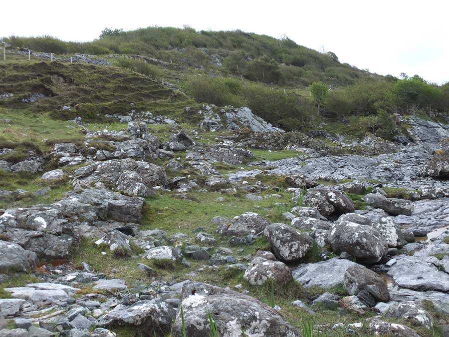
This scrub is not impenetrable, and minimal route searching is needed to fight through it for perhaps 50 metres until a stone wall comes into view: this is the latter-day cattle fold that was constructed by destroying almost all the original stonework of the fort. This construction fills almost the entire area of the fort, which is grassy with a number of bedrock intrusions.
The only significant remaining stretch of the original wall of this fort stands in its northwest corner where huge stones reach to almost two metres (topped by a scattering of broken fragments that don’t belong there). From outside the cattle fold you can still see evidence of foundation courses of the walling, which was either double—or galleried—as shown in one of the photographs. At the far end of the structure (in the southeast) a few large foundation blocks remain in situ with the modern wall built over them.
Viewed from the shore of Loch Slapin, about half a kilometre south of Torrin, Dun Mor rises as a tree covered dome.
Image credit: Les Hamilton

Looking out from the cattle fold through its entranceway.
Image credit: Les Hamilton

The interior of Dun Mor, its grassy summit ringed by scrub and its original stonework destroyed to build a huge cattle fold.
Image credit: Les Hamilton

The walling of the cattle fold is of poor construction, and fabricated from fragments of the destroyed original fort wall.
Image credit: Les Hamilton

This 2-metre tall section of the original dun walling has been incorporated into the cattle fold’s northwest corner.
Image credit: Les Hamilton

The original dun wall from above, over a metre wide.
Image credit: Les Hamilton

The short stretch of original dun wall, seen from above.
Image credit: Les Hamilton

Seen from outside the northwest corner of the cattle fold, you can still see the formidable foundation courses of the original fortification.
Image credit: Les Hamilton

A view of Dun Grugaig from the far end of its internal court – with masses of blubells in full bloom in late May.
Image credit: Les Hamilton

A three image composite of Dun Grugaig from the interior court of the structure.
Image credit: Les Hamilton

Almost all the lintels of the entrance passage remain. The door checks in the entranceway are also shown.
Image credit: Les Hamilton

One of the bar holes, used to secure the original wooden door of the dun.
Image credit: Les Hamilton

It is not obvious, but this is a view of the three remaining stairs to the second level, highly obscured by undergrowth.
Image credit: Les Hamilton

Climbing the remnant stairs, it is just possible to get a peek into a section of the level-2 gallery (otherwise inaccessible).
Image credit: Les Hamilton

This view shows the prominent scarcement ledge that once supported the internal flooring of Dun Grugaig.
Image credit: Les Hamilton

This is a side-on view of the scarcement ledge.
Image credit: Les Hamilton
Visited: May 23. 2017
During this week on Skye I determined to revisit the amazing Dun Grugaig at Glasnakille, and if possible to find a more direct route to the semi-broch. This time I walked north from the same starting point as previously, and right to the northern boundary of the fenced area (almost opposite the next property on the road). Here I found a stile (which I had used previously, but which simply led into an almost impenetrable tangle of scrub and undergrowth). Ignore this stile!
Instead, walk a couple of metres past this stile, and follow the outside of the fence towards the coast. A reasonable footpath has been tramped here, so Dun Grugaig must receive quite a number of visitors. Follow the path until it levels off at a point where the fence turns to the right and an open area dominated by bracken lies ahead.
Here the path becomes obscured, but actually heads left through the bracken towards the next stand of birch trees. Just walk towards these trees, and you will resdiscover the path running between them directly to Dun Grugaig. Because the birch trees are now quite rampant, you don’t actually see the dun till the last moment, when you step out from under the trees.
The map below illustrates the path, including the short dog-leg from the fence through the bracken.
With more time to spend at the dun (rather than hunting for it), several previously unnoticed features came to light. To the right of the broch wall (in the interior) is a short flight of three steps, remnant of an original stairway to a second level. Climb these, and you can just catch a glimpse of a section of second-level gallery.
On the left-side of the wall is a promnent scarcement, a row of stones forming a ledge which would have supported one end of the original wooden flooring over the interior court.
The entrance passage is extremely well preserved, although one of its original complement of seven massive lintels has been lost. The broch would originally have possessed a wooden door, and door checks to keep it in place are prominent, as are bar holes in each side wall into which bars to secure the door would have slid.
This is a fascinating site, just five minute’s walk from the road. The first part of the path is quite steep and could be tricky when wet, but poses no real obstacle. Good walking boots, though, are recommended.

