
Seen with a little optical assistance from the northern cairn upon Bryn Rhosau
Image credit: Robert Gladstone

Seen with a little optical assistance from the northern cairn upon Bryn Rhosau


Looking more-or-less west (I think) across what appeared to be a mound... but is apparently a massive, heavily grassed cairn.


Domen-ddu – with its brace of monuments – can be seen top left.


Looking approx south toward distant Domen-ddu...


Pumlumon, source of the Severn, Wye and Rheidol... not to mention possibly the UK’s finest upland cemetery... forms the northern vista. Nature accorded the appropriate flourish

(arguably) Three cairns in a row. But let’s talk about the clouds...

Needless to say there was a major lashing awaiting in those clouds; critical saturation... the rucksack gives an indication of scale.

Looking across the southern cairn, with Cwmdeuddwr upon the left hand skyline.


The northern monument... of what I took to be a trio....


The western summit of Gwastedyn Hill... with 1977-vintage cairn and beacon... can be seen through the hill fog, top right.


Showing what could well be interpreted as the remains of a cist..

Travellers heading south upon the A470 – or at least those with a tendency to, perchance, lift their eyes above the horizontal plane – will note, upon leaving the limits of the busy town of Rhayader, a substantial ridge dominating the skyline. This is Gwastedyn Hill, and, although rising to no more than c1,565ft, the ‘summit’ is conspicuously crowned by a neat ‘beehive’ cairn of the type so beloved by visitors to the erstwhile ‘wilder’, more inaccessible heights of Cwmdeuddw feeding the famously nearby Elan Valley Reservoirs with their not inconsiderable watery excess. However, appearances, as are often the case, are deceptive here, for no Bronze Age VIP was interred upon that rocky spine. Indeed, a rusting iron lattice-work ‘beacon’, set upon a post beside the cairn, commemorates a much more recent event... that of Queen Elizabeth II’s 1977 Jubilee. An event which this then proto-Modern Antiquarian spent dressed as a pirate... well, as the wondrous Mr Ant said, ‘ridicule is nothing to be scared of’... attending the local street party, whilst Mr Rotten and his dodgy cohorts had their collars ‘felt’ by the Thames river police. And Rod Stewart apparently got to No.1. Apparently. Don’t get me wrong; The Pistols were just stupid kids.... but out of the mouths of babes, as they say. Curious how ‘criminality’ is sometimes defined, isn’t it?
Nevertheless should one decide to park up just beyond the sewage works (on the right) and follow the (unsigned) public bridleway, steeply up through trees beside a tumbling stream in the general direction of Bwlch-y-llys, an equally taxing pull up the bare north-west flank of the hill will bring ample reward in a fantastic panorama to all points of the compass. Here the Royalist can drink his/her fill... the prehistorian, however, must head to the true summit of the hill some way to the approx south-east, where.... well, to be honest I don’t think anyone’s been able to define just what the hell is going on.
Two things, however, are apparent to me today: the remains of a substantial cairn still stand at SN98686614... the Carn Wen (White Cairn), one of a number so named in the extended locality; and secondly, the inclement weather, the peripheral effects of Hurricane Irma no doubt, is certainly in no hurry to leave. But what can you do? Except offer heartfelt ‘thanks’ to the wondrous institutions of Berghaus and Karrimor for the blessings of their waterproof garments. Not so much in physical genuflection, you understand?.... but such a posture does have much to recommend it when faced with rain seemingly not in obeyance of the laws of physics.
In my opinion Carn Wen is worthy of the honour of such personalised nomenclature. As Coflein duly notes, it features “...the remains of a substantial bouldered kerb and a possible cist”. Always welcome features to find associated with one’s upland cairn. Furthermore, to seal the authenticity deal, as it were, “A battle-axe, a bracelet and some other relics’ were recovered in 1844 and a large erect stone was noted at the centre of the monument”. So, clearly, what we have here is but the shattered remnants of what once was. But it is enough. Large, erect stones notwithstanding. However there is more... apparently much more, for immediately to the approx north-west stands the circular ‘Druid’s Circle’ feature, currently interpreted as “a roundhouse and enclosure” (at SN98676615), whilst to the north-east, three further cairns have been recorded by CPAT. None of this detail was obvious to me, I have to confess. Although, in mitigation, lashing, freezing rain and swirling hill fog do tend to adversely affect observation. If not authentic upland vibe.
After a couple of hours the weather’s onslaught finally triumphs over my resolve and I descend back to the car... ironically in brilliant sunshine. Yeah, Gwastedyn Hill is a curious place. Just what an apparently prehistoric ‘enclosure’ is doing immediately adjoining a bone fide summit burial cairn is, of course, open to much debate. If Iron Age, perhaps it was indeed – for once – actually associated with those enigmatic Druid priests, holding ceremonies with meaning now lost in the mists of time, if no longer, thanks to penetrating sun, opaque mists of H20?


Hunter’s Tor itself can be seen centre right background

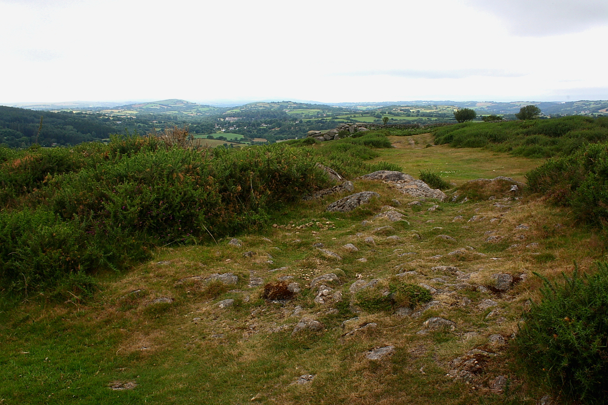
The outer defences are arguably most substantial to the approx south-east.

The eastern flank is heavily overgrown..... at least during summer.
Officially the bridleway skirts the ramparts... yeah, right.


According to Pastscape this aesthetically pleasing site located, with far ranging views, to the immediate approx south-east of the crags of Hunter’s Tor, represents the remains of a:
“Triple-ramparted hillfort of stone with shallow ditches, widely spaced with level berms 12m-15.5m wide between each rampart in the ttradition of SW England. Entrance is from the SE with the end of the middle rampart inturned to form an embanked entranceway which joins the innermost rampart. Entrance through the outer rampart and ditch via a causeway. The outer rampart and ditch are obscured on the slopes to the north and west. condition good despite the removal of much stone for field walls by farmers.“[sic].
Access is excellent since the hill fort is traversed by a public bridleway... however please bear in mind that car parking, if approaching from the north, is non-existent. I therefore left my car roadside at the nearby hamlet of Barnecourt and walked back down the road, ascending via Peck Farm.

I couldn’t make out/wasn’t aware of the apparent northern cairn... however, as can be seen, the southern is pretty substantial beneath all that vegetation.


Looking approx south past the southern cairn to Black Hill. There is a quintet of excellent cairns up there....


Locating the row in high summer is no mean feat... looking across Trendlebere Down from the southern cairn


