There is a prescient line within Gustave Flaubert’s ‘Madame Bovary’ which – anticipating the disillusionment seemingly inherent within today’s celebrity-obsessed culture – (roughly) translates as ‘You shouldn’t touch your idols; a little gold always comes off on your fingers’, this a full 120 years prior to the Pistols’ equally realist stance of ‘I don’t believe illusions ‘cause too much is real’. Fair play to the cynical French gentleman, I say... and Johnny is, well, Johnny. However, consider: while it’s surely good practice to view our heroes as the flawed constructs they most probably are beneath the promoter’s glossy sheen, what about the natural world beyond the confines of ‘Logan 5’s geodesic dome’? Should we refrain from venturing to apparently iconic landscapes in case they should disappoint? And what about those craving another brief taste of youthful triumphs many years later? Does not adventure depend – nay, thrive – upon a significant element of the unknown, the risk that things won’t necessarily go to plan?
Such are the thoughts swirling around my head – along with ‘don’t hit that landrover that’s just suddenly materialised around that corner’ – as I gingerly negotiate the seriously serpentine, single-track road penetrating deep into the heart of Y Rhinogydd, arguably Gwynedd’s roughest range of mountains, from Harlech, the latter’s magnificent fortress still possessing the capacity to make this currently rather unkempt jaw drop at its sheer, overwhelming solidity. The thing is, the rather clement weather conditions have placed me in a state of flux, in a quandary: should I stick to plan and seek out an apparently rather fine kerbed cairn overlooking Cwm Bychan at SH63153238... or yield to the insidiously burrowing mental worm and attempt to revisit the summit cairns of Rhinog Fawr some 27 years after my last sojourn? Hmm, what could possibly go right? Nevertheless, upon arriving at the eastern shore of the impossibly idyllic Llyn Cwm Bychan, the matter is self-evidently already settled, the rugged environs, while evoking no less brutal a visual aesthetic than Edward I’s uncompromising, concentric masterpiece, proving much more beguiling in their natural lack of any uniformity whatsoever. Yeah, clearly I’ve been engulfed by the moment, the urge to don boots and get up close and personal too overpowering to resist. And damn those torpedoes.
The initial route is pretty straightforward, a signposted, stony track ascending southwards through light woodland towards Bwlch-y-Tyddiad, the famous ‘Roman Steps’, the air filled with a cacophony of rushing water courses attempting, not altogether successfully, to channel excess rainfall discharged upon the inhospitable hinterland into the lake. Now pedantic muppets will inform you that the series of worn stone slabs easing progress across the boggier terrain probably date from medieval times, although the remains of a Romano-British settlement do lie nearby. Nonetheless, it seems pretty obvious that any prehistoric traveller wishing to cross these forbidding mountains would have chosen this route, the path of least resistance? Whatever, here in the 21st Century the angle eases as I emerge from the foliage, negotiating as perfect a little stone bridge as one could wish to encounter, prior to venturing across open moorland towards the distant pass. The landscape becomes less welcoming as height is gained, the early morning sunshine progressively excluded as shattered crags begin to loom upon either flank, restricting the light. Suddenly a helicopter appears and proceeds to buzz me – not once, not twice... but thrice, prior to making off in the direction of Dyffryn Dwyryd. Seems there is still no escape from The Village, No.6? Thankfully, however, the central Rhinogs are not conducive to the deployment of large, white, inflatable balls so I make the summit of the bwlch without further incident.
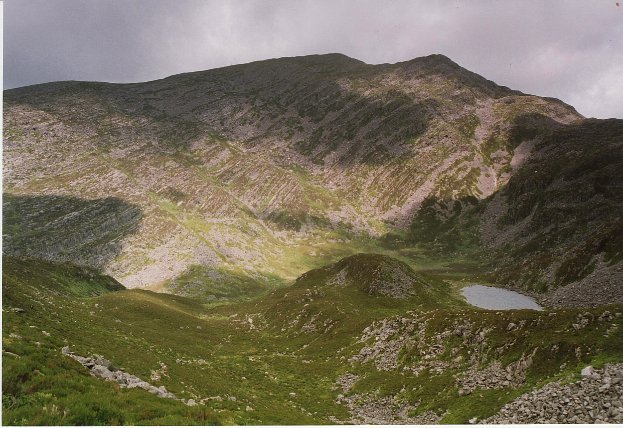
A vague path breaks right through heather and rockfall, briefly escaping the half-light only to re-enter the shadow realm once more some distance above at Llyn Du (Black Lake), to my mind one of Wales’ finest upland sheets of water, cradled beneath the towering northern cliff line of Rhinog Fawr itself. Here I pause to physically and mentally regroup, elated to witness such a natural wonder once more, yet dismayed at the realisation of how much further effort will be demanded of me to reach the summit seemingly so far above. I exchange pleasantries with a rather ‘Spock-like’ teacher-type shepherding a gaggle of kids with abundant energy to burn, the encounter shaming me into engaging that extra ‘gear’ now so clearly required. So, onwards and upwards it is, then, initially clambering across shattered rock forming the northern shore of the lake, followed by a steep scramble southward beside a trademark Rhinogydd drystone wall. As I do so, I unwittingly pass right by “a cup and ring mark on a smooth, slightly sloping rock facing to the south...” at SH65342942. Now, granted, I’ve unleashed a fair bit of jibber jabber concerning a perceived ‘relationship’ between prehistoric monuments and water in my time; however, it’s difficult to fathom why else something as enigmatic as this should have been thought appropriate hidden away up here? Intriguing in the extreme. Suffice to say, pity my focus upon reaching the top wasn’t a little less myopic. But there you are.
The final inordinately inclined struggle eastward to attain the summit plateau extracts everything I have, energy-wise. As I scuttle seemingly forever upward, the thought occurs that the kids will probably run up, the little blighters, while ‘Spock’ no doubt teleports. Consequently, the vision of a very substantial cairn crowned by an OS trig pillar that finally greets me as I attain the summit is truly one to behold and much larger than I recall from ‘95, although, to be fair, that was way back BC... Before Cope. OK, but why here, why crowning a mountain which, nomenclature notwithstanding, isn’t even the second highest peak of The Rhinogs, but the third? Why indeed? The answer, I’d suggest is that, unlike Y Llethr and Diffwys rising across Bwlch Drws-Ardudwy, Rhinog Fawr makes the very most of its 2,362ft... and simply looks the part, particularly when viewed from the A470 to the east. As the late, great Terry Hall laconically noted: “It ain’t what you do, it’s the way that you do it”.
One wonders if any of The Specials/FB3 frontman’s distant ancestors had a part in the construction of the great stone pile since the cairn makes artful use of the summit crags in a similarly resourceful – one might even say ‘labour-saving’ – manner as employed upon the magnificent Foel Grach some 20-odd miles to the north upon Y Carneddau. OK, let’s immediately set things straight and state that the monument, despite a lack of official OS and Coflein recognition, is obviously of prehistoric origin – at least to GAT and this Citizen Cairn’s eyes – with tell-tale embedded radial kerbing clearly seen upon the eastern and western arcs, this despite the all-too-predictable structural damage inflicted by so-called walkers. Yeah, unfortunately, the propensity for idiot vandals to do idiotic things – such as the gouging out of ‘shelters’ to cower in upon mountaintops – is not exactly unsurprising, but nevertheless deserves nothing but contempt. Having said that, I did ponder that the situation could have been a lot worse, if only to gauge by the incoherent, dishevelled state of another, still relatively substantial cairn standing a short distance to the east of the summit cairn. This, however, unlike the much smaller eastern-most of the trio upon this plateau, still retains a degree of structure and embedded footprint and thus, on balance, is not suggestive of a modern ‘marker cairn’.
But enough about mere archaeological detail. Yeah, for me it is where these monuments were placed – where those holding the beliefs intrinsically connected to these ‘piles of stone’ felt they should, indeed MUST be located – that truly captures my imagination. I retreat to the northern crags, a move presaged by an approaching infestation of very noisy muppet walkers, selecting a vantage point (almost) overlooking Llyn Du to chill out and soak up the upland vibe. Ironically enough, despite the effort required, this is possibly the most popular mountain top I’ve visited since Moel Siabod several years back. It is, however, worthy of attention, the views to every point of the compass of the highest calibre... the glorious vista looking approx northwest, across the shimmering waters of Gloyw Lyn to the sweeping arc of Tremadog Bay, sublime in composition. To be fair, that to the north is not exactly bad either, the all-important ‘water feature’ – in this case Llyn Morwynion (incidentally, not to be confused with that upon The Migneint) – leading the gaze, beyond the cairn crowning the summit of Moel Ysgyfarnogod, to the serried ranks of the Central Snowdonian heights, Yr Wyddfa, naturally, in primacy. But wait, there’s more: to the south, the sinuous main ridge stretches away towards Barmouth Bay, the prodigious mass of Cadair Idris floating majestically above all; indeed, it seems beyond churlish to relegate the expansive eastern panorama, taking in Y Berwyn and The Arans, to last place. Guess everything’s relative, right?
There is an argument for viewing the rock-strewn slopes of Rhinog Fach as a topographical threshold between the progressively smoother, grassy ridges of the southern Rhinogydd and the chaotically rocky northern section... Dr Jekyll and Mr Hyde writ large upon this gloriously upland landscape. In my opinion, neither is ‘better’, an accolade I doubt even Harry Hill could determine through idiosyncratic conflict, although, perhaps, the sense of accomplishment upon the latter is more intense? The constant applicable throughout the entire 19 miles, however, is the sheer joie de vivre to be experienced in reasonable weather. Is it any wonder Bronze Age locals, despite the ‘access issues’ viewed these mountains as an appropriate setting to begin that journey to eternity? I lap up the upland vibe, switching viewpoints before finally returning to reprise my time at the great summit cairn, now long vacated by inconsiderate, noisy muppets. With silence now in the ascendancy, this is truly a location to savour. I begin to appreciate the detail, the landscape context seemingly absorbed through every pore as if by osmosis. I note the distinctive trident profile of Yr Eifl resplendent upon the northern coastline of the Lleyn Peninsular, the landward summit of the triumvirate hosting the magnificent Tre’r Ceiri... ‘the Town of Giants’.. to the right of which looms Garn Ddu and its great Bonze Age cairns visited earlier in the week... while, nearer to hand, the shapely crags of Moel y Gest rear up above Porthmadog, these but a few of the more upstanding of a plethora of sites gracing this iconic landscape of prehistoric heritage hidden in plain sight, treasures waiting to be discovered by those who wish to see.
The old adage ‘what goes up must come down’ is particularly apt for those venturing upon the high places... the dead about to be interred within great tombs, naturally, excepted. Now back in 1995, as I recall, the young pre-Citizen Cairn opted to return to Cwm Bychan by way of the direct ‘as-the-crow-flies’ route via the aforementioned Gloyw Lyn. In retrospect, this was probably not the optimum option for 2022, given my depleted energy stocks. But hey, hindsight is a wondrous thing. It has to be said that so is the Gloyw Lyn, another of The Rhinogs’ first-rate upland lakes and as such well worth a visit in its own right. The intervening landscape looks far more benign from above than it really is, the terrain in fact steep and trackless, the subsequent very heavy going characterised by rocky outcrops and hollows camouflaged by deep heather to twist/break the ankles of the careless, unwary... or simply unlucky. Thankfully I make the near shore in one piece, a somewhat paradoxical sense of desolate beauty all-pervading, the almost total silence here broken only by the occasional sound of water lapping upon shoreline. A lack of time and, more conclusively, a fast declining ability to function coherently precludes any follow-up exploration of the Carreg-y-Saeth (’Arrow Rock’) rising beyond (well worth a diversion if you are so able). The final descent to Cwm Bychan and the car is upon legs not strictly functioning as such.
Safely back within the consummate confines of Cwm Bychan as daylight begins to fade, I reflect upon the time elapsed upon the fastness of this hostile, yet nonetheless somehow welcoming landscape. Granted, a 53 year old electing to retrace the footsteps of his much younger self was never going to be easy, demanding the expenditure of every joule of energy available to me. Furthermore, to reveal the limitations of one’s advancing years is something not devoid of poignancy, right? However, if we accept that overcoming challenges and pushing the boundaries of what one believes one is capable of is a fundamental, inherent aspect of the human experience... then, even from a very limited viewpoint excluding all aesthetic considerations, what a day this has been! Yeah, don’t get me wrong, cynical realists such as Monsieur Flaubert may well be right to point out the dangers of dreaming, of highlighting the risks of leaving potentially inflated expectations liable to a veritable dashing against the jagged rocks of error and misfortune. However, what is this life if we don’t weigh the odds, consider such risks... and look to find a way of doing it regardless? Those of a certain age will recall The Stranglers once pondered the whereabouts of the heroes of this world, those who somehow managed to match hyperbole with actual deeds. Indeed. However, perhaps this is not the pertinent question to ask after all, given the apparent impossibility of such people existing/having ever existed? Perhaps there is a case for not being so hard upon ourselves as human beings and accepting failure as the inevitable by-product of striving for heightened experiences... Truman Capote’s ‘condiment’ ensuring success tastes all the more sweeter when attained. Perhaps we should all be looking a little closer to home when debating the answer to Hugh Cornwell’s dilemma and accept that we all have the capacity to further the cause of the human race in our own little ways. Hey, we can all be heroes, if just for one day? Trust Bowie to presage these musings by 45 years...