
Taken from the roadside to the north west, attempts to get to the top proved impossible. Forgot my hacking devices.
Image credit: drew/AMJ

Taken from the roadside to the north west, attempts to get to the top proved impossible. Forgot my hacking devices.
An enclosure measuring 40m N-S by 15m E-W which crowns the lower summit of Cnoc a Bhatra is suggested as a possible fort. The walls which rise to a maximum height of about 1.5m above surrounding land utilises the extensive rock outcrops in the area whenever possible. Evidence for an entrance was extremely difficult to find partially due to cattle damage and partially due to the thickness of the undergrowth, notably blackthorn. In the main, the walls seem to follow a contour marked by rock outcrop.
F Hood [et al.] 1993; F Hood 1994, visited April 1993.
(They managed to get much closer than me)

South east looking north west. Head high stuff again :-(


Right underneath, no apparent way up – further north, the same.

Taken from the south-east, bog in front, brambles etc, and two very sore legs. I’ll climb up there – next time.
A Bronze Age hoard discovered on land that was due to be turned into football pitches will go on display for the first time next year.
A team of archaeologists have discovered a “high status” Bronze Age burial site in a quarry in the Yorkshire Dales.


Looking down on top of the stone.


Looking north, not very far away is Aird Innse Cairn.
Volunteers have come together to begin work to rebuild a replica of an ancient roundhouse destroyed in a suspected arson attack.
The thatched Iron Age-era copy was almost completely destroyed in the blaze at Peterborough’s Flag Fen Archaeology Park on 13 July.
Work to rebuild a replica of an ancient roundhouse destroyed in a suspected arson attack is to begin.
The thatched Iron Age-era copy was almost completely destroyed in the blaze at Peterborough’s Flag Fen Archaeology Park on 13 July.
An appeal has been made for materials to help rebuild a replica Iron Age thatched roundhouse destroyed in an arson attack.
The roundhouse at Flag Fen Archaeology Park, Peterborough, was burnt down on Sunday 12 July.
Archaeologists say they have found evidence that a site in a village near St Andrews has been used by people for about 10,000 years.
Traces of an ancient hunter gatherers’ campsite and remains of grains harvested by some of Fife’s first farmers were among items discovered on the land in Guardbridge.

The north side of the smaller cairn, decent footprint, decent amount of all sorts of jabby stuff as well.


Both cairns, Gigha very rural place, almost NE of Scotland, with all of the cows and sheep.
Tucked away in a corner of Hove Park in East Sussex is a big, brown and somewhat unassuming boulder.
But the story of the so-called Goldstone is far from unremarkable.

South side of the internal part of the dun looking north east.


Looking east from the middle of the dun, the wall probably made from the dun’s stones.


Defences both natural and man-made on the north.


Looking back to Auchamore Farm. From the Ogham Stone / St Cathans, there is a path, you’ll pass the chamber cairn on the way to the stones.

They’re saying go to Cuddiport, there’s a cairn you can fall into over there.

Perched on top of a wee hill beside things that won’t last as long.
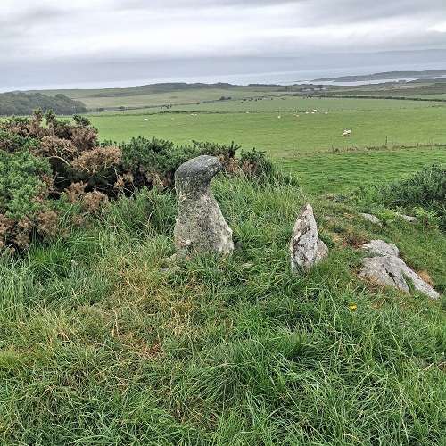
Looking towards Kintyre, they didn’t see me sneak up.

It isn’t connected to the grass in the top half of the photo, a nasty drop, a wee valley, then a climb to get over there.


The south east corner, the drop is higher than it looks.


