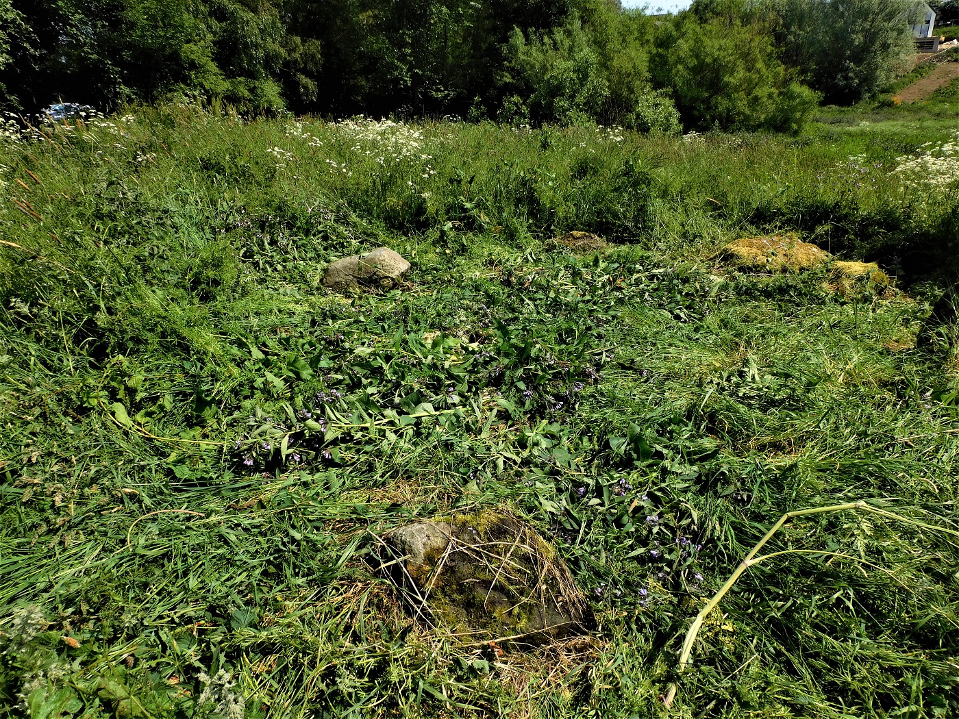
Slightly to the east of Glennan 1 is a cup marked slab (there appears to be lots of cup marked slabs in the area, another visit required). Nine cup marks can be seen, three are slightly larger.
Visited 07/04/2023.
Slightly to the east of Glennan 1 is a cup marked slab (there appears to be lots of cup marked slabs in the area, another visit required). Nine cup marks can be seen, three are slightly larger.
Visited 07/04/2023.
Head east on the B840, just north of Kilmartin, and pull in at the second track track heading south. If you can get a reasonable run and can jump the gate, you’ll land on the cairn.
Surrounded by wonderful scenery and prehistory Cairn 1 sits at over 11m wide being 1.5m tall. It has been houked revealing a probable cup marked cist cover at the centre of the site. Several kerbs remain in place.
Next to road, open the gate, no need to jump.
Visited 07/04/2023.
Walking south from the Castle Sween Cairn you head straight into the hill on which Dun Beag sits, after jumping the Beag Burn. The final climb and final site for this adventure in Knapdale.
The walls here must have been huge, Canmore says entrance, but a gap on the north side might suggest such a place. It could also have been made at a later stage to make an enclosure. The north climb is a bit easier than the south, where the defences are best preserved. There is some amount of fallen stonework for a dun sitting at 10m wide. A popular area for duns / forts – there are plenty nearby.
These other sites will have to wait till 2024 to see my feet.
It started with dun / fort, it finished with a dun / fort. A great end to a great week.
Visited 06/04/2023.
I left my car at the entrance to Castle Sween and walked back up the minor road until I was beyond Castle Sween cottage. Cross a flat field to the west, then make the tricky but short descent to the field below. Look north and the grass covered cairn will be seen.
A lovely well shaped site, 7m wide and 1m tall. Kerbs remain on the south arc, two large boulders on their side on the west could be the remains of a chamber, a large slab on the east might be a cist cover, it might belong to west slabs or it simply might have been dumped there. it would be nice to think it was a capstone to a small chamber.
A lovely site on a lovely evening.
Visited 06/04/2023.
Remains of what is believed could have been a Bronze Age ritual cremation cemetery have been found at Shetland’s planned SaxaVord spaceport.
More info :
bbc.co.uk/news/uk-scotland-north-east-orkney-shetland-66259713
Situated in the field at the entrance to Castle Sween and its massive caravan site Drum A’ Chladha must have been huge, when it comes to width it still is.
However it has been massively robbed and probably most of the stones can now be seen in the castle nearby. A lot of the boulder kerbs remain in place which circle the 30m wide site. At its tallest it is only 0.5m. As usual field clearance has been dumped in the middle. Intriguingly a couple of slab like stones remain on edge, possibly the remnants of a cist or small chamber.
Plenty parking opposite the entrance to the caravan site.
Worth a look.
Visited 06/04/2023.
Heading south from Gariob I parked just to the north of the small village of Achnamara. Walk back up the road to the middle of the long corner, then head north east. You walk across, or splash across a clearing that also appears to be a shooting range in a bog, fortunately no shooting on my visit.
There are two cairns sitting next to each other at this site, situated on a higher piece of ground beyond the clearing. However they are badly damaged by robbing, fallen trees, tree roots and are covered in moss. Size makes the cairns recognisable, the west cairn is 9m wide by 0.5m high, the east is much bigger being 14m wide by 1m high.
A good clean up would hopefully reveal the cists, kerbs and the wee space between the cairns.
All part of the jigsaw.
Visited 06/04/2023
Gariob is a fairly easy cairn to find, just behind the cottage of the same name. I was given permission to park on the track just before the cottage. Follow this track for approximately 100m and jump the dyke into the field to the south. The branches of a tree cover the site.
It is a well shaped cairn being 8m wide and 0.7m tall. Sadly the well made cist had been completely covered by fallen branches and damaged by tree roots. These tree roots had also nudged some of the kerbs. If these trees hadn’t there, a clear view of Loch Sween would be seen.
Still, a nice place on a nice Spring day.
Visited 06/04/2023
Archaeologists have unearthed a loom weight believed to date to the Bronze Age during an excavation.
More info :
From the dun at Cosandrochaid it was a very pleasant walk along the wide ridge to the cairn at Droineach. No difficulties, just a few fences and a couple of walls to jump. Once again different angles to see different sites (Carn Mor is to the east, far below), once again the different shades of blue on the sea, bits in mist bits clear. The cairn has fantastic all round views and has clear views of the southern tip of the peninsula, Rubha Na Cille, along with southern tip of Danna – the neighbouring island.
Kilmartin is superb but in a tamed way, Droineach is he exact opposite, almost as far south as you can go. It feels remote but yet somehow it feels like it is in the centre of things. Islay and Jura, various sites over at Loch Sween, sites to north are all clearly visible, the sea and sea lochs are clearly visible – the waterways must have very important here. Follow the Sound Of Jura coastline north east and Crinan is reached, home to the famous canal. The nearby harbour at Keills had a ramp for cows that swam over from Lagg, Jura.
Whoever the cairn was built for must have been well respected to earn such a site. Twelve kerbs remain in place, several have toppled and even more more remarkably it still survives to 8m metre wide, reaching 1m high, at its tallest.
Tremendous site.
Visited 06/04/2023.
An early morning start for the climb to the dun Cosndroichaid, like everywhere on this wee peninsula the scenery is stunning. What I like about these places is the different angles, as with everywhere, you can see different sites. The dominant feature being the Paps Of Jura. A weird shimmery mist lightly covered the Sound Of Jura, whilst Loch Sween was clear.
Parking in the same place as I did for Carn Mor, I headed back up the road until the first gate then headed west. The climb is reasonably steep through a well spread wood, keep going until a fence. The last part is the steepest part, along with the dun, stunning all round views greet the visitor as flatter land is reached.
A wall surrounds the 10m wide site, it has been severely robbed. Within the turf covered defence only several stones can be seen. Canmore don’t mention an entrance but I thought a wee gap on the south might be the front door.
A wonderful site, wonderful scenery.
Visited 06/04/2023.
It’s a reasonably steep climb from Dun Beag to the summit of Din Mor. Eventually I entered the fort from the north. The views are absolutely stunning, Jura, Islay, all points north south and east can clearly be seen. For scenery, it must be one of the most spectacular places I’ve. Just as night started to fall the sun broke out above the clouds giving remarkable views of the Paps Of Jura.
A wall surrounds the 30m by 20m site, this can be traced all the way round as stones can be seen or remains which are turf covered. At about 1.5m wide, the gap in the south west probably represents the entrance. Not much is left of the forts interior except the view.
After sitting for quite a while I made my way back down to the road to head back to Tayvallich.
Fortunately I had enough energy left to walk to a place of refreshment!
Visited 05/04/2023.
On arriving back to Tayvallich from Craighouse I decided to walk south west from the village to the track that leads to the abandoned ‘ferm toun’ of Drimnagall.
The dun is easily spotted to the west, head towards the ruined house at Barbae then enter the dun from the north walking up the ridge, an easy ascent. Only the west side is really steep.
Measuring at 15m by 8m not much remains of the surrounding walls, nature has helped with construction as well. Still standing are walls at just over 1m, with a possible entrance on the east according to Canmore. To me, there appeared to another possible entrance on the south east slope.
Views to the north, south and east are stunning. Not much views to the west. However, climb this hill to get even more stunning views of Dun Beag, this time Loch Sween can be seen.
You’d be just as well climbing to the top of this hill as it is Dun Mor, a hillfort.
Some place.
Visited 05/04/2023.
A section of a Bronze Age twisted gold torc has been found in a field by a metal detectorist.
More info :
Returning to Tayvallich by mid morning from Learg Mhor, the early morning start had proved to be cloudy and fairly damp, it was now warming up and sunny. Time to return Jura for a day via the passenger ferry.
Same directions as before. My last visit to Carn Liath was during the Summer of 2021. Ferns and other vegetation covered the site.
This time being April, the vegetation was much less which revealed that the dun was and is surrounded by a defensive wall. Slightly more stonework can be seen as well.
Clear views over to the Knapdale Peninsula. It’s good to be back. All of this ferry taking and walking makes a Drew thirsty and hungry. Just as well that the famous distillery is down below, next door to a fine restaurant.
Re-visited 05/04/2023.
The severe vegetation at Dun Bhronaig became a memory as I headed south climbing up and down small valleys. Slightly boggy but an easy walk. Walkers are clearly being encouraged to walk here as there a new gates all over the place.
The cup marked rock at Learg Mhor has 9 well worn cups that are still visible, overnight rain helped. 100m south, as a bird would fly, sadly that 100m is across a bog and I needed to head back to Tayvallich.
Next time for the second stone.
Ferry to Jura next.
Visited 05/04/2023.
To get to Dun Bhronaig is very easy from the standing stone at Barnashaig, just head west and its in front. There is even a handily placed dam to cross the north end of Loch Dun Calltain, there even looks like a path heading into the dun from the north.
That’s where the help stops, to get any further I had to batter my way though close knit trees all about 8 feet in height. A few times I thought about turning back as arms and legs were taking a battering. To probably only go about 100 yards seemed to take ages but eventually I broke through to the remnants of the dun. There are probably plenty remnants under the vegetation.
Even the rucksack seemed to tired as I propped it against the southern wall, it promptly fell down.
Walls can be seen on the south side of the 15m by 8m dun, but have been reduced to 1m in height. Steep but short slopes cover the north west, where I climbed up in the north east wasn’t steep. However, there is a far easier entrance. Funnily enough it is the entrance on the south side, a gentle climb on flat rock and grass until the first wall.
It was by this way I descended, skirting the loch, crossing the dam to walk south.
Cross the dam, walk south along the water’s edge, easy climb to the dun. A good tip!
Visited 05/04/2023.
Walk north a short distance from Upper Fernoch and the standing stone at Barnashaig will soon appear. Standing at 3.5m tall the nicely shaped stone is situated in a boggy clearing. Lichen is always a good sign of age and to back this up there cup marks on the south east.
A superb stone, not to far away to the west is Dun Brhonaig.
Visited 05/04/2023.
Parking at Tayvulin, the paths today would be slightly different to the well trod paths of Kilmartin, I headed north following reasonably green pastures, going over a couple of gates before the standing stone of Upper Fernoch appeared.
A lonely but beautiful place, back in the day several farms or ‘ferm touns’ would have been occupied but now many, like many others, are in a ruinous condition. The stone must have seen it all before and must miss the people at the nearby farm as it leans south east. If standing upright it would stand at 2.5m tall. Hopefully, like the stone at Largie, it will one day be restored to its original position.
Nice way to start the the day.
Visited 05/04/2023.
A day that started with the superb Galleried Dun at Druim An Duin ended up at the Rowanfield Standing Stone.
From Kilmartin I took the A816 south then the B8025, signposted Crinan / Tayvallich. Take the first minor road heading west, then take the first farm track at Fasgadh, just before Mheall Cottage. Plenty room to park at a now defunct quarry.
Follow the track uphill until a clearing, the standing stone is straight ahead. It stands at 2.6m high. If the trees weren’t there it’s a fair chance you could see down into the Kilmartin valley.
A nice way to finish the day.
Visited 04/04/2023.
To my complete surprise I spied a barrow, almost next to the A816. It must have been huge in its original condition as it still is 30m wide and still has a height of over 1m. As usual, field clearance has been dumped on top.
Not much to see, the site is grass covered, I found the site fascinating, so fascinating I jumped the dyke and walked back to Kilmartin to catch up with A & B. I’d forgotten about the henge, I’ll visit that in 2024.
Yet another part of the jigsaw.
Visited 04/04/2023.
Next to the stone row is an excellent wee kerb cairn, with some decent kerbs or teeth (as I call them) in the place. Yet again, my thoughts travelled to another place in Scotland, this time to Aberdeenshire, where I live, and the excellent Clune Recumbent Stone Circle. (T also mentioned this as in Temple Wood)
The RSC has a decent kerb cairn next door, just like here, it also has a very decent boulder cairn reasonably close, about the same distance to my next stop – the lesser spotted barrow.
Visited 04/04/2023.
I followed the path to the stone row or stone rows, 4 and 2, another excellent site complete with rock art. My thoughts went instantly to the stone rows on Islay and Jura. As with all of the valley’s sites there is plenty nearby so a good look round is essential.
I looked over the kerb cairn, and to my surprise spied what looked like the flattened remains of a massive cairn or barrow.
To the wee kerb cairn first.
Visited 04/04/2023
Walking down the A816 from the Great X etc we reached Dunchrigaig which still stands at 30m wide, 2.5m high. Lots of stone has been robbed, probably all of which can be seen in nearby dry stane dykes and local road repairs.
I saw the rock art but I’d no idea what it was, perhaps the stags mentioned had ran away. It certainly is a massive capstone.
A great site, an equal to what is to the north.
Visited 04/04/2023.
Researchers in Kent have unearthed some of the largest early prehistoric stone tools ever found in Britain.
More info :
I had no idea the Nether Largie Standing Stone had been re-erected in 2015, an unexpected bonus.
It stands at 1.5m, a smaller version of taller neighbours.
Good to see the smaller sites being looked after as well.
Visited 04/04/2023.
Plenty has been said about the tall standing stones, I took a wee bit more interest in the wee four poster or kerb cairn nearby and wondered if there had a been a standing stone set inside. One of the standing stones looks like it has a kerb surrounding it as well, perhaps there are hints of something at another.
Another mystery at Kilmartin, no real surprise.
Visited 04/04/2023.
Like other contributors the cairn at Ri Cruin had no visitors when we arrived, a fine place to reflect on previous sites visited on the way here, a fine place to think about the sites yet to come, a fine place full stop.
The cairn has seen a fair amount of the ‘recycling’ treatment but retains its almost 20m width, some kerbs in situ, three cists along with plenty cairn material.
A great site, before the complex X.
Visited 04/04/2023.
Can’t really add anything much to fieldnotes as everybody has said what I would say. On reaching here though, my first thought was much closer to home, the Loanhead of Daviot Recumbent Stone Circle. Just like the circle here it has an ancient burial place next door.
Equally beautiful scenery as well.
Visited 04/04/2023.
Linmere site has more monumental pits in a single area than anywhere else in England and Wales
More info :
The southern of the three Largie cairns, slightly oval shaped at 34m by 27m. At every angle there is something different to see – in the cairn and the surrounding landscape.
A Clyde chamber can be found along with cists, interestingly it appears that cairn was extended to house two further cists. Sadly one has gone, gladly one remains with its huge capstone.
Its hard to describe these places, pictures do the best talking but one thing they all seem to miss is the Kilmartin burn. I think it’s hugely influential, a source of food, trout were jumping when we walked past, and a link to the sea as it joins the River Add to find salt water at Crinan. The start of the famous canal, water might have played a part in all of this.
Visited 04/04/2023,
The north and south cairns are excellent thanks to their reconstruction but like some of the other contributors I really liked this site. It gives a glimpse of the reality of its ruinous state after it has been houked, robbed, recycled etc leaving behind cists and cup marked rocks.
To me it also gives an idea of actual size and a fair idea of how it was constructed (and deconstructed), it remains at 31m wide and at its tallest 1.5m. However in the 1920s it was practically demolished, originally standing at 3m tall its a safe bet much of the road repairs came from this and other sites in the glen.
Same everywhere I guess.
Visited 04/04/2023.
German archaeologists are thrilled to have dug up a Bronze Age sword more than 3,000 years old which is extraordinarily well preserved.
More info :
Just south of The Glebe, follow the track to the next cairn, Largie North, classified as Bronze Age. It has been rebuilt and capped with a concrete slab plus hatch. Access into the cairn is via this hatch, therefore all three of us (B is a dog) made it inside.
Inside is a treat, the cist is revealed with its fantastically decorated capstone. The cairn stands at 20m by 2.7m and is a brilliant example of restoration.
The whole site is situated inside a fence.
A wonderful opportunity for members of the public to see what is inside these stony mounds.
Visited 04/04/2023.
We parked in front of Kilmartin Parish Church and walked past the soon to be opened visitor centre to the track just beyond which leads straight to the Glebe and its sheep bodyguards.
It has been a long time since my last visit and its good to see the local greenkeepers keep the grass short. At 35m in width and 4m tall it is the most northern cairn of the Kilmartin Prehistoric walk.
On we go.
Visited 04/04/2023.

What you from the path, if the foliage is tramped down.


The new placing, or reasonably new placing of the Ythan Terrace stone circle.


30 minutes of tramping very large weeds revealed the stones.

In the original position probably all of the stones stood.
Along the Ythan valleys, archaeologists have identified cairns, stone circles and cists, many destroyed or badly damaged in previous centuries by farmers and builders before their importance was understood. Most standing stones suffered a similar fate, but one of these “menhirs”, the Candle Stone, persists at Drumwhindle. On the Hill of Logie, about a mile downstream from Ellon, evidence of round, stone-built huts from the Iron Age is clearly visible. And further downstream near the estuary, a village from that same period has been unearthed (unsanded?) at Forvie. A stone circle of unknown purpose stood on the riverbank near Aldi’s current location at the charmingly named Pinkie Park. The 3ft high stones are still visible upstream on the riverbank, though sadly not in the original circle. And if you visit the Prop of Ythsie, take a look at the stone circle known as Druid Temple, started around 3000 years ago, when the third phase of Stonehenge was under constructon.
From the dun at Barnluasgan (NR78719113) I made my way back down the track after gracefully crawling underneath the deer fence. On reaching the B8025 I walked until I reached the Knapdale Nature Reserve, now famous for the re-introduction of beavers to Loch Barnluasgan.
The cairn is on the opposite side of the road to the reserve, a wee jump over a fence and a short walk, situated in a clearing that follows a dry stane dyke.
The cairn sits at almost 8m wide and is almost 1m high at its tallest. A slab remains in the centre, a possible cist cover and some stones on the east are possibly kerbs. Some probable field clearance has been dumped on top whilst the rest of the cairn is covered in turf.
A nice morning walk completed, back to the car, pick up A and B, Kilmartin next.
Visited 04/04/2023.
After climbing back down from Druim An Duin I walked on the B8025 heading south towards the next hairpin in the road, then headed north on another road kindly provided probably by the forestry people. Thanks to Storm Arwen a lot of these tracks have appeared, lots of tarred roads have been improved or strengthened due to the volume of lorries.
I took the west track and followed it until I was almost directly below the dun. Instead of trees a deer fence provides the main obstacle, that didn’t prove a problem as luckily animals of some kind had made a gap under the fence wide enough so I could crawl through.
A short walk leads to the much damaged site which is slightly oval shaped being 18m by 15m. Traces of turf wall remain in the east and west, to the north and south the defences are better preserved. A dry stane dyke that goes through the site has probably upcycled stones from the dun.
A bit of a ‘what if’ site but worth a visit.
Visited 04/04/2023.
If Dun Mhuirich is a stunning site, about 7 miles north east close to the B8025 Druim An Duin might be even more stunning site. Luckily at the bottom of the hill, north of Tayvallich, there is plenty of parking, thank you to the forestry people.
From there it is a steep climb through trees and rubble, it doesn’t last for long and I somehow walked straight into a type of causeway which led to the north entrance. Best not to go to fast because on the other side of the dun’s entrance is a straight drop onto the road below.
At the north entrance there is a door check complete with guard room which guards an entrance of almost 1m which doubles in size a few steps later. The walls here are huge, and even larger to the south, the main entrance. Yet again another door check / guard room in an even better state of preservation, also slightly larger the north entrance. Further to the south there appears to be an outer defence.
The internal dun is oval being 15m by 9m, it is surrounded by some of the best preserved walls I’ve seen. When you look all round, the stonework is astounding, still standing in parts at almost 2m.
To the north and south are also large amounts of fallen stone which only adds to the sense of how big this place must have been.
Having served my time as a stone mason and having built many a dry stane dyke I’d be shocked but happy if my work remained standing for 2,000 plus years.
An astounding site, a must visit. Take care on the climb!
Visited 04/04/2023.