Thanks to Ian Suddaby for this information. One of the co-leaders of this research. Brilliant stuff.
drewbhoy

A rare sighting of a bhoy on top of Mither Tap which isn’t so rare. Shock..............hope you all recover quickly!!!
Image credit: john smith


Hopes that outside investment will be found to save business branded a ‘white elephant’.
More info :


To get here instead of going back to the Tap O Noth car park I headed east following the heather/park line which leads straight to the cairns. A walk of about 1 mile it involves a few fences otherwise under foot conditions are good. To get back to the car I wandered down onto A941.
Newseat 2 is only a few meters north of it’s neighbour but somehow I missed the first time I visited this place. It is in a badly ruined state tho some kerbs survive on it’s southern side. At 7 meters wide and 0.4 high the cairn is grass covered and hollowed out. Magical views especially in winter time.
Visited 17/2/2011.


A full description and some magnificent aerial pics.


Archaeolink staff given notice as council withdraws funding.
More info :
Half way up the Tap O Noth a massive rock can be seen. It is named after St. Moluag who was a missionary. It is a good 500 yards from the path across boggy heather and many potholes. Nobody would have disturbed him up here and he most certainly would have enjoyed the views. Windy tho!
Visited 17/2/2011.
‘A large rock called St Moluag can be seen to east of the path up Tap O Noth. St. Moluag was a famous Celtic missionary and a contemporary of St. Columba. Sent to Pictland in AD562 he founded several churchs in the area including one at the nearby village of Clatt. The great rock Clochmaloo (stone of St. Moluag) was probably used as a retreat whilst he worked in the area.‘
From the notice board at the car park.

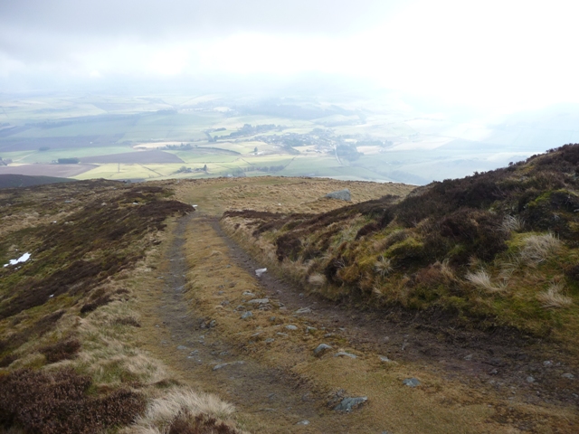


From the centre of Rhynie take the A941 west and look for the sign post to the Tap O Noth car park. The first stage of the path is grassy and boggy then turn west. At the moment the path is now a mud bath thanks to the construction of a man made lake. After a 1/2 mile of this the path turns north and starts to climb and improve. This is on the sheltered side and there still is a lot of snow on the path but as the path goes to the front of the hill the snow lessens.
The summit of the Tap O Noth supposedly an extinct volcano, the 2nd highest hillfort in Scotland, has a rampart surrounding it. On the southern side the rocks are vitrified. The reason for building it is obvious – the all round views. To the north the fort at Durn Hill, to the eastern side various hillforts including Wheedlemont, Cairnmore, Dunnydeer, Hill of Christ’s Kirk and Mither Tap can all be seen.
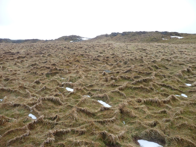
This is a very pleasant climb, steep in bits but the weather is changeable. Today the climb was fine but on the next hill north a blizzard raged as can be seen in some of the pics.
Visited 17/2/2011.


Museum has been allocated the 6,000 year old treasure which is just one of the finds north of the border.
More info :
Tillyching 2 NJ60160499
This is a well shaped and turf covered cairn. It survives at 6m wide and 0.6m high. From Tillyching 1 go through the nearby gate and turn left.
Visited 10/2/2011.
Revisited 8/6/2017.
Tillyching 3 NJ60140498
The last time I visited here I couldn’t find the third cairn as the site was covered in vegetation. This time it was much easier to find. Somehow the jabby stuff had gone to reveal several small kerbs still in situ. It stands at approximately 6m wide and is no more than 0.4m high.
Visited 8/6/2017.

Looking up the hill, the cairns are near the solitary tree in the middle.
Image credit: drew/amj
From Lumphanan I walked east along the A980 until the second farm track heading north. Once again it was hard to believe that on Tuesday this area was under 2-3 inches of snow. However the much improved conditions, it was sunny (very), had melted most of it away. Take the track going up the hill which leads past Tillyching farm following the edge of aqwood. Keep going until the track, more like a stream, runs out. To the east there is another wood follow the fence, climb the gate and the cairns are in front.
Tillyching 1 is quite easily spotted as the circular pile of stones isn’t grass covered. Sensible farmworkers rebuilt the cairn after it’s excavation in the 1800’s. It now stands at 41/2 meters wide and is 0.9 meters tall. The views are spectacular looking over to the Highlands and down Deeside. Being a Spring like day it was also nice to see plenty of snowdrops growing amongst the trees.
Visited 10/2/2011.


Go south from the village of Auchleven (parish of Premnay) and stop at the Towmill track on the B992. This part of the road is known as the Brindy and marks the western end of the Bennachie range. There is a small car park here for people who walk the Gordon Way. On the other side of the road there are wooden steps on to the Gordon Way.
Two days ago this area had been under 2 inches of snow and I’d been chased back down the first hill, The Brindy, by a blizzard. However most of the snow had gone for todays visit. The climb is quite steep. Fortunately a frost had saved the area from being a mudbath so underfoot conditions were fine. At the top of the Brindy Hill keep going straight as turning right leads eventually to Auchleven.
At one side is a mature forest on the other Christmas trees grow. Sadly one Christmas tree, complete with tag and price, had been left lying on the ground. Keep going until the deer fence and turn north following the fence. If you stick to the path eventually you will reach the cairn at Knock Saul.
The cairn is situated on the peak of Satter Hill with fantastic views all round. Unfortunately most of the stones have been removed to make dry stane dykes but some original material is still there. On top of this stones have been built to make a wind break. This cairn I estimate would have been about 8 meters wide, how high would have to be guess work. Also there are many rocks possibly one, I saw, with cup marks. The next time Tiompan is up in the area I will lead him to this place.
But a very beautiful and thoughtful place. It was great to be back in the hills.
Visited 5/2/2011.

Taken from the top of Brindy Hill. Cairn to the right side of the pic.
Image credit: drew/amj


Looking south east towards Cothiemuir and the Lord’s Throat (River Don).
Image credit: drew/amj