

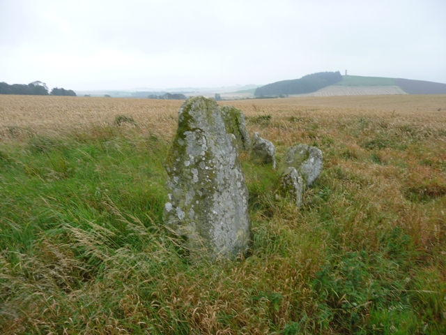
Looking south west to the face of the massive rock.
Once again another cairn that survives despite the ravages of time and agriculture. Thankfully the site is now protected but in reality there is very little to see. However it’s location is special, it is almost exactly in the middle between two of Aberdeenshire’s most famous RSCs, Louden Wood and Aikey Brae. Throw in Dens, Cairndale and Auchmachar as well.
On what was to prove a very good day I parked at the entrance to Mains Of Bruxie, just west of Deer Abbey. The cairn is sited on top of the hill near the sadly uninhabited farm of Stockbridge looking down onto the South Ugie Water, being some 16 meters wide, at it’s highest it might be close to a meter. A scattering of cairn material remains as well of evidence of robbing. Still on the good news front it is protected by a fence from the friendly bulls who made sure I left safely.
Visited 21/09/2011.

From the field entrance, looking south west, the cairn is near the solitary tree.

Good news, the farmer now protects the remnants of the cairn.


Note the drenching coming down the road.
Litterty Hill is situated in the valley to the west of the Cummerton Cairn. From where I parked I walked a further 1/4 mile north then took the first tractor track to the west. To call this a track is ambitious but it does lead down to the bottom of the quiet and almost forgotten Glenquithie valley.
Further south is Strath Howe, the hillfort, to the north is the Moray Firth and Pennan, now famous for it’s crumbling cliffs as well as Local Hero. However here at Litterty time seems to have stood still empty crofts and farmsteads providing an eerie backdrop even during a nice warm (a shock) September’s day.
The cairn itself must have been huge at some stage. Records have it at 24 meters wide and 3.5 meters tall. Nowadays it might still reach 24 meters in width but it has been much robbed leaving it around about a meter tall. It is now also covered in ferns and turf but underfoot cairn material can still be felt. One thing nobody can take away is location and nature. The views north and south are still wonderful. As for nature young red deer played in the sun, red squirrels played in the trees and birds chirped away quite merrily.
Visited 19/09/2011.


Looking south down Glenquithie valley, which leads to Strath Howe Hillfort.

Looking north over the cairn towards Pennan and the Moray Firth.


Two things really astonished me about this cairn, 1) how I didn’t know about it until recently and 2) how it managed to survive despite the growth of Inverurie.
Go to the town centre in Inverurie and look for Barclay Road making for the streets end. In front is Kellands Park (a place were I terrorised Inverurie’s batsmen many a time) turn right and enquire at the first house. Unfortunately the people who live here were out but the kindly next door neighbour allowed to ‘loup’ her dyke to see the ancient site.
Somehow, miraculously really, the cairn is almost 25 by 20 meters and a further 5 meters tall. It is now covered in turf and trees. Some damage has been done to the eastern end but overall it is in fine condition. In 1902 an urn was discovered during excavations and displayed in Inverurie museum.
Bizarrely the building of houses has protected this cairn from major damage and it seems to be looked after in the appropriate way. Good news for a change and a nice way to end the day.
Visited 8/9/2011.
From the ruined piano on top of Clachcarr I headed further north downhill until I came to a wee track heading in a south westerly direction. Keep going until the junction of two tracks, one coming from the Don which heads eventually back up Culquoich, and another track which leads to the ruins at Barns farmstead. Don’t take the track to Barns, jump the fence and head to the summit of Cairnbeg Hill passing another ruined steading.
Not much remains of this once huge cairn but the rise of the land and a scattering of stone gives an idea of size. Once again the views are superb with Morven to the south west and Clachcarr/Culquoich to the north east/east. Also the A97 is clearly visible, heading south, giving an idea of the distance covered as the road goes past the Deskry, Cairnbeg, Clachcarr and Colquoich hills.
A great place to walk and there must be easier ways than my route. But Donside is beautiful and I love this area, always have and always will which is good news as on my return to the first cairn I marched straight back down the hill only to realise I’d missed a kerb cairn of considerable size plus no injuries. Oh dear I’ll have to go back.
8/9/2011.


