
Looking south from the entrance across the valley below.
Image credit: A. Brookes (8.6.2013)
Looking south from the entrance across the valley below.

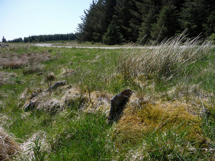
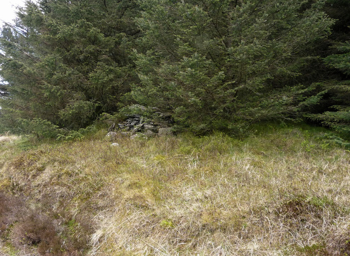
Fallen slabs at the southern entrance into the ring cairn.

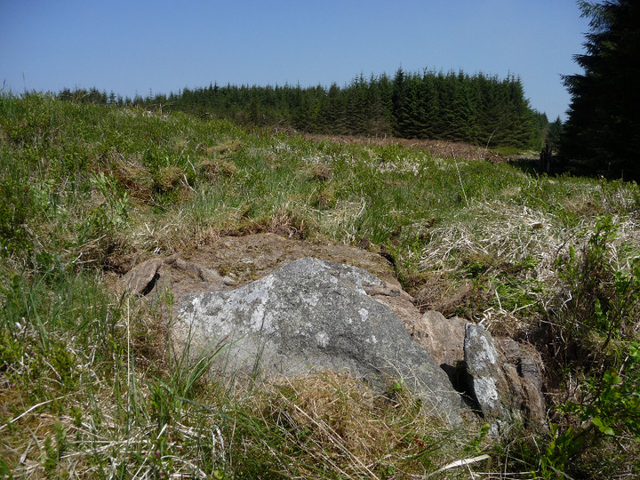
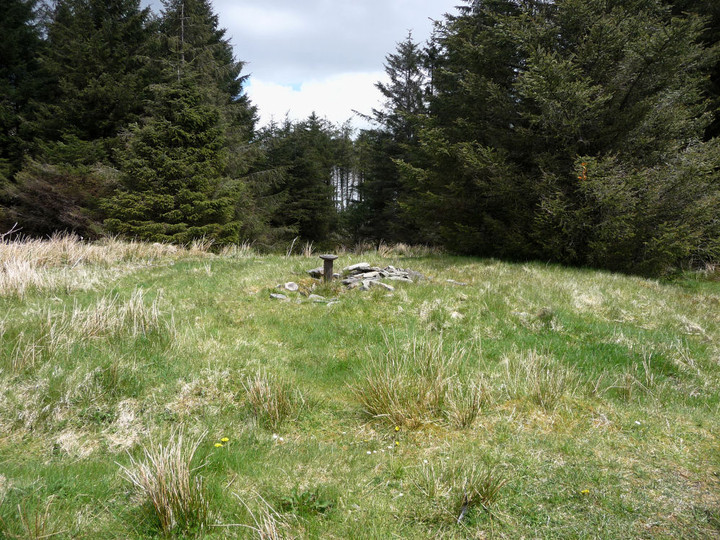
General view across the interior of the ring cairn. The greener line below the trees is the bank.
Description from “A Guide To Ancient and Historic Wales – Glamorgan and Gwent” – Elisabeth Whittle (1992 HMSO):
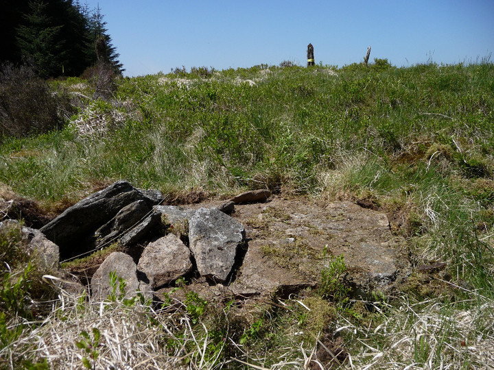
This is a large oval ring cairn, consisting of a low stony bank with level ground inside it. On the north-east side there are traces of the original kerb on the inner face of the bank. There is an entrance to the south which may have been lined by upright slabs; three are still visible, leaning or fallen. A smaller entrance on the north-west still has one of its jamb stones in place. On the south-east of the interior is a small cist with three of its sides still intact. Three small holes to the north may indicate the position of upright stones, long since disappeared.
The book has a plan of the ring cairn.

The summit cairn is built at the eastern end of an oval ridge, the western end of which is an outcrop of exposed slabs.


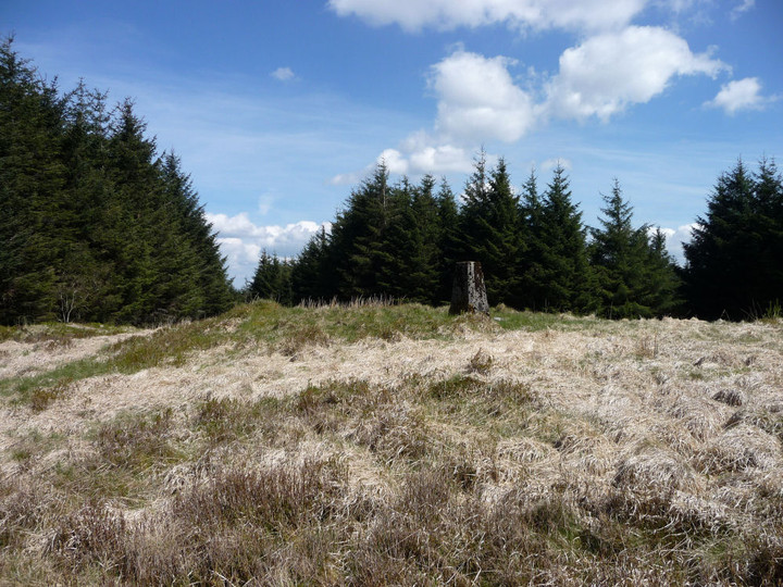
Mynydd Blaengwynfi summit cairn, looking ENE-ish.

Mynydd Blaengwynfi summit cairn, in its clearing amidst modern forestry.

Bachgen Carreg from the SW, where the mound appears most prominent.

Bachgen Carreg cairn, showing apparent kerbing.

Looking NE. The block of forestry to the NW of the cairn shown on my 1/25000 map has been felled, allowing the full light of day to shine on the site once more.

Coflein doesn’t mention anything structural, but this looks awfully like a cist – note in particular the two upright slabs placed at right angles, at the top of the picture.

General view of the cairn, looking SW.

Additional landscape context for the settlement, perched on the lip of the escarpment. Seen from Pen-pych to the south.

The walk up to Carn-y-Wiwer from the floor of the Rhondda Fawr valley via Cwm Lluest passes a lovely series of waterfalls. Lost on the cairn-builders? Doubtful.

Hatterrall Hill (centre) framed by Mynydd Pen-y-Fal/The Sugar Loaf (left) and Ysgyryd Fawr (right). The hillforts of Twyn-y-Gaer and Pentwyn Camp can also be seen below the hill. Viewpoint is Ysgyryd Fach.

Ysgyryd Fawr seen from its little sibling, Ysgyryd Fach to the south. Hatterrall Hill at the southeastern tip of the Black Mountains rises on the left.

Mynydd Pen-y-Fal/The Sugarloaf rises above Abergavenny, Usk Valley to the left, Black Mountains to the right. Seen from Ysgyryd Fach.

Blorenge, seen from footpath east of Abergavenny Station.
On the map, the route looks straightforward, with little in the way of ascent or descent over the three miles or so between Pen Bwlch Llandrillo (north top) and Moel Fferna. The Nuttalls helpfully inform us “a path has developed beside the fence which runs the whole way, making walking and route-finding quite straightforward”. Sounds fine, even on such a fog-bound day as today. What neither map nor guidebook tell us is just how miserable a slog the next three miles will turn out to be. For a start, on heading northeast we have found ourselves more exposed to a wind now blowing in keenly from our front-right. The wind carries with it a stinging rain, quickly lowering our temperature and splattering my glasses to render the already limited visibility almost non-existent. Secondly, the “path” that “has developed” is barely anything more than a boggy rut cutting through heather and mud. The surface is anything but level, every few steps requiring a detour around a crumbling peat hag or muddy pool. The heather drags at our shins, making each lift of the leg a trial.
With no visibility, it becomes near-impossible to gauge how far we’ve come and how far we still have to go. Instead, we concentrate all our efforts into placing our feet and forcing ourselves on into the soaking, freezing wind. Although there is little real up-and-down, each minor rise becomes an impediment of cliff-like proportions. By the time we reach Cerrig Coediog, we’ve pretty much had enough, but we’re so close that it would be a waste of our efforts so far to turn back. We plod on down to the bwlch, from where one last climb to the summit awaits us.
At first a broad, muddy path heads away north, but soon reaches an area of waterlogged, impassable bog. The only option is to divert around to the west, but this involves leaving the path to force a way through the tough heather that characterises these Berwyns slopes. Progress is very, very difficult. G/F’s leg is playing up at the constant lifting needed to negotiate the vegetation. Despite waterproof boots, her feet are now quite wet (mine aren’t much better) and there is little in the way of enjoyment to be had from any of this. Eventually we hit a narrow path running laterally across our route, we still can’t see the summit so it’s difficult to know how far we have left to go. We take this and soon meet up with the main path again, still making its way north and upwards.
The final straw looms out of the mist in the shape of a stile. You know those stiles that you sometimes find on uphill routes where even getting your leg onto the lowest board is a struggle? One of those. I have been with my G/F for a long time, but never have I seen such an expression of “I’m going to kill you” as I do when she sees this stile. Any comment I could make along the lines of “nearly there” is unlikely to help now. But we climb the stile and plod on, across yet more featureless bog.
At last, a shape looms out of the mist ahead of us. The unmistakable shape of a sizeable summit cairn. We’ve made it! It’s taken us 1 hour and 50 minutes since leaving Pen Bwlch Llandrillo (north top) but it feels like several weeks have passed. Much as I dislike the idea of a Bronze Age summit cairn being turned into a shelter, we have little choice but to embrace its waiting charms. The only solution now is hot tea, and quickly.
Perhaps it’s because we’re British, but the restorative power of hot tea, even the metallic variety from a cheap flask, should not be underestimated. Out of the wind and rain, we start to feel like we may survive the walk back to the bus. Suitably envigorated, I also take some time to have a look at the cairn that we’ve come so far to see. It’s a big bugger, despite its mistreatment over the years. Slumped on one side, there is still a substantial amount of material here. Just a shame that the undoubtedly superb views are absent today. Some snow still clings to the base of the cairn, a reminder that it’s only February and we’re above 2,000 ft here.
We take the bus towards Llandrillo, passing the visible remains of the Tan-y-Coed chambered tomb. The driver very obligingly drops us off at Pont yr Hendwr (“Bridge of the Old Water”), from which a minor road takes us southeast, climbing steadily at first, then with increasing steepness up into the Berwyn foothills. By the time we reach the end of the road to join a rather muddier bridleway, we are both out of breath and overheating under our waterproof coats, while the mist has thickened into a fog that reduces visibility to a hundred yards or so. We hear rather than see some voices ahead, presumably other walkers heading off to the main Berwyns ridge, their voices brought nearer by the weird sonic effects of the fog.
The final approach to the ring cairn is up a steep, grassy slope. The circle doesn’t come into view until we are almost at the top – luckily the fog is thin enough to at least show us where to go. The local sheep look on, bemused by the stupid humans coming into their midst in these conditions. Sadly, the far-reaching views from the ring cairn are entirely absent, but we do at least get plenty of solitude to enjoy the stones themselves.
The name, pronounced “Moil Tee Ickavv”, translates as “house on the highest bare hill”, which certainly seems apt today, when the undoubtedly higher hills normally visible in just about every direction are blanked out.
A rounded boulder lies a little way to the west, described by Burl as an outlier of the circle. The circle itself is made up of chunky stones, some round shouldered, others squared, not graded but nevertheless very aesthetically pleasing. There is a “gap” at the SSW, although the ring continues across it by use of seven or eight much smaller stones. Inside the ring are the remains of a cist or central cairn, on the largest stone of which someone has scratched a crude pentagram. Other than that, the place is devoid of signs of human intrusion, no litter or offerings (tat), just the stones on their grassy hilltop. Perfect.
The fog makes for a strangely intimate visit, not exactly claustrophobic, but there is a sense that the world may not extend much beyond our immediate surroundings. I’m reminded of the Doctor Who story “Warrior’s Gate”, where the TARDIS becomes trapped in a slowly-shrinking, featureless void between universes. A wonderful site this, but a return on a clear day is now assured.
We make our own escape from the void by dropping off the hilltop to the southwest, to investigate the two cairns shown on the map, somewhat unusually placed in the saddle between Moel Ty Uchaf and the rising ground to the east. The two cairns differ greatly in construction, the northeastern being a wide, low platform, kerbed liberally with small blocks of local quartz that stands out brightly against the turf covering much of the contruction. The southwestern cairn is much smaller, covered in several flat slabs of stone and overgrown with reeds. The stones of the circle standing proud on the hill above are visible from the cairns, an obvious relationship between them all.


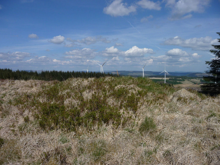
The apparently undisturbed top of Garn Fach. Much of the surrounding forestry is being felled to make way for a wind farm.
The grassy mound of Garn Fach, looking NE-ish.

Y Carn Bica stands in a little oasis of clearing at a meeting of tracks through dense conifer forest.

There’s not much visible stonework in the mound of Y Carn Bica, and what can be seen is quite small.

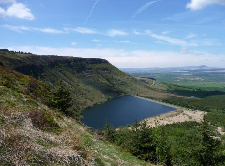

At the foot of the escarpment that Garn Fach and Y Foel Chwern perch above is the lovely Llyn Fach. Coincidence? Seems unlikely. Iron Age votive deposits have been found in its larger companion Llyn Fawr. The backdrop is provided by the much be-cairned mountains of Y Mynydd Du and Fforest Fawr.

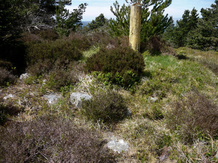
Detail of the stones comprising the cairn of Y Foel Chwern. Note inexplicable sawn-off post.

Overgrown Y Foel Chwern from the west.

Y Foel Chwern, the most northerly of the four cairns on Craig y Llyn. The mountains of Y Mynydd Du can just be seen peeking through the trees.

One sizable slab on the half-buried mound of Craig-y-Pant cairn.

A battle through the brush gives some limited access to Craig-y-Pant cairn, but the details remain largely hidden.
The heavily overgrown Craig-y-Pant cairn, approached from the SW.

Carn Foesen enjoys extensive views to the south, as far as Werfa (centre). The post in the foreground is the cast iron boundary marker mentioned in the Misc. post.

Carn Foesen has a decent spread of cairn material, suggesting that this was a fairly substantial cairn.

The low mound of Carn Foesen, with Willy Llewellyn memorial in the the foreground (see Misc. post).

Carn Foesen, approaching along forestry tracks from the north.

The wonderful, unobstructed view north from Garn Fach. The cairn stands on the highest hill in South Wales outside of the Brecon Beacons National Park and enjoys views of the ranges of Y Mynydd Du, Fforest Fawr and the Beacons themselves.

General view of Garn Fach, from the east.
Garn Fach, partially disappeared under forestry. The general shape of the cairn can still be seen under its “modern stone pile”.
