


SW fallen(?) stone, looking to NE stone (far left).


NE stone, looking towards SW stone.

Landscape context for the prominent hill with its summit enclosure, seen from the SW.

Landscape context for the fort/enclosure, which occupies the left hand end of the wooded hill, centre. Laugharne can be seen further to the left. The viewpoint is Pont-y-Mwche, on the opposite side of the Afon Taf.

The view from the fort to the confluence of rivers Tywi and Taf, no doubt important transport arteries in the Iron Age.

The fort’s placement ensures that it dominates the mouth of the Tywi.

The southern (cliff-ward) end of the western ramparts. The Gower can be seen in the distance, right.

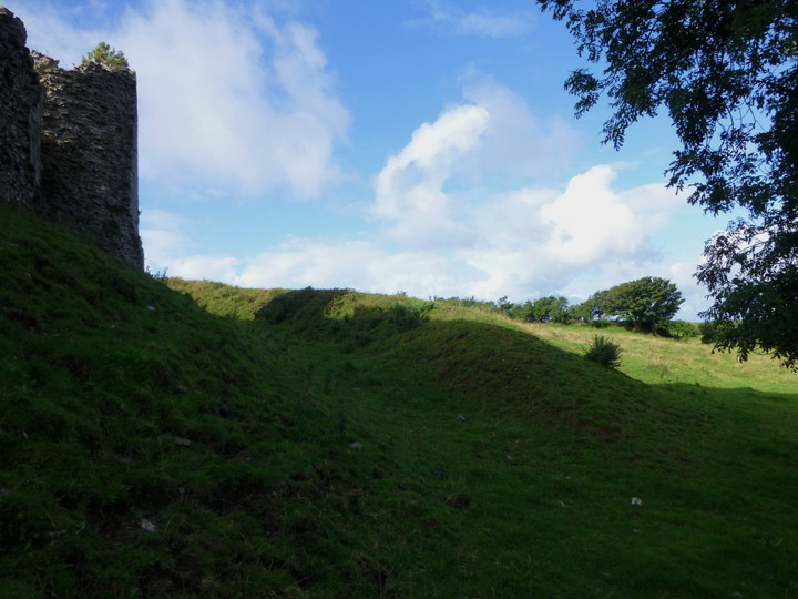
The outer of the double banks on the west side.

The inner of the double banks on the west side of the fort.
The inner of the double banks on the west side.

Rampart on the north side of the fort.

Seen from the north-east and emphasising the cliff-top positioning of the fort.
Visited 16 October 2013.
We take the Thurso-John o’Groats bus as far as Brough (pronounced to rhyme with “loch”), then it’s a simple road walk of three miles to Easter Head, the most northerly part of Dunnet Head. I had completely underestimated the distance from the map (doh), so it becomes a bit of a rush to get up here. The quiet road climbs steadily, winding its way past a selection of heather-imprisoned lochs, bright mirrors in a dark and impenetrable setting.
The highest point of the headland, where the cairn is, is visible the whole way, but doesn’t seem to get any closer for quite a long while. Eventually we round the corner and the lighthouse suddenly comes into sight. A car-parking area is available, which attracts several blink-and-they’re-gone other visitors during the time we’re here.
The cairn itself has sadly disappeared under a circular seating/toposcope thing, but this place is well worth the effort of the visit on a clear day for the views of the Orkney Islands across the Pentland Firth, almost close enough to touch. As the helpful, albeit cairn-destroying, panels inform us, we can see Hoy, Scapa Flow (which brings schoolboy memories of the sinking of the Royal Oak by Gunter Prien’s U-47), as well as the cliff fort of Holburn Head, Ben Loyal, Cape Wrath to the west and Duncansby Head to the east, amongst other things.
We have about three quarters of an hour before the repeat journey back to catch the bus, during which time the wind whips up a frenzy, even on this mild and sunny afternoon. The headland is dotted with abandoned concrete buildings of a military-looking type, casting an air of post-apocalyptic decay onto the scene. I’m sure the weather was all lovely and tropical in the Bronze Age when the cairn was built, but this feels as close to the ends of the Earth as anywhere right now. Perhaps they felt that too, some days. Until we make it across to the Orkneys one day, this is as far north as we get.
For all the howling wind, I find it a wrench to leave here.
Round cairn on the summit of Easter Head, the northern headland of Dunnet Head, making this presumably the most northerly prehistoric site in mainland Britain. Sadly the cairn has been covered by a modern viewpoint seating area.
Canmore’s successive listings tell the story:
This is a small cairn of low elevation with a diameter of approximately 16ft. A surveyor’s cairn has been erected on the top.
RCAHMS 1911, visited 1910.The much mutilated, grass-covered remains of this cairn survive to a maximum height of 1.5m and measure some 12.0m in diameter. The cairn has been flattened on top where a modern concrete building has been built. Resurveyed at 1:2500.
Visited by OS (R B), 23 May 1965.This roughly circular cairn, 12m in diameter and about 1m high, has been badly damaged within the last two years by the superimposition of a ‘scenic viewpoint’.
C E Batey 1982
From Canmore:
There are ‘two huge granite boulders, situated on a shelving rock over an abyss on the Loch Avon side of Cairngorm, with hand-made cups on them about a foot wide and correspondingly deep – “sitting on which is said to be efficaceous in cases of barrenness” ‘. Pilgrimages have been made to them within living memory.
A Mitchell 1875.
Mitchell and Drummond, A and J (1875) ‘Vacation notes in Cromar, Burghead, and Strathspey. Including notice of one of the supposed burial-places of St Columba’, Proc Soc Antiq Scot, vol.10
Page(s): 645

A splash of Summer colour on a cloudy day, eastern rampart.

The erosion scar patched in Winter re-opens by Summer.


Long zoom from another hillfort, Leckhampton Hill 20 miles to the SE.


The wonderful setting, looking up the Tawe Valley.

Approaching from Pwll-yr-Wydden Fach.

“Once upon a time there were three little sisters, and they lived at the bottom of a well”


The improbably situated hut circle, at the bottom of the sink hole.


There are some bigger slabs in the mound.

The fabulous view NE up the Tawe valley towards Fan Gyhirych.

Looking south towards Cribarth, which is not visible from the cairn.

Pwll-yr-Wydden Fach cairn, looking NW to the limestone plateau of Dorwen ar Giedd and Carreg Goch. The hut-swallowing shake hole is behind the cairn on the left.

Showing the position of the (grey) cairn between the two enormous shake holes. The hut circle lies improbably at the bottom of the one on the left.
There are two contrasting man-made monuments to see here, a cairn and improbably sited hut circle, as well as Nature’s own efforts in the form of some serious shakeholes.
The name is a bit obscure, as “Wydden” appears to have several different meanings. The most likely for a place-name element seems to be “tree”, although generally it means that in the context of particular species, e.g. onn-wydden = ash tree; ffynidd-wydden = fir tree, whereas a non-species specific tree would usually be “coed”.
However, a more interesting translation is “wood spirit”, as in Bodelwydden (“Home of the Wood Spirit”).
Hopefully someone who speaks Welsh can confirm or otherwise!
If it is “tree”, the name would be something like “Small pit of the tree” (there’s a non-“fach” version a little to the north, with a waterfall).
Pwll-yr-Wydden Fach cairn (SN82921508)
A cairn is located between two shakeholes.
It measures 10m in diameter and 0.5m high and is composed of loose small grade stones with some larger stones. The edge of the mound is grassed over. On the north-west lies a large slab and at the centre is a hollow 1.5m across and 0.3m deep.
Pwll-yr-Wydden Fach hut circle (SN82891510)
The hut circle is located at the bottom of a shake hole. Internally it measures 3.2m north to south by 2.8m and is bounded by a low stone wall of roughly coursed slabs and blocks. The wall measures 0.6m thick and survives to a height of 0.6m above the rubble strewn interior. On the west is a well marked entrance flanked on each side by boulders; they measure 1.1m and 1.3m long respectively and are separated by a distance of 0.45m.

Shapely Fan Gyhirych seen from slopes near Cribarth. Waun Leuci, on the left, also has Bronze Age cairns.

Waun Leuci/Cefn Cul is the central hill in shot, flanked by the mountains of Fan Hir (left) and Fan Gyhirych (right). Looking up the Tawe valley from Cribarth in a reversal of one of Gladman’s images.


