
One of the circular structures, looking towards Carnedd Dafydd.
Image credit: A. Brookes (26.8.2017)

One of the circular structures, looking towards Carnedd Dafydd.

Carnedd Dafydd towers top right, an immense mass of rock, plunging down to the Afon Llafar below. Seen from Mynydd Du.

Below the long ridges of the Carneddau are some spectacular cliffs and cwms. Here Carnedd Llewelyn is top left, with Ysgolion Duon (the Black Ladders) to the right, above the head of the Afon Llafar.

Drosgl is the rounded summit to the right of centre skyline. Looking across Cwm Llafar from Foel Meirch.

A hint that there is a world below, looking west with the cairn’s guardian.

The cairn seen across the summit plateau of shattered rock from the northeast.

Showing the damage done by walkers creating shelters from the stones of the cairn.
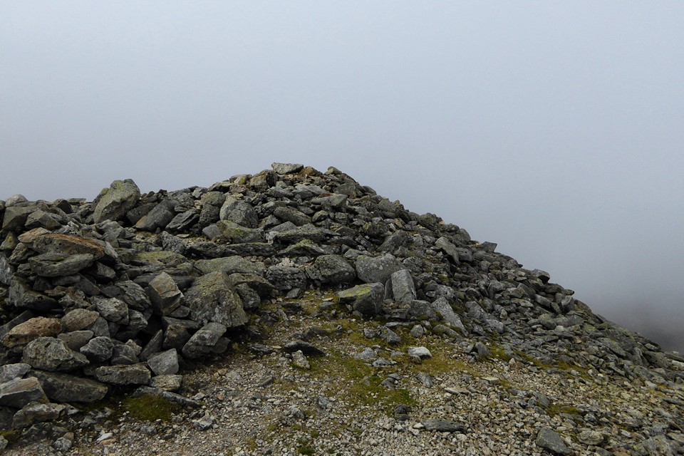
The cairn is positioned right at the top of the slopes of Carnedd Dafydd.

The summit cairn, with kerbing visible on the southeast.

Although the centre is disturbed, there is a good thickness of stones below the shelter’s floor level, highlighting how big the cairn is.


The ridge on the left leads to Pen yr Ole Wen – the magnificent Carnedd Fach cairn is just behind the more distant person. Y Garn, Elidir Fawr and the western end of the Glyderau are the backdrop.

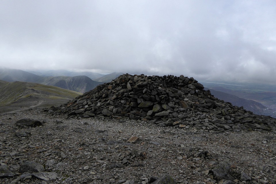
The veil lifts to reveal a world below.

Approaching in the mist from Carnedd Fach.

The mists swirl in again. Time to go.

The western side of the cairn, Elidir Fawr briefly emerging from the cloud.


Looking down on lovely Cwm Lloer in a reverse of one of Gladman’s images.

The cairn is so large that the wind shelter only occupies part of its top. The rest is shattered rock. Looking towards Tryfan.

The inevitable shelter has been built into the top of the cairn. The swirling cloud hides Elidir Fawr and the western Glyderau.

Big cairn this, despite the name.

The mist lifts to reveal the cairn on the approach from Pen yr Ole Wen. Carnedd Dafydd remains hidden beyond.

The solitary bulk of Carnedd Moel Siabod is centre, seen across lovely Cwm Lloer from the massive Bronze Age cairn of Carnedd Fach. Tryfan to the right of centre, with my route up here rising from centre to right of shot.

Castell y Gwynt can be seen as a prominent point on the shoulder of Glyder Fach, left of centre. For me this is probably the best side to view the Glyders from, showcasing the rugged rocky terrain and the plunging valleys and cwms beneath the peaks.

Tryfan does its magnificent pyramidal thing. Seen across the valley from Afon Lloer.

The settlement is far right, above the lakeshore. Tryfan and Y Garn preside.

Location, location, location. I’m sold.

Looking southwest towards Cwm Idwal and Y Garn.

Looking across the site and Llyn Ogwen towards Tryfan.

If it is prehistoric, it’s well preserved.

Pen yr Ole Wen towers above.

Arriving at the “house” on the footpath from the southwest, which cuts straight through the middle of it.

A bit glarey, but hey, it was nice to have some sunshine. From the path along the northern shore of Llyn Ogwen.
Visited 2.9.2017
The wheel of the year turns another click. It’s dark when I get up, and mist fills the valley of the Severn as I ride the early train along the estuary, a chill in the air in plain contrast to the heat of the last few days.
By the time I get to the pretty town of Ledbury several hours later, the sun has returned, the heat with it. The summer bus service to British Camp is in its last couple of weeks, and I’m keen to revisit a fort that I last came to on a cold and wet December day some seven and half years ago.
Rather than climbing onto the hills, I take the lower path round British Camp reservoir, unusually starting my walk with a descent rather than getting the uphill out of the way at the start. From down here, the bulk of British Camp looms oppressively, blocking all views westwards. People high on the ramparts are tiny, dwarfed by the enormity of earth and rock.
But I’m not going to get distracted by British Camp today, instead heading south to see the near-neighbours. Woodland canopy provides welcome shade on Tinker’s Hill, continuing more sparsely to Shadybank Common and the picturesque Dales Hall. Across Berrow Downs the view opens up massively to the east, from Bredon Hill (two hillforts) to the Cotswold escarpment (lots of hillforts).
Past Fairoaks Farm a path sneaks invitingly into the trees, so I head off this way. It proves to be a steep pull through Hollybush Roughs, and by the time I emerge onto a wider path I’m feeling rather disorientated about where I am in relation to the fort. A final slog takes me up to the open top of the hill and the memorial shelter mentioned by Carl. This is where I came on my previous visit, but on that occasion I was with a group and we climbed up from the northeast, as cold December rain started to fall. No such problem this time, instead it’s blazing heat to contend with.
There are a few people up here, unsurprisingly on a day like this. I head to the southern edge of the fort, where two ramparts head off around the western circumference. Following the higher of the two, some way below the top of the hill, the lower rampart soon drops away, leaving a wide space and steep hillside between the two levels. The views south and west are terrific, from the inevitable May Hill, across the Forest of Dean, the hills above Cwmbran, Pen-y-Fal (The Sugarloaf), the high ridge of the Black Mountains, the Radnor Forest, the hills of Herefordshire and eventually northwest to the Clee Hills in Shropshire. There must be two dozen hillforts in view from here.
I follow the inner rampart round, a challenge in places as the chest high bracken conceals some ankle catching brambles. Eventually coming to the northern entrance, the higher hills of the Malverns and the obvious contours of British Camp fill the view.
Last time I was here we only visited this higher part of the fort, but actually it comprises less than half of the occupied area. This time I head eastwards downhill, back into the trees. Passing through the woodland, the path re-emerges into another open area. The fort is in the shape of a fat-tailed ‘q’, and the eastern area is broad and flatter than the high part of the hill. Sadly the views here are much more restricted by the trees below the rampart, and the rampart itself is overgrown with brambles that make it impossible to follow. Instead I walk south through the middle of the section – it seems probable that this was the main residential area of the fort, sheltered from the winds and exposure of the western part. On a nice sunny day it feels like a good place to make your home. It’s easy to see why the fort is where it is, well-defended by steep slopes and with commanding views in all directions.
Eventually I re-enter the trees at the southern end, trying to get back to the rampart on the western side of the “tail”. Crossing a fence brings me to the lip of a huge drop, with water glinting far below. This marks the edge of a deep quarry cut into the hillside below the fort, taking the edge of the rampart with it. A potentially dangerous place for the unwary, the sheer drop is head-spinning and I head back to the open area before following the rampart again along its southern route. It’s probable that the main entrance was close to where the body of ‘q’ joins the tail, but a group of teenagers are doing teenager stuff in the trees here, and it’s not clear that an old git lurking in the woods with a camera is going to provoke a positive response, so once again I head back uphill.
By now time has run away, as it always seems to, and it becomes a dash back to British Camp to get to the bus-stop. Still, it’s been a very satisfying return to Midsummer Hill. By the time I get home it’s getting dark, and the fleeting months of summer seem to be ebbing away. The wheel keeps turning.

Between the outer and inner ramparts in the wooded western half of the fort.

Impressive section of the inner rampart, towards the middle of the south side of the fort.

Looking southeast towards the almost inevitable May Hill.

Southern defences, looking east. The inner rampart is much higher than the outer.

Southern defences, looking west. The edge of the Black Mountains can be seen in the distance, far left.

The fort from the east. The main entrance is at this end, centre of image.


The open interior of the eastern half of the fort.


The northern defences, following the track below the inner rampart eastwards.


Cherry Hill is the hill to the left of the church spire. Seen across Fownhope from the southeast, about halfway between Cherry Hill and the nearest hillfort neighbour Capler Camp.

Aconbury rises prominently above its surroundings, centre. Seen from the road below Capler Camp to the northeast.
Visited 12 August 2017.
After last weekend’s unplanned spontaneous trip to British Camp in the Malverns, this weekend I have a plan. And it’s a cunning plan, so cunning you could put a tail on it and call it a fox, etc. Anyway, I’m off to Fownhope, a little village on the banks of the River Wye towards the south of Herefordshire.
As well as two pubs (one called the Green Man), a shop and fine church with slightly twisty spire and a Norman tympanum carved with a toothy winged lion, Fownhope sits between two wooded Herefordshire hillforts. I have three hours to visit them both. That’s the plan.
Things start promisingly, the sun has come out and the bus from Hereford drops me off on time. I’ve decided to visit Capler Camp first, on the basis that it looks less likely to be an overgrown slog and also it’s further away than Cherry Hill, which is right next to the village, so will help gauge the time I have better. A fairly straight minor road leads from Fownhope church towards Capler. I’ve anticipated a slow climb followed by a steep bit at the end, but that’s because I haven’t read the map properly and don’t realise that the whole way is a succession of up and down hill bits, guaranteed to tire out of practice legs before I even arrive at the proper hill. The first of these ridges does at least give a nice view of both forts from about halfway between them.
A buzzard flies over the tractor throwing up dust in the nearby fields, sheep are cajoled and corralled at Rise Farm, and I realise that there is a good view of Aconbury, another of Hereford’s fine hillforts.
Passing Capler Cottages marks the start of the steep section of the road, but a slightly overgrown track beckons invitingly off to the left, promising a less direct and more zig-zag route up to the fort. It proves a good choice, quite dry despite the ridiculously wet summer, and far less steep than the road would have been. It emerges near the top of the footpath to the south of the fort.
From here I head to the ramparts. The fort is in two distinct halves, the western side covered in trees, the eastern side an open field. I head west, into the trees.
It’s not a good time of year to visit wooded hillforts, brambles make the earthworks difficult to access and the thick canopy makes photography frustrating. Nevertheless, getting round this fort is easy enough as a wide swathe has been cleared inside the perimeter of the inner rampart, and a broad track follows what would have been a ditch between the inner and outer defences. The defences are strongest on the south, two lines of earthworks making up for the relatively shallow gradient compared to the west end and north side. It’s very pleasant under the trees and on reaching the north side I drop down from the inner rampart to the track below.
On the north side the natural steepness does all the work, and the track is a good three metres or more below the inner rampart. Some of the trees that mark the outer “bank” here are towering, one is a venerable beech that wouldn’t be out of place on the chalk Downs or limestone scarps to the southeast. The woods are an attractive deciduous mix, not the dense conifers of recent forestry plantations, but an older woodland that feels right on this hilltop.
At length I come round towards the eastern end. Climbing the inner bank brings me out into the open half of the fort. I’m somewhat surprised to find a tall post, carved to the effect that this is an Iron Age hillfort. It turns out that this is the end of a succession of similar posts marking a permissive path up from the picnic area on the road to the south. The interior is lovely, the inside of the southern rampart is rich with harebells. From here the view stretches south and east. I’m not in the slightest surprised to see the ever-present shape of May Hill, while the vista to the south is filled with the dark mass of the Forest of Dean, over the border in Gloucestershire. To the southwest the edge of the Black Mountains is visible. This is a great spot, and I end up sitting here for a while in the summer sunshine.
Finally leaving through the eastern entrance, past a lovely old stone barn and a neat cottage, I follow the Wye Valley Walk footpath along the outer rampart. It’s a good hillfort this, not perhaps in the front rank of Herefordshire examples like Wapley Hill and British Camp, but a very decent site nonetheless.
Reluctant to leave, I take a final turn around the wooded half of the interior, before heading south back to the road. A little picnic area gives glimpses of the Wye sparkling in the sunshine below, living up to its picturesque billing. I follow the road down, noticing the steepness and also how many cars seem to be driving up and down this narrow lane, from nowhere to somewhere or back again.
The extended stay has wiped out the time I have left, and Cherry Hill will have to wait after all. A Spring visit would be better anyway I reckon. The best thing about a cunning plan is how easily it can be abandoned or reshaped, and this one will easily bear a bit of reshaping.

I’ve no idea if this is anything to do with the cairn or not. It seems to have gone unremarked by other visitors and this is the only picture I have of it. Needless to say the village is Long Compton, and this is in the position of the mound that blocked the King’s view.