thesweetcheat

thesweetcheat

All posts 5,201-5,250 of 16,561 posts

British Camp

Visited 5.8.2017.

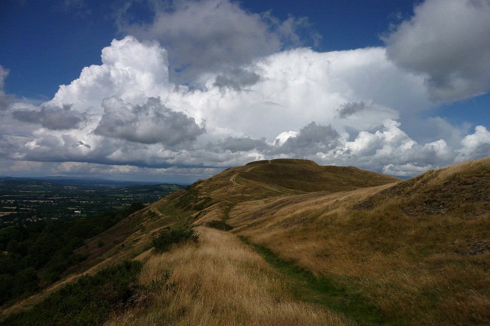
Three and a bit years on since my last visit, which was a claggy Easter day with visibility truncated by hazy mistiness. No such problems today, a rolling front of thunder has pushed its way up from the Black Mountains across Herefordshire, and the skies are clear and views are long in its wake.

No plan, just an entirely spontaneous diversion, jumping off a train at Hereford and catching a bus at Ledbury to emerge at the foot of the hill as the rain carries on to soak Worcester.

I decide to follow the lower rampart round the west side of the fort, which gives a great view of the ranks of earthworks climbing the flanks of the hillside, as well as beautiful unfolding panorama of Herefordshire. When I first came here in 2009, I hadn’t explored the Black Mountains, or Radnor Forest, and my memories of the Clee Hills were from my childhood. All of these are in clear view today, as well as the Cotswolds escarpment to the southeast, Bredon Hill to the east and the ridiculously ubiquitous May Hill to the south. Three English counties and quite a bit of Wales to admire then.

In the years since that first visit I have come to recognise these distant hills, and the Malverns ridge is the common landmark visible from where I grew up and where I live now. The fort itself overawed me when I first came, and this third visit does nothing to diminish the impression of what must be one of the finest hillforts in these islands. The presence of other visitors, tiny specks against the serried rows of banks and ditches, serves only to enhance the sense of wonder.

I spend an hour walking the perimeter and up to the top, before reluctantly deciding to continue my broken journey. The thunderheads have broken over Worcester, and magnificent rainbows over Bredon and Cleeve Hill will follow later. Sometimes England is really very lovely.

Image of British Camp (Hillfort) by thesweetcheat

British Camp

Hillfort

Looking northwest. The Clee Hills in Shropshire are the next big upland area, on the distant skyline. To the left is where I grew up in Herefordshire.

Image credit: A. Brookes (5.8.2017)
Image of Kemerton Camp (Hillfort) by thesweetcheat

Kemerton Camp

Hillfort

Severn Valley context, from Witcombe. Bredon Hill in the distance, right of centre. Other Iron Age sites on the Malverns (far left), Churchdown Hill (in front of the Malverns), Oxenton Hill (right of Bredon) and Nottingham Hill (far right).

Image credit: A. Brookes (4.10.2009)
Image of Graig Lwyd (Ancient Mine / Quarry) by thesweetcheat

Graig Lwyd

Ancient Mine / Quarry

Graig Lwyd (far right) in its setting between sea and mountains. The Druid’s Circle and monument complex is in the hills towards the centre. Seen from Trwyn Du at the northeast tip of Anglesey.

Image credit: A. Brookes (22.7.2017)
Image of Pant-y-Saer (Burial Chamber) by thesweetcheat

Pant-y-Saer

Burial Chamber

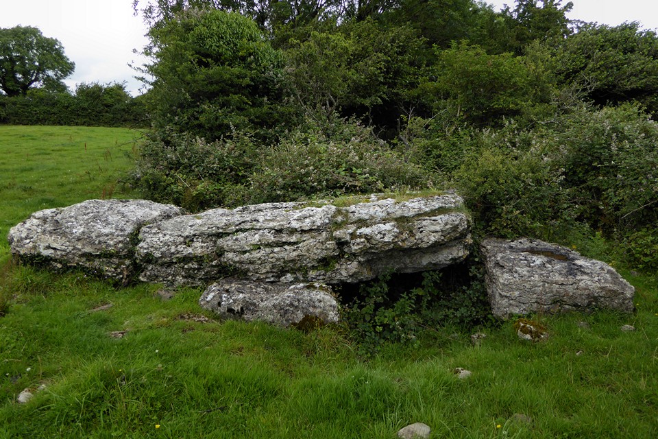
Looking through the TMA photos of this site sequentially makes it even more obvious that the bush needs cutting right back. Great site, despite the vegetation overload.

Image credit: A. Brookes (22.7.2017)
Image of Bwrdd Arthur (Llanddona) (Hillfort) by thesweetcheat

Bwrdd Arthur (Llanddona)

Hillfort

Bwrdd Arthur is the very obvious flat-topped eminence towards the left-hand end of the headland opposite. Looking across Traeth Coch – Puffin Island (Priestholm) far left, Snowdonia’s mountains glowering from underneath the clouds the background.

Image credit: A. Brookes (21.7.2017)

Miscellaneous

Benllech
Burial Chamber

The Gwynedd Archaeological Trust record has more information. The site appears to be in someone’s garden:

The small megalithic burial chamber (SH 51908275) at Benllech was excavated on behalf of the MOW in March 1965. It was previously unrecorded and was revealed when new sewers were dug nearby and the site cleared for the erection of a bungalow.

No prehistoric finds were made and the only reason for regarding the main chamber as a prehistoric burial chamber is its structure, which is comparable with the Lligwy and Glyn burial chambers. The annexe and field wall are relatively modern.

Not entirely convincing small low ‘burial’ chamber. Capstone perforated (natural limestone pavement). Now in garden of Drws y Nant and in built up area. Capstone supported by uprights and blocks at west side and by recent concreted pillars at east. Stands on gently sloping hillside above the coast. 2 large orthostats – one 2.2 x 1.2m stand just to south. Cadw recently reclassified this as a ‘goose house’ after F Lynch – this doesn’t seem to be a prehistoric monument as it stands – the chamber is very low and could not have been deeper because it stands on bedrock. This could have been disturbed at the time of the sewer construction – a considerable depth of bedrock would have been removed.

Image of Ystradfawr (Cairn(s)) by thesweetcheat

Ystradfawr

Cairn(s)

Time ran out and I realised that the cisted cairn was further away from the standing stone and its cairn than I’d thought, so I had to abandon looking for it. But I did come across this little dolmen folly made from field clearance.

Image credit: A. Brookes (8.7.2017)