
The Cheesewring with the walls of Stowe’s Pound to the left.
Image credit: A. Brookes (22.6.2018)

The Cheesewring with the walls of Stowe’s Pound to the left.

The Cheesewring with Daniel Gumb’s House in front.

Hut circle, looking towards Stowe’s Pound.

Bracken-covered hut circle. Looking towards Kit Hill with Dartmoor beyond. Caradon Hill rises far right.

The centre of the cairn at SX 26833 70162. Although it looks like remains of a central chamber, it’s probably the natural arrangement of tor and clitter.

The cairn at SX 26833 70162, on the southwestern edge of the group. It’s built around a granite outcrop.

The huge cairn at SX 26852 70058 from the northwest. Although it looks like a ring cairn, the centre is full of stone but it’s turfed over.

The western arc of the cairn at SX 26852 70058.

Stones of the southernmost cairn at SX 26852 70058.

The cairn at SX 26852 70058, the southernmost in the group and at 23m across the biggest on the hill.

Kerbing and cairn material on the eastern side of the tor cairn at SX 26966 70186.

Edge-set granite slabs in the kerb of the tor cairn.

Detail of the kerb and cairn material of the tor cairn at SX 26966 70186.

The tor cairn at SX 26966 70186, the most unusual of the monuments on Caradon Hill. A kerb of edge-set slabs surrounds most of the granite outcrop in the centre.

Quartz block exposed in the centre of the cairn at SX 26976 70323.

Smaller, centrally disturbed cairn at SX 26976 70323, on the western edge of the group.

The cairn at SX 26988 70283. The centre is a little damaged, but this is a fine example of an upland cairn.

Excellent cairn at SX 26988 70283, looking over the western slopes of the hill.

Looking north across the big cairn at SX 27085 70314 towards the summit. The nearest cairns of the northern group are around the masts.

The mostly intact top of the big cairn at SX 27085 70314.

The massive cairn at SX 27085 70314.

Massive cairn at SX 27085 70314, standing over 2m tall and the best part of 20m across.

Neat cairn at SX 27208 70282, towards the northeastern edge of the group.

The relatively small cairn at SX 27260 70284, the easternmost in the group. It enjoys extensive views east and southeast. The hill over to the left is Kit Hill. Behind that the edge of Dartmoor fills the skyline.

The top of the cairn at SX 27115 70385. Difficult to see for the blue on blue, but the sea near Looe can be seen on the horizon.

The round cairn at SX 27115 70385, the northernmost in the group. Looking south.

The southernmost cairn in the group at SX 27073 70541. I didn’t pay this one much attention, but the stones to the right of centre are the possible cist elements mentioned in the miscellaneous post.

The badly damaged cairn at SX 27114 70566, a victim of stone-robbing that has left a very low, uneven mound.

The pretty trashed cairn at SX 27119 70608.

Very low remains of the banked cairn at SX 27170 70633. The encircling bank is quite clear, but the central mound has practically disappeared.

The prominent platform cairn at SX 27215 70682.

Detail of the inner mound of the platform cairn at SX 27215 70682, with the outer bank behind.

Platform cairn at SX 27215 70682. The monument is the most prominent of the group, consisting of a high central mound with an outer bank.

The round cairn at SX 27216 70717. Stowe’s Pound can be seen on the far left, with Langstone Downs and Kilmar Tor beyond.

Damaged and relatively small round cairn south of the OS trig pillar at SX 27303 70733. The vegetation beyond covers the nearby embanked platform cairn on the highest point of the hill. To the left of that is the top of Stowe’s Pound and to the far left, distant Brown Willy can be seen on the skyline.
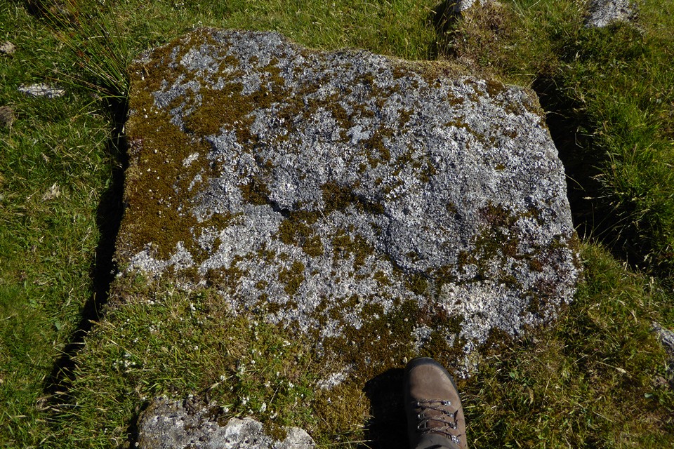
Exposed slab in the centre of the embanked platform cairn at SX 27280 70791, boot for scale.
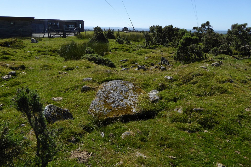
The pitted centre of the embanked platform cairn at SX 27280 70791, showing exposed slab.

Embanked platform cairn at SX 27280 70791. This is the summit cairn.

Impressive section of double kerb around the inner mound of the banked cairn at SX 27331 70870.

The apparent chamber or cist in the banked cairn at SX 27331 70870.

The central mound in the banked cairn at SX 27331 70870, showing a probable cist or chamber.

The excellent banked cairn at the northern end of the group (SX 27331 70870). The monument consists of a low rubble bank (like a ring cairn) seen in the foreground, enclosing a kerbed inner mound. In my opinion this is the most interesting monument in the group.

Detail of the well-defined rubble bank of the ring cairn at SX 27377 70759.

Remains of kerbing on the ring cairn at SX 27377 70759.

The southeastern arc of the ring cairn at SX 27377 70759, looking eastwards off the moor, towards Kit Hill in the middle distance and the distant edge of Dartmoor beyond.

The ring cairn at SX 27377 70759, from the east.

The two barrows are slowly disappearing under the gorse again. This is the better SE barrow.

One of the smaller round houses.


Solstice offering of cotton grass and heather.