
Becairned Mynydd Machen is one of the most prominent hills visible from the Severn/Hafren shoreline. Seen on a grey and drizzly day from the coast path near West Usk lighthouse.
Image credit: A. Brookes (2.9.2012)

Becairned Mynydd Machen is one of the most prominent hills visible from the Severn/Hafren shoreline. Seen on a grey and drizzly day from the coast path near West Usk lighthouse.

At Uskmouth. Easy enough to imagine two skin-clad fishermen making their way across the flats, with an excited child on their first fishing trip chattering and trotting alongside.

Intertidal mudflats at Uskmouth, where the three footprint trails (and antler mattock) were found.

These intertidal flats at Goldcliff have yielded an impressive array of multi-period finds. Looking across the Severn/Hafrern towards Portishead.

Approaching Goldcliff “island” from the east along the modern coastal defences.

Mudflats at Magor Pill. A trail of footprints left by a Mesolithic fisherman is out there, under the lapping tidal waters of the Severn/Hafren.

Zoom through the criss-cross of power lines, from the Wales Coast Path.

Wooded Wilcrick Hill (centre), seen across the Gwent Levels from the Welsh Coast path, showing the relative prominence of the fort in this flat landscape.

Tree-covered Piercefield Camp, seen across the Wye from Wintour’s Leap.

The large grooved block.

The remains are difficult to see under a covering of low summer vegetation.

General view of the site in its woodland clearing. The large block in the foreground (left) is referred to in the “miscellaneous” post.

Tree-covered Black Cliff fort, seen across the River Wye from Shorn Cliff on a mizzly day.

Ysgyryd Fawr, with the conical Sugarloaf behind. Seen from The Kymin above Monmouth, the best part of 20 miles distant.


Blorenge seen from far to the ENE, on Offa’s Dyke Path near White Castle in Monmouthshire.

Ysgyryd Fawr rises above fertile Monmouthshire farmland. From Llangattock Lingoed to the NE.

Seen from over 10 miles away to the SE, the unmistakable be-cairned summit of Pen y Gadair Fawr dominates the landscape.

Pen-Twyn Camp is the light green hill, dotted with trees, in the centre. Behind it, the bulk of Hatterrall Hill rises at the southern end of the eastern Black Mountains ridge. Seen from Wern-Gifford, across the Honddu Valley to the SE.
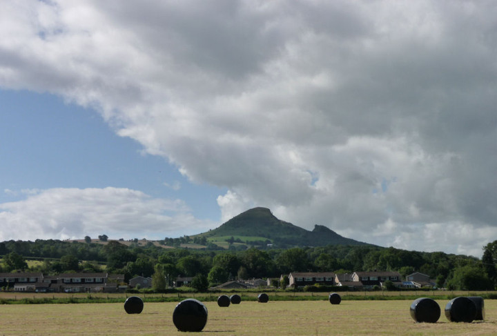
Ysgyryd Fawr, seen from Pandy to the north.

The shapely hill dominates the Abergavenny skyline.

Summer Blorenge, seen from Abergavenny Castle. The cairn is positioned away from the lip of the hill, so as to be completely invisible from down here in the Usk Valley.

Quartz-veined stone in the exposed cairn material.

The biggest risk to the cairn is that someone will drive over it. The track marks are perilously close.


One of the most beautifully sited cairn circles you’ll find.
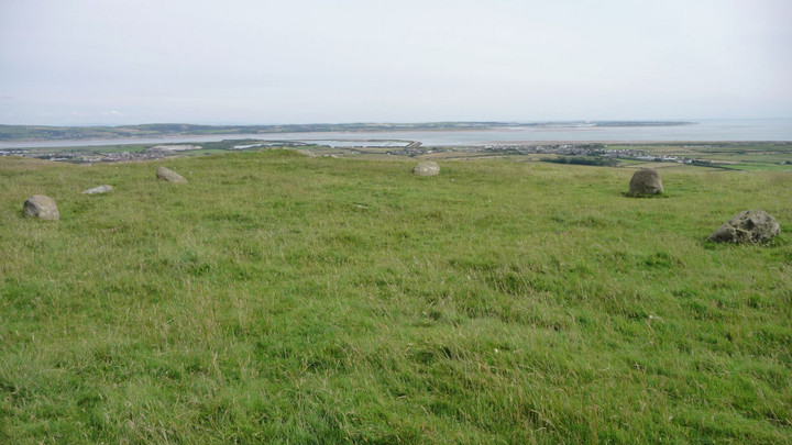
Lacra B, missing NW arc in the foreground.
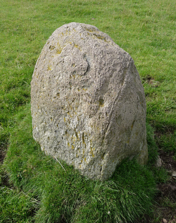

Lacra B, looking SE towards Millom, with its distinctive coastal defences.

Lacra B, looking south across Duddon Sands towards North Walney.

Another very uncertain shot of what may be Lacra E, this time from the hillside above. The sheep are running towards Lacra D. Happy to delete if this turns out not to be Lacra E!

Based on the descriptions, I think that the three stones in the middle ground may be Lacra E. The stone in the bottom left corner is part of Lacra D, I’ve included it to help anyone who might want to orientate themselves and have a proper look (as we didn’t).

The vague possibility of a SW continuation to the alignment/row/avenue. The stones of Lacra D circle can be seen up the slope on the left.

Elevated view of the possible NE alignment/row/avenue. The stones run from the bottom left of the picture towards the right centre. The sheep are clustered around Lacra D (one of them is actually standing on top of the NW stone of the circle).

Looking southwest towards Lacra D along the possible NE alignment/row/avenue.
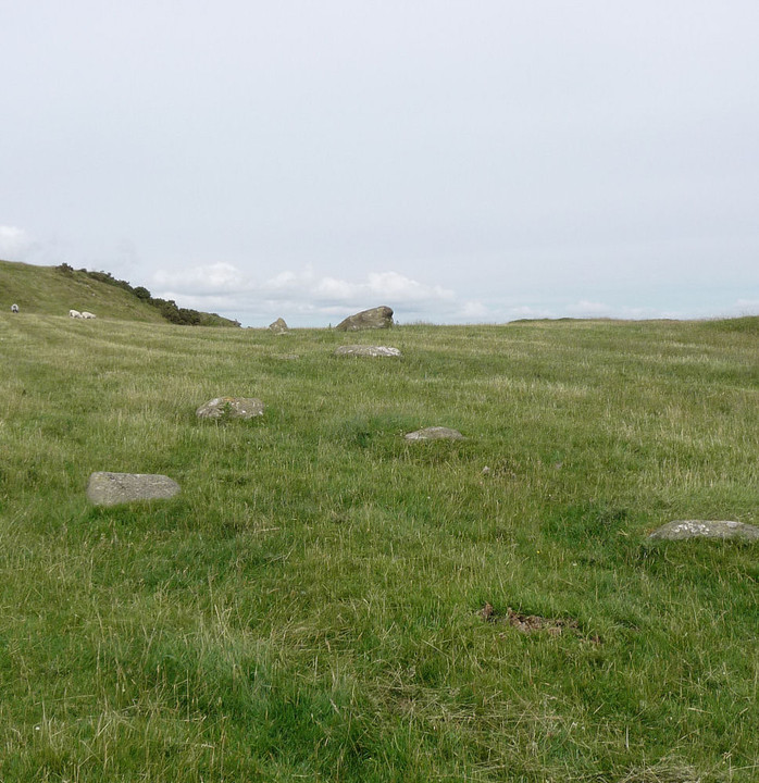
Looking northeast from Lacra D, along the possible alignment/row/avenue.

Lacra D’s central slab/druidical sacrificial table.

Lacra D, looking NE in the direction of the stone row.

Lacra D, looking north-ish. The top of Black Combe is visible over the ridge to the left.

Lacra D, looking SSE (actually almost directly towards Lacra B and C, but neither can be seen due to the intervening ground).


Looking SW, the stones reminded me very much of Drift in West Penwith, in a setting of neat fields and scattered cottages.


