
The grass appears to have been cut by a tractor. This has left tracks all over the extent of the original mound and has knocked out some of the marker stones. Bah.
Image credit: A. Brookes (8.12.2012)

The grass appears to have been cut by a tractor. This has left tracks all over the extent of the original mound and has knocked out some of the marker stones. Bah.


The chambered tomb from the west. The stones that mark out the original extent (see foreground) are getting a bit lost and knocked about.

Some landscape context for the low-lying stone (centre), looking SW towards Tor y Foel and the Brecon Beacons.

By the time I got here, the Winter sun had already sunk below Myarth, leaving the stone in shadow. Looking NW towards Ffynnon Las.

A fine stone, this. It’s bigger than it looks, standing at over seven feet tall.

The cairn may be a bit of an overgrown mess, but 100% worth the visit for the excellent views, especially of be-cairned Pen Allt-mawr/Pen Gloch-y-pibwr.

Did I mention that it was overgrown? Looks like a job for a megalithic gardener. Looking NE.

Looking SSE down into the valley of the Rhiangoll.

There is some visible stonework under the bushes, just to let you know you really have found the cairn. Ffynnon Las on the skyline opposite is home to a much more extensive Bronze Age cemetery.

The cairn is seriously overgrown (clue: it’s under the gorse) but has very decent views. Looking SW towards the eastern peaks of the Brecon Beacons, Tor y Foel, Allt Lwyd and flat-topped Waun Rydd.

Looking down on the site from the slopes of Pen Tir above, showing its position above the Rhiangoll valley. Apologies for flare, the low winter sun made it difficult to get a decent picture from here.

The northern bank, viewed from the interior. There is no counterscarp. The steep slope makes this bank almost as formidable an obstacle from inside as outside the site. I think this may be suggestive of use for stock, rather than as a defensible or even occupational site.

Looking across the interior of the site, showing how steeply it slopes.

The overgrown ditch on the western side of the site.


Looking west along the northern rampart. The hill on the right skyline is Fynnon Las, home to a sizeable Bronze Age cemetery.

The northern rampart, looking east. Pen Allt-mawr rises beyond.

Some landscape context, from Cefn Moel to the west. The promontory fort is in the trees, dead centre of photo. The bank of the rampart can be seen as a dark line under the trees. Pen Allt-Mawr looms above.

Looking east across the cairn to Pen Allt-mawr in the Black Mountains.

The mound is substantial underneath the covering of tussocky grass and dying bracken, and appears to be fairly undisturbed.

Looking SW across the top of the cairn to the snow-capped Brecon Beacons.

The rather overgrown top of the cairn, looking NW towards Llangorse Lake/Llyn Syfaddan. The wooded hill on the far left is Allt yr Esgair, topped with a hillfort.

Looking NNW, with the lower slopes of Mynydd Llangorse on the far right.

More overgrown than on my previous visit. Looking SSW towards the hills above Llangynidr and Tor y Foel.

Looking northeast towards the Black Mountains ridges, Waun Fach and Pen y Gadair Fawr are snow-capped above a high snow-line. Sadly there is evidence of a small fire being lit on the cairn itself.

Looking southwest towards the snow-capped central Brecon Beacons.

Looking southeast along the Usk valley. Be-cairned Pen Cerrig-Calch rises on the far left, the conical peak of Sugarloaf/Pen y Fal beyond. The Usk Valley is lined with various standing stones around the wooded hill of Myarth (below, right), Blorenge fades to blue on the skyline.

The western profile of Pen Allt-mawr and Pen Gloch-y-pibwr, rich with Bronze Age cairns. The snow-capped peak of Pen y Gadair Fawr (also be-cairned) can be seen at the extreme left of the picture. Coed y Gaer promontory fort is in the trees on the ridge sloping down from the left-hand edge of the picture.

Looking northwest.

Winter morning, Bwlch.

Looking ESE. Be-cairned Pen Cerrig-calch is the mountain on the left, wooded Myarth hill on the right.

Eye of the needle.

Looking northeast.

Seen from the road to the west. The Sugarloaf/Pen-y-Fal provides the skyline backdrop.

Mynydd Dinas from Port Talbot. The barrow is on the highest point, in forestry now.


On the berm below the southwestern bank, looking northwest.


Looking north along the eastern ramparts. The banks and ditch are full of dying bracken, as well as plentiful rhododendrons. A summer visit might be less rewarding.

The eastern rampart, looking south. Steep natural slopes are augmented by two banks and a ditch on this side of the fort.

Low inner scarp, possibly representing the remains of an earlier settlement phase.
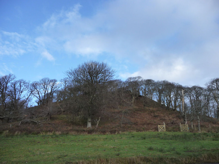
The steeply sloping southern aspect of the fort, from Margam Castle.

Looking northeast towards Mynydd Margam.

In the shadow of a cold stone, freezing to the bone.

