
Looking WSW towards Swansea and Mwmbwls. The cairn has been very robbed out, but an arc of its original footprint remains.
Image credit: A. Brookes (25.2.2023)
Looking WSW towards Swansea and Mwmbwls. The cairn has been very robbed out, but an arc of its original footprint remains.


The northwestern rampart. Y Mynydd Du mountains on the right skyline.

The southwestern part of the rampart has been rather damaged over the centuries. Looking towards Mwmbwls and Gwyr across Bae Abertawe.

Looking over the southern rampart towards Twyn Disgwylfa, with the Hafren/Severn beyond.

The badly damaged round cairn inside the fort.


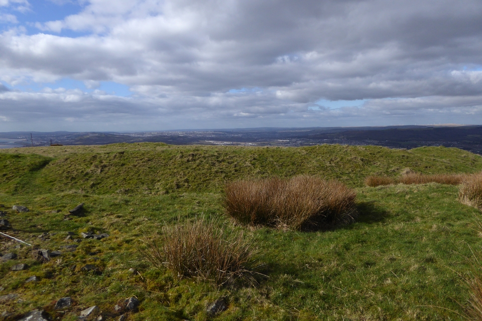

Twyn Disgwylfa from the nearby hillfort Buarth y Gaer. Looking across the Hafren/Severn to Somerset and Exmoor.

Although it’s an extremely prominent summit, the forestry surrounding the summit clearing cuts off any views. Without the trees there are extensive views of Bae Abertawe across to Mwmbwls, as well as north to Y Mynydd Du’s gentler southern flanks, taking in the Buarth-y-Gaer hillfort and the barrow on Foel Fynyddau nearer at hand.


It’s quite a decent sized mound.

There are some stones protruding through the turf, indicating a stone cairn.


The solitary Ashton Court stone.

I came across this stone alone while crossing Ashton Court on the Community Forest Path. It stands on the slopes of a dry valley, just below the “probably prehistoric terraces”. It’s quite likely natural, and the area has been heavily landscaped, but there are no other similar stones or outcrops around so it makes for a striking feature.

There are various earthworks in the eastern part of Ashton Court, including a field system and terraces which the North Somerset HER describes as “probably prehistoric”. Looking towards Dundry Hill.


Looking across the Avon Gorge to Clifton Down Camp from the eastern tip of the fort.


The stony construction of the inner rampart shows through the thin turf.

The top of the inner rampart, western side of the fort.

Looking down on the inner ditch and outer rampart.

Looking towards the inner rampart from the outer, west side of the fort.

Inner and outer ramparts on the west side.

Clifton Down Camp from across the Clifton Suspension Bridge. Nice strata and a long drop.

My previous visits have been in the summer, but even in January parts of the rampart are densely overgrown.


Outer rampart in the foreground, much larger inner rampart behind.

Possible Bronze Age barrow for goalposts? Isn’t it? Marvellous.


There’s a definite circular mound, but as to it being a barrow, who knows? Handy bench to sit on while you ponder.

The top of the large mound. It’s slightly dished in a way that suggests excavation.

This substantial mound is in the vegetation along the edge of the ridge. I’m not sure it is one of the barrows, but it’s not explained by anything else on the SMR and is clearly artificial.

This low patch of scrubby grass is likely to be the remains of one of the barrows.

Difficult to see, the photo shows a section of the low remains of the sub-circular earthwork to the southwest of the fort, curving round to the right, away from the viewer. There was a linear group of round barrows over on the left, but they have been all but obliterated now.

The western rampart from its southern end.

Looking north along the western rampart.

Bank and ditch of the western rampart, with mountain bike erosion.


The modern path cutting through the western bank and ditch reveals the stone construction.

Below the northern rampart there’s a narrow level terrace. It’s not clear whether it’s part of the fort’s construction, but the way it intrudes in the natural slope of the hill suggests it’s artificial.;

Approaching the northern rampart from below. The fort doesn’t look much once you’re inside it, but this approach allows the natural defences to be appreciated.


Outer rampart on the western side of the fort.

Standing in the ditch below the inner rampart, which rises to a huge height on the left.