
The eastern side of the promontory.
Image credit: A. Brookes (24.9.2016)

The eastern side of the promontory.

Looking over the sheer cliffs forming the seaward extent of the fort.

Looking along the western end of the bank, across the bay towards Barclodiad-y-Gawres on the opposite headland.


The eroding promontory from the west.

Looking across to the tomb from the promontory fort at Porth Trecastell.

The tomb, on the headland centre, is a prominent landscape feature from some distance. Seen from Porth Terfyn to the south.


The last of the blue skies belie a howling gale that made standing up here challenging.

The superbly situated kerb cairn, overlooking Traeth Mawr.

Hut circle slightly north of the cairn.

The cairn is positioned above the mouth of Afon Ffraw, on the tip of the low headland.

1951 paperback edition of Pevsner’s Cornwall volume of Buildings of England has Trethevy as its cover star.

Yr Wyddfa wreathed in cloud.
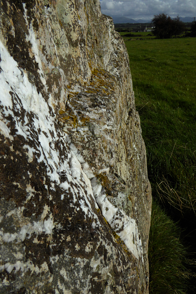


A superb stone, massive and liberally veined with quartz.

Looking to the promontory fort across a windswept Malltraeth Bay from Ynys Llanddwyn.

The promontory fort from Ynys Llanddwyn. Holyhead Mountain can be seen beyond.

Yr Eifl (centre) with Tre’r Ceiri on its lefthand peak and Carn Fadrun over to the distant right. From Traeth Llanddwyn, Ynys Mon.


Quartz and autumn equinox elderberries.


At this time of the year the tree line blocks much of the view of the mountains across the Menai Straits, but Elidir Fawr and Y Garn in the Glyders can be seen. Yr Wyddfa would be visible over to the right without the trees.

For all that it’s partially collapsed, I really liked this one with its massive, quartz-studded capstone.

As Carl says, the hedges are high. It looks as though access to the field is from the north via the farmhouse. The mountains behind are Moel Eilio and Mynydd Mawr, both with substantial Bronze Age cairns on their summits.

Pole for scale (approx. 25”).

There’s a small circular dent in the top of the stone, like someone has taken a drill to it at some point.

The stone just inside the churchyard wall.

The Victorian church at Llanedwen, showing the location beside the Menai Straits with the backdrop of Carneddau mountains. Follow the path to the left, round to the east end of the churchyard to the stone I found. Bryn yr Hen Bobl chambered tomb is two fields away.

Lanyon in its landscape, looking towards Carn Galva and Ding Dong mine. Traces of the mound can be seen surrounding the chamber.

Four of the stones in a line. The second from the right is unnumbered and is probably a fragment only.

Magnificent countyard house with Chapel Carn Brea beyond.


The fort boasts a superb view over the Severn estuary, looking across to Cardiff and Newport. The headland to the right is Sand Point, which has barrows and a field system.

Brean Down seen at low tide from Weston-super-Mare, Late August Bank Holiday Monday

Looking down the passage to the chamber, lit by light from the low sun coming through the blocked portal.


The replica of the astonishing decorated stone.

Hard to imagine a more perfect evening to arrive here.


