The Modern Antiquarian
Log in
|
Register
Home
Latest Posts
Forums
Maps
Help
Browse Sites
News
Blog
Contributors
The Books
Select
-
Belgium
Denmark
Eire
France
Germany
Greece
Italy
The Netherlands
Norway
Portugal
Republic of Malta
Spain
Sweden
Switzerland
United Kingdom
County Tipperary
Kedrah Fort
Kedrah
Round Barrow(s)
Kedrah (Round Barrow(s)) on The Modern Antiquarian, the UK & Ireland's most popular megalithic community website. 1 image, plus information on many more ancient sites nearby and across the UK & Ireland.
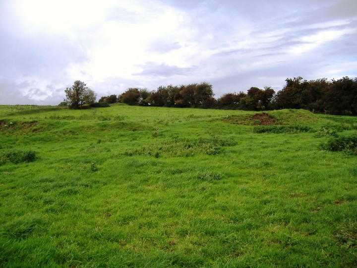
Image © Bawn79
Nearest Town:
Caher (3km SSW)
OS Ref (IE):
S068274 /
Sheet: 74
Latitude:
52° 23' 53.55" N
Longitude:
7° 54' 0.32" W
Added by
bawn79
Images (1)
0 discussions
Start a topic
Show |
Hide
Web searches for Kedrah
Flickr
Google
Google Images
The Megalithic Portal
Bing
Stone Pages
Wikipedia
Show map
(inline Google Map)
- Sites within 20 km -
-
Kedrah Fort (0.1km W) (5 posts)
Cloghabreedy (0.92km WNW) (1 post)
Knockgraffon Motte (2.65km WNW) (5 posts)
Caherabbey Lower (2.83km SW) (3 posts)
Knockmorris (2.98km ESE) (3 posts)
Husseystown (4.04km E) (1 post)
St. Patricks Stone (4.46km SSW) (2 posts)
Lissava (5.06km WSW) (4 posts)
Ballymorris (6.19km W) (1 post)
Toureen Peacaun (6.27km W) (3 posts)
Slieveanard (6.36km WSW) (6 posts)
Mullaghnoney (7.5km E) (4 posts)
Ballyroan (7.81km SW) (6 posts)
Carron Henge (8.54km N) (8 posts)
Rosegreen (9.3km NNE) (4 posts)
Sturrakeen (9.79km WSW) (4 posts)
Ballinree South (10.49km NNW) (2 posts)
Rath na Drinne (10.52km N) (4 posts)
Giantsgrave (11.46km E) (4 posts)
Laghtshanaquilla (11.9km WSW) (4 posts)
St Berriherts Kyle (12.02km W) (5 posts)
Rossadrehid (14.05km W) (2 posts)
Ballagh II (14.28km W) (1 post)
Corralough (14.48km N) (2 posts)
Kilfeakle Churchquarter (14.54km WNW) (3 posts)
Knockballynoe (14.58km WNW) (2 posts)
Knockballynoe (14.75km WNW) (2 posts)
Ballagh I (14.91km W) (3 posts)
Greenane (15.44km WSW) (2 posts)
Donaskeagh (17.62km WNW) (2 posts)
Gortavoher (North) (17.78km W) (4 posts)
Togher (18.08km E) (5 posts)
Knockshanahullion (18.19km SSW) (6 posts)
Rock an Tarbh (18.37km W) (3 posts)
Gortavoher (18.6km W) (1 post)
Ardmayle (18.62km NNW) (6 posts)
Jamestown (19.03km E) (3 posts)
Temple-etney (19.03km E) (1 post)
Harps of Cliu (19.29km WSW) (5 posts)
Gurteen Lower (19.92km E) (0 posts)
Bawnard (19.92km E) (0 posts)
- Add -
-
Add news
Add an image
Add fieldnotes
Add folklore
Add miscellaneous
Add a link
-
Add a site
Add a nearby facility
Add an alternative name/spelling
Images
(click to view fullsize)
Add an image
 Image © Bawn79