Skip to content
Julian Cope
presents
The Modern
Antiquarian
Latest
Posts
Sites
Map
Blog
Forum
search
Search
⚠️
Sign in
more_horiz
United Kingdom
Scotland
Dumfries and Galloway
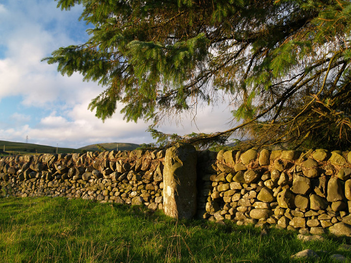
Holm of Daltallochan
Holm of Daltallochan
Standing Stone / Menhir
NX554942
expand_more
Nearest town:
New Galloway (17km SE)
OS reference:
NX554942
OS sheet:
77
Latitude:
55° 13' 14.34 N
Longitude:
4° 16' 24.26 W
Added to TMA by
rockartwolf
Images (4)
Add
content
Images
10-8-06
wolfy
Image credit: pebblewolf
rockartwolf
Aug 11, 2006
10-08-06
wolfy
Image credit: pebblewolf
rockartwolf
Aug 11, 2006
10-8-06
wolfy
Image credit: pebblewolf
rockartwolf
Aug 11, 2006
10-8-06
wolfy
Image credit: pebblewolf
rockartwolf
Aug 11, 2006
Sites within 20km of
Holm of Daltallochan
Holm of Daltallochan
Stone Circle
•
0km N
photo
7
description
2
Lagwine
Cairn(s)
•
0.69km E
photo
13
description
2
Cairn Avel
Cairn(s)
•
1.86km SE
photo
18
description
2
Bardennoch
Cairn(s)
•
3.32km SE
photo
4
description
2
link
1
Braidenoch Cross Slabs
Christianised Site
•
3.77km SE
photo
5
description
1
link
1
Lamford Hill
Cup and Ring Marks / Rock Art
•
5.13km NW
photo
16
Lamford Burn
Cairn(s)
•
5.55km NW
photo
3
description
1
link
1
Brownhill Burn
Cairn(s)
•
6.69km NNW
photo
6
description
2
link
1
King’s Cairn
Chambered Tomb
•
6.89km NNW
photo
7
description
1
Craigengillan
Cairn(s)
•
7.27km ENE
photo
9
description
2
Cairnennock
Cairn(s)
•
8.01km WNW
photo
13
description
2
Carlins Cairn
Cairn(s)
•
8.16km SW
description
1
Smittons Bridge
Kerbed Cairn
•
8.3km E
photo
8
description
1
Stroanfreggan Craig
Hillfort
•
8.54km E
photo
13
description
1
link
1
Stroanfreggan
Round Cairn
•
9.01km E
photo
22
description
3
link
1
Round Craigs
Cairn(s)
•
9.1km E
photo
8
description
1
link
1
Mackilston N
Cairn(s)
•
9.84km ESE
photo
4
description
1
link
1
Mackilston S
Cairn(s)
•
9.87km ESE
photo
6
description
1
link
1
Stellhead S
Cairn(s)
•
10.69km E
photo
10
description
1
link
1
Stellhead N
Cairn(s)
•
10.71km E
photo
7
description
1
link
1
White Laise
Cairn(s)
•
10.81km W
photo
10
description
2
Nether Holm of Dalquhairn
Cairn(s)
•
11.31km ENE
photo
5
description
2
Waterside Hill
Cairn(s)
•
13.18km SE
description
1
Moss Knowes
Natural Rock Feature
•
13.19km WSW
photo
10
description
2
Devil’s Bowling Green
Natural Rock Feature
•
14.25km SW
photo
2
description
1
Milnmark Hill
Cup and Ring Marks / Rock Art
•
14.95km ESE
photo
8
forum
1
link
1
The Grey Man
Natural Rock Feature
•
15.31km SW
photo
5
description
2
Cairnwhapple Stone
Natural Rock Feature
•
15.42km W
photo
4
description
1
link
1
Corriedoo White Cairn
Round Cairn
•
16.69km ESE
photo
6
Dalarran Holm
Standing Stone / Menhir
•
17.2km ESE
photo
3
description
1
link
1
Bruce’s Stone (Clatteringshaws)
Natural Rock Feature
•
17.21km SSE
photo
3
description
1
link
1
Clatteringshaws
Ancient Village / Settlement / Misc. Earthwork
•
17.67km SSE
photo
1
description
1
Lochrennie Hole Stone
Holed Stone
•
18.54km E
photo
3
description
1
link
1
Kirriemore
Cairn(s)
•
19.65km WSW
photo
5
description
1
link
1
White Cairn, Clatteringshaws
Cairn(s)
•
19.74km S
photo
2
description
1
link
1
search
I’m looking for…
location_on
photo
ondemand_video
forum
description
link