Real photographic postcard of the Vugha, Porthcothan Valley, St Eval, c.1910 (The Vugha, Porthcothan Valley, publisher not stated, not numbered)
Real photographic postcard of the Vugha, Porthcothan Valley, St Eval, c.1910 (The Vugha, Porthcothan Valley, publisher not stated, not numbered)
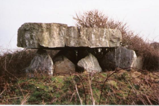
Known locally as the fogou, this narrow cave is situated about a mile inland from Porthcothan beach
The low entrance to the cave is halfway up the valley side on the right. It’s very well hidden in bracken and gorse in the summer. I’m not totally sure that public access is permitted as it is on farmland. (Find a friendly local who may know the way)
The site has been used in the past for smuggling and also as a hide-out during the Civil war.
There are notches near the mouth, into which smugglers lodged a beam of timber; they then heaped earth against the beam and covered the pile with furze to hide the entrance. The tunnel supposedly led to a farm half a mile away
Although some may say it is cave, on the 1888 map of Cornwall it is marked “fogou”
see the 1888 map online at old-maps.co.uk/
In the Co-ordinate box type:- 186461,71394
and click – search