Open Source Environment agency LIDAR
Image credit: © Environment Agency copyright and/or database right 2015.
Open Source Environment agency LIDAR

The fort from the south, the ramparts clearly visible. Park Head fort can be seen beyond.

The overgrown double rampart from the southeast.

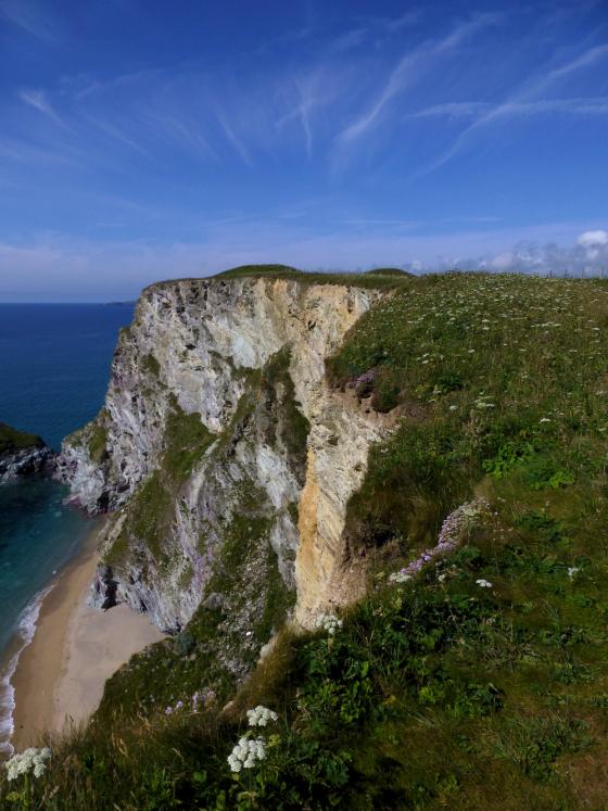
Looking over the vertigo-inducing northern side of the fort towards Park Head fort, the next cliff fort north.

The northern ends of the ramparts.

The inner rampart, terminating abruptly on a crumbling cliff face.

The outer rampart, which completely hides the inner rampart from this angle.

The fort is on the cliffs far left, covered in dark green vegetation. Bedruthan Steps and the rock stacks attract all the visitors.
Mentioned by Craig Weatherhill, in “Cornovia: Ancient Sites of Cornwall & Scilly” (Cornwall Books – 1985, revised 1997 & 2000) – “Two Iron Age ramparts and ditches cross this small headland, penetrated by a simple central entrance. The ditches are cut from solid rock and are from 0.7m to 2.1m deep, with the southern end of the outer ditch reaching a depth of 4.7m. The ramparts stand to a height of 2.0m. The fort’s interior area has been much reduced by coastal erosion, and no dwelling sites have been found”