Skip to content
Julian Cope
presents
The Modern
Antiquarian
Latest
Posts
Sites
Map
Blog
Forum
search
Search
⚠️
Sign in
more_horiz
Eire
County Tipperary
Ballinlough
Ballinlough
Round Barrow(s)
R993747
expand_more
Nearest town:
Toomyvara (3km NW)
OS reference:
R993747
OS sheet:
59
Latitude:
52° 49' 24.02 N
Longitude:
8° 0' 37.39 W
Added to TMA by
bawn79
Images (1)
Add
content
Images
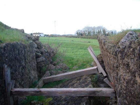
Image credit: Bawn79
bawn79
Jun 6, 2006
Sites within 20km of
Ballinlough
Ballinlough
Standing Stone / Menhir
•
0km N
photo
2
Knockanora
Cairn(s)
•
3.88km SE
photo
3
description
1
Garrangrena Lower
Hillfort
•
5.02km SE
photo
1
description
1
Devilsbit Mountain
Christianised Site
•
6.38km E
photo
3
forum
1
description
2
link
1
Bendubh
Cairn(s)
•
7.08km NE
photo
2
description
1
Ballinacurra
Cairn(s)
•
8.36km SW
description
1
Killawardy
9.09km E
photo
2
description
1
Borrisnoe
Standing Stone / Menhir
•
9.15km ENE
photo
1
description
1
Borrisnoe
Cup and Ring Marks / Rock Art
•
9.15km ENE
photo
1
description
1
Borrisnoe
Round Barrow(s)
•
9.15km ENE
photo
4
description
1
Rathfalla
Henge
•
9.55km W
photo
4
forum
1
description
1
Rathurles
Rath
•
10.14km W
photo
1
description
1
Rathurles
Standing Stones
•
10.32km WNW
photo
5
description
1
Rathurles
Rath
•
10.34km W
photo
2
description
6
link
1
Knockalton Lower
Standing Stone / Menhir
•
10.51km W
photo
1
forum
2
Cooneen
Cairn(s)
•
11.01km SW
photo
7
description
1
Middlewalk
Round Barrow(s)
•
11.04km NW
photo
2
description
1
Gorraun
Wedge Tomb
•
11.48km NNW
photo
5
description
2
Cooneen
Kerbed Cairn
•
11.87km SW
photo
2
description
1
Foilnamuck
Wedge Tomb
•
12.01km SW
photo
9
forum
1
description
1
Foilnamuck
Standing Stone / Menhir
•
12.08km SW
photo
4
description
1
Glastrigan
Stone Row / Alignment
•
12.14km SSW
photo
12
description
1
Pallas Upper
Bullaun Stone
•
12.19km SE
photo
3
description
1
Toorfiba
Standing Stone / Menhir
•
12.76km SSW
photo
2
description
1
Kilruane
Bullaun Stone
•
12.78km WNW
photo
2
description
1
Cooga
Round Barrow(s)
•
13.69km S
photo
2
description
2
Cooga
Standing Stone / Menhir
•
13.69km S
photo
1
description
1
Knockcurraghbola Commons
Wedge Tomb
•
14.28km SSW
photo
20
description
2
Corravalley
Round Barrow(s)
•
14.67km NW
photo
3
Shevry
Artificial Mound
•
15.18km S
photo
1
Cureeny Commons
Wedge Tomb
•
15.21km SW
photo
16
forum
1
description
1
Shevry
Standing Stones
•
15.28km S
photo
7
description
1
Townfields
Bullaun Stone
•
15.35km NW
photo
2
description
1
Ardcroney
Portal Tomb
•
15.44km WNW
photo
9
forum
1
description
3
Reisk
Standing Stone / Menhir
•
15.82km SSW
description
1
Castleleiny
Round Barrow(s)
•
15.87km E
photo
3
description
1
Tullahedy
Artificial Mound
•
15.91km W
photo
1
description
1
Knockcurraghbola Crowlands standing stone
Standing Stone / Menhir
•
15.91km SSW
photo
2
description
1
Knockcurraghbola Crowlands (central)
Wedge Tomb
•
16.04km SSW
photo
2
forum
1
Knockcurraghbola Crowlands
Standing Stone / Menhir
•
16.07km SSW
photo
1
Knockcurraghbola Crowlands (west)
Wedge Tomb
•
16.07km SSW
photo
7
description
1
Knockcurraghbola Crowlands (east)
Wedge Tomb
•
16.17km SSW
photo
1
description
1
Knockmaroe
Wedge Tomb
•
16.31km SSW
photo
2
description
1
Graniera
Standing Stones
•
16.39km SSW
photo
2
description
1
Coolagorane Upper
Cairn(s)
•
16.55km WNW
photo
3
description
2
Ashley Park
Wedge Tomb
•
16.58km WNW
photo
2
description
1
Bauraglanna
Stone Circle
•
16.71km WSW
photo
6
description
3
Knocknabansha
Wedge Tomb
•
16.84km SSW
photo
4
description
1
Ardcroney
Burial Chamber
•
16.88km WNW
photo
5
description
2
Ashley Park
Burial Chamber
•
17.07km WNW
photo
17
forum
2
description
4
Knigh Hill
Cairn(s)
•
17.18km WNW
photo
3
Mauherslieve
Cairn(s)
•
17.43km SW
photo
5
description
2
Mauherslieve
Sacred Hill
•
17.43km SW
description
1
Loughbrack
Wedge Tomb
•
17.69km SSW
photo
10
description
1
Kilcolman
Sacred Well
•
18.2km W
photo
1
description
1
Whitstone
Cairn(s)
•
18.25km WNW
photo
2
description
2
Creggane
Wedge Tomb
•
18.67km W
photo
1
description
1
Goulmore
Standing Stones
•
19.63km SW
photo
3
description
1
search
I’m looking for…
location_on
photo
ondemand_video
forum
description
link