Skip to content
Julian Cope
presents
The Modern
Antiquarian
Latest
Posts
Sites
Map
Blog
Forum
search
Search
⚠️
Sign in
more_horiz
Eire
County Kildare
Little Curragh
Little Curragh VIX
Round Barrow(s)
N747134
expand_more
Nearest town:
Kildare (2km WSW)
OS reference:
N747134
OS sheet:
55
Latitude:
53° 9' 57.15 N
Longitude:
6° 52' 58.58 W
Added to TMA by
bawn79
Images (1)
Add
content
Images
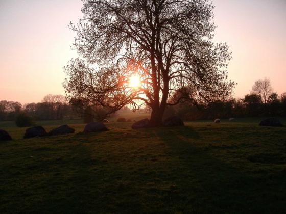
Very small barrow maybe 2m diameter
Image credit: Bawn79
bawn79
May 17, 2006
Sites within 20km of
Little Curragh VIX
Little Curragh X
Round Barrow(s)
•
0.32km WSW
photo
1
Little Curragh Barrow IV
Round Barrow(s)
•
0.6km N
photo
3
description
1
Little Curragh Barrow III
Round Barrow(s)
•
0.63km NW
photo
4
description
1
Little Curragh Barrow II
Round Barrow(s)
•
0.64km WNW
photo
2
description
1
Curragh (Kildare ED)
Round Barrow(s)
•
0.81km SSE
photo
2
Little Curragh Barrow VIII
Round Barrow(s)
•
0.86km NE
photo
1
Curragh Racecourse
Round Barrow(s)
•
0.9km E
description
1
Little Curragh Barrow I
Round Barrow(s)
•
0.92km WNW
photo
6
description
1
Curragh (Kildare ED)
Barrow / Cairn Cemetery
•
0.94km NE
photo
5
description
2
Little Curragh Barrow V
Round Barrow(s)
•
1.02km N
photo
5
description
1
Little Curragh Barrow VI
Round Barrow(s)
•
1.08km NNE
photo
4
description
1
Little Curragh Barrow VII
Round Barrow(s)
•
1.3km NNE
description
1
Curragh Racecourse
Round Barrow(s)
•
1.8km ENE
description
1
Kildare
Christianised Site
•
1.87km WSW
photo
2
description
1
Gibbet Rath
Rath
•
2.19km ESE
photo
6
link
1
Curragh (Kildare ED) I
Round Barrow(s)
•
2.26km ESE
photo
1
Curragh (Kildare ED) II
Round Barrow(s)
•
2.35km ESE
photo
4
Curragh
Artificial Mound
•
4.09km ESE
photo
1
Curragh
Round Barrow(s)
•
4.13km E
photo
1
Red Hill
Round Barrow(s)
•
4.7km W
photo
4
description
1
Chair of Kildare
Artificial Mound
•
4.82km WNW
photo
3
description
2
Hill of Allen
Sacred Hill
•
7.19km N
photo
3
forum
1
description
3
link
1
Grangebeg
Burial Chamber
•
8.42km WSW
description
2
Dun Ailinne
Hillfort
•
9.68km ESE
photo
4
forum
1
description
1
Rathangan
Rath
•
9.93km WNW
photo
7
description
1
Old Kilcullen
Christianised Site
•
10.45km ESE
photo
1
Kilgowen
Standing Stone / Menhir
•
12.61km ESE
photo
10
description
2
Brewell’s Hill
Ancient Village / Settlement / Misc. Earthwork
•
14.71km ESE
photo
2
description
1
Brewell’s Hill
Round Barrow(s)
•
14.71km ESE
photo
1
Brewell’s Hill
Stone Circle
•
14.79km ESE
photo
9
description
4
Kingsland
Round Barrow(s)
•
14.81km ESE
photo
4
description
1
Barretstown Hill
Barrow / Cairn Cemetery
•
15.94km NE
description
1
Craddockstown West
Standing Stone / Menhir
•
16.69km ENE
photo
7
description
2
Punchestown
Round Barrow(s)
•
17.05km ENE
photo
5
description
1
Ballybought
Round Barrow(s)
•
17.08km E
photo
2
description
1
Punchestown Standing Stone
Standing Stone / Menhir
•
17.21km ENE
photo
12
forum
1
description
3
Ticknevin
Bullaun Stone
•
17.27km NW
description
2
Killeen Cormac
Passage Grave
•
17.38km SE
photo
3
description
1
Clonkeen
Standing Stone / Menhir
•
17.39km W
photo
3
description
2
Firmount East
Artificial Mound
•
17.52km NE
photo
1
The Ring
Hillfort
•
17.53km E
Mullamast Rath
Rath
•
17.64km SSE
photo
6
Mullamast Barrows
Barrow / Cairn Cemetery
•
17.75km SSE
photo
2
Ballybought
Bullaun Stone
•
17.77km E
photo
4
description
1
Mullamast Long Stone
Standing Stone / Menhir
•
17.98km SSE
photo
4
description
1
Tornant Lower
Rath
•
18.13km ESE
photo
2
Ballymore Eustace West
Bullaun Stone
•
18.15km E
photo
4
description
1
Longstone
Standing Stone / Menhir
•
18.39km E
Tornant Upper
Passage Grave
•
18.55km ESE
photo
6
description
2
Maudlings
Standing Stone / Menhir
•
18.63km ENE
photo
3
description
1
Crehelp II
Round Barrow(s)
•
18.68km E
photo
3
description
1
Bishopsland
Round Barrow(s)
•
18.97km E
photo
2
description
1
Baltracy
Standing Stone / Menhir
•
19.04km ENE
photo
1
Clane
Bullaun Stone
•
19.05km NE
photo
3
description
1
Broadleas
Stone Circle
•
19.16km E
photo
29
description
4
Whiteleas
Stone Circle
•
19.16km E
photo
8
description
3
Kinsellastown
Standing Stone / Menhir
•
19.29km E
photo
2
description
1
Kinsellastown II
Round Barrow(s)
•
19.32km E
photo
1
description
1
Cloncanon
Standing Stone / Menhir
•
19.59km WNW
Plezica
Stone Circle
•
19.61km ESE
photo
7
description
2
Forenachts
Cup and Ring Marks / Rock Art
•
19.7km ENE
photo
2
description
1
Crehelp
Standing Stone / Menhir
•
19.88km E
photo
4
description
2
Crehelp
Standing Stone / Menhir
•
19.88km E
description
1
search
I’m looking for…
location_on
photo
ondemand_video
forum
description
link