Visited 27th May 2015
Image credit: Uwe Häberle 05/2015
Visited 27th May 2015

Visited 27th May 2015

Visited 27th May 2015

Dun Telve stands out among the trees.


The ‘double skin’ construction...

A lot of masonry remains at Dun Troddan.......

Probably a bit ‘off piste’ here. But I assure you the only damage was to my head. Add it to the list, then.


The deep shadow to right of image emphasises the gap between the two dry-stone wall construction.

Nice n’cool in here.


Among Scotland’s finest surviving brochs....


This is a log of visits to various sites from a number of Ambient Rambles over the years, with a number of people. Mostly around the Yorkshire Dales and the Scottish Highlands.
The Witch’s Pool and Glen Elg Brocks
On a trip into the Highlands with Scott and Shaun in May 1998, we’d stayed with a guy called Geordie who was building his own house near Drumnadrochit, overlooking Loch Ness and were now making our way over west for a couple of nights in the Bothy at Glen Torridon.
Near Loch Arkaig we came across a waterfall near an old bridge, down what is known as the ‘Dark Mile’ that seemed like an ideal place to have a poke around. Shaun and I climbed the path at the side of the waterfall and found a wonderful spot at the top. The hillside stream enters a natural rock basin where the water bubbles and boils as if in a deep green cauldron. The water then tumbles over a short ledge and on to a big waterfall into the pool below. The rock around the basin has an amazing swirly, almost psychedelic stratification. Not a megalithic site as such, but I can’t imagine that this place went unnoticed and it must have had some pretty powerful associations in pre-history.
The folklore of the site tells that it got it’s name after the Camerons once chased a witch, in the form of a cat, over these falls to her death. But I suspect that the name originates from the time of Christianisation of Scotland and reflects it’s older pagan associations.
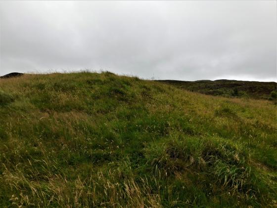
Carrying on northwards we took a diversion over Bealach Mam Ratagan with it’s stunning views over the Five Sisters of Kintail, down into Glen Elg. Near the old Red Coat Barracks and the ferry to Skye are two magnificently preserved Iron Age Brocks, Dun Telve and further down the glen, Dun Troddan.
Both brochs retain about a half of their walls up to about 25ft high and many of the steps and galleries within the walls. Dun Telve still has its entrance intact, which is pretty megalithic looking. They must have been pretty forbidding when they were complete and inhabited with people defending it!
Clava Cairns
Later the same year I returned to Geordie’s, this time with my old friend Carol and her two young lads. Before we made our way over to Glen Torridon, we went for an Ambient Ramble around Loch Ness. After appeasing the young ‘uns with a visit to Urquhart Castle (nice loch, nice ruins, but clipped and pruned to death and crawling with punters) we headed out to more remote areas to seek out the local pre-history.
Trundling along we spotted signs for Corrimony Cairn in Glen Urquhart. A beautiful example of a Clava type cairn with a surrounding stone circle. When excavated in the 1950’s, many of the stones were found to be replacements and the outline of a crouched burial was found. There is also a cup marked slab which may have been part of the cist cover.
Onwards over to the eastern side of Loch Ness for a trundle over the higher moors. Skirting the edge of a plantation near Inverness, I spied a very obvious standing stone in the field. Gask is a Ring Cairn with most of the kerbstones still intact. Three standing stones remain from it’s circle, the largest being the one I had seen from the road, which is a massive flat slab about three meters high and the same wide. I liked this site as it hadn’t been trimmed or prettied up for visitors at all.
Next stop, the Balnuaran of Clava. Three of the many cairns in this area, situated in a wooded glade, with attendant stone circles. A beautiful spot, but we didn’t get long here as a coach-full of huge American tourists turned up and began to squeeze through the entrance, shattering the ambience of the place (I’ve never seen so much hardware in my life – video cameras, dicta-phones.... bet the BBC aren’t as well equipped as this lot!).
Also worth a visit just around the corner (while your there) is the Culloden Battlefield. Again, not a prehistoric site, but interesting non-the-less to see where it all came to an end. A very poignant place.
Ilkley Moor
Managed to fit a couple of trips onto the moor in with a couple of Ambient Rambles around the Dales, staying with friends at the study centre on Malham Tarn. The first being in Autumn 2000, my first time back on the moor for nine years, with a quick stomp up to the Twelve Apostles. I was disappointed to find that a couple of stones had fallen since my last visit. A thin pointed stone at the north eastern point of the circle that had leaned perilously a few years ago, had now completely fallen and lays partially embedded on the ground. Also, a low, flat stone that had stood on it’s longest edge had fallen and been re-erected nearby on it’s short edge. Many of the stones that had lain loose had been propped up with small rocks.
Upon leaving the circle and making our way back down the boardwalk, a plane circling Leeds/Bradford Airport skimmed low over the top of the moor and turned up into sky above us. Quite a sight!!
We returned to the dales the next spring, this time with Shaun along too, and fitted a day on Ilkley Moor in. I did my usual route over the moor – Cow n’ Calf, Haystack, Backstone Beck, Twelve Apostles, The Grubstones, Little Skirtfull, Idol Stone and the Pancake Stone.
While we approached the Grubstones, I notice some folk on a quadbike tearing up n’ down the moor. “Rich kids from Ilkley” I thought at first. We reached the gamekeeper’s hut and found the small path through the heather down to the Grubstones. No sooner had we reached the circle than I saw the quadbike twatting across the heather towards us. It was the flaming Gamekeeper!
“What you doin’ here” he shouted at us.
“Just looking at the circle mate” I replied.
“Keep t’fooking path. You’re disturbing the grouse”.
I pointed out that we’d quietly walked down a path disturbing nothing, whilst he’d just torn up about 20 yards of open heather with his four big wheels.... it didn’t go down well.
“If it were up to me I wouldn’t let no fookin’ c*nt up here”
“Good job it isn’t then!.... hang on a minute, you’ve just called us f*cking c*nts!”
And so it carried on until we walked off n’ left him to it. He got back on his bike with his two square-headed kids and rode off to find someone else to take a pop at. Sure enough, he was back ten minutes later to see if he could catch us in the circle! He became the winner of our first ‘Ambient Rambler’s Monumental Twat of the Week Award’!
So a word of warning to those who like to frequent Ikley Moor... if you see someone on a quadbike, avoid him n’ wait for him to sod off before you wander off the path.
Appletreewick
A bit of a flying visit this one as we were passing through Grassington. A hop over a rickety old dry-stone wall, scamper uphill a while and a bit of a search over scrubby, boulder strewn ground. A very small, low circle, not obvious until you’re right on top of it.... lots of sheep shit too.

This is a log of visits to various sites from a number of Ambient Rambles over the years, with a number of people. Mostly around the Yorkshire Dales and the Scottish Highlands.
The Witch’s Pool and Glen Elg Brocks
On a trip into the Highlands with Scott and Shaun in May 1998, we’d stayed with a guy called Geordie who was building his own house near Drumnadrochit, overlooking Loch Ness and were now making our way over west for a couple of nights in the Bothy at Glen Torridon.
Near Loch Arkaig we came across a waterfall near an old bridge, down what is known as the ‘Dark Mile’ that seemed like an ideal place to have a poke around. Shaun and I climbed the path at the side of the waterfall and found a wonderful spot at the top. The hillside stream enters a natural rock basin where the water bubbles and boils as if in a deep green cauldron. The water then tumbles over a short ledge and on to a big waterfall into the pool below. The rock around the basin has an amazing swirly, almost psychedelic stratification. Not a megalithic site as such, but I can’t imagine that this place went unnoticed and it must have had some pretty powerful associations in pre-history.
The folklore of the site tells that it got it’s name after the Camerons once chased a witch, in the form of a cat, over these falls to her death. But I suspect that the name originates from the time of Christianisation of Scotland and reflects it’s older pagan associations.
Carrying on northwards we took a diversion over Bealach Mam Ratagan with it’s stunning views over the Five Sisters of Kintail, down into Glen Elg. Near the old Red Coat Barracks and the ferry to Skye are two magnificently preserved Iron Age Brocks, Dun Telve and further down the glen, Dun Troddan.
Both brochs retain about a half of their walls up to about 25ft high and many of the steps and galleries within the walls. Dun Telve still has its entrance intact, which is pretty megalithic looking. They must have been pretty forbidding when they were complete and inhabited with people defending it!
Clava Cairns
Later the same year I returned to Geordie’s, this time with my old friend Carol and her two young lads. Before we made our way over to Glen Torridon, we went for an Ambient Ramble around Loch Ness. After appeasing the young ‘uns with a visit to Urquhart Castle (nice loch, nice ruins, but clipped and pruned to death and crawling with punters) we headed out to more remote areas to seek out the local pre-history.
Trundling along we spotted signs for Corrimony Cairn in Glen Urquhart. A beautiful example of a Clava type cairn with a surrounding stone circle. When excavated in the 1950’s, many of the stones were found to be replacements and the outline of a crouched burial was found. There is also a cup marked slab which may have been part of the cist cover.
Onwards over to the eastern side of Loch Ness for a trundle over the higher moors. Skirting the edge of a plantation near Inverness, I spied a very obvious standing stone in the field. Gask is a Ring Cairn with most of the kerbstones still intact. Three standing stones remain from it’s circle, the largest being the one I had seen from the road, which is a massive flat slab about three meters high and the same wide. I liked this site as it hadn’t been trimmed or prettied up for visitors at all.
Next stop, the Balnuaran of Clava. Three of the many cairns in this area, situated in a wooded glade, with attendant stone circles. A beautiful spot, but we didn’t get long here as a coach-full of huge American tourists turned up and began to squeeze through the entrance, shattering the ambience of the place (I’ve never seen so much hardware in my life – video cameras, dicta-phones.... bet the BBC aren’t as well equipped as this lot!).
Also worth a visit just around the corner (while your there) is the Culloden Battlefield. Again, not a prehistoric site, but interesting non-the-less to see where it all came to an end. A very poignant place.
Ilkley Moor
Managed to fit a couple of trips onto the moor in with a couple of Ambient Rambles around the Dales, staying with friends at the study centre on Malham Tarn. The first being in Autumn 2000, my first time back on the moor for nine years, with a quick stomp up to the Twelve Apostles. I was disappointed to find that a couple of stones had fallen since my last visit. A thin pointed stone at the north eastern point of the circle that had leaned perilously a few years ago, had now completely fallen and lays partially embedded on the ground. Also, a low, flat stone that had stood on it’s longest edge had fallen and been re-erected nearby on it’s short edge. Many of the stones that had lain loose had been propped up with small rocks.
Upon leaving the circle and making our way back down the boardwalk, a plane circling Leeds/Bradford Airport skimmed low over the top of the moor and turned up into sky above us. Quite a sight!!
We returned to the dales the next spring, this time with Shaun along too, and fitted a day on Ilkley Moor in. I did my usual route over the moor – Cow n’ Calf, Haystack, Backstone Beck, Twelve Apostles, The Grubstones, Little Skirtfull, Idol Stone and the Pancake Stone.
While we approached the Grubstones, I notice some folk on a quadbike tearing up n’ down the moor. “Rich kids from Ilkley” I thought at first. We reached the gamekeeper’s hut and found the small path through the heather down to the Grubstones. No sooner had we reached the circle than I saw the quadbike twatting across the heather towards us. It was the flaming Gamekeeper!
“What you doin’ here” he shouted at us.
“Just looking at the circle mate” I replied.
“Keep t’fooking path. You’re disturbing the grouse”.
I pointed out that we’d quietly walked down a path disturbing nothing, whilst he’d just torn up about 20 yards of open heather with his four big wheels.... it didn’t go down well.
“If it were up to me I wouldn’t let no fookin’ c*nt up here”
“Good job it isn’t then!.... hang on a minute, you’ve just called us f*cking c*nts!”
And so it carried on until we walked off n’ left him to it. He got back on his bike with his two square-headed kids and rode off to find someone else to take a pop at. Sure enough, he was back ten minutes later to see if he could catch us in the circle! He became the winner of our first ‘Ambient Rambler’s Monumental Twat of the Week Award’!
So a word of warning to those who like to frequent Ikley Moor... if you see someone on a quadbike, avoid him n’ wait for him to sod off before you wander off the path.
Appletreewick
A bit of a flying visit this one as we were passing through Grassington. A hop over a rickety old dry-stone wall, scamper uphill a while and a bit of a search over scrubby, boulder strewn ground. A very small, low circle, not obvious until you’re right on top of it.... lots of sheep shit too.


17/7/94-with me for scale!
Only half a kilometer separates this broch from its nearest neighbor Dun Telve to its west, but unlike it’s slightly more complete brother it is higher up the northern hillside of the valley, affording it better views up and down the glen and of the mountains, and for that reason I’m out, I mean in, I mean I prefer this one (rolls eyes).
When we first got here there was already two cars so instead of overcrowding the place we went up the road to the burial chamber, which was nice, upon our return we found no cars, and had the place to ourselves, take note incidental tourists that have to read the information board.
For a good ten minutes we poked our noses into every nook and cranny the broch had to offer, we walked round it several times, nearer and farer, yep I like this one best. Fabulous views of the glen, all these trees with afternoon mists wandering round at will, then the other people came, we were nearly done anyway, a couple of minutes more wouldn’t have hurt though. Bloody tourists.
Visited 26.7.13
Not quite as impressive as its near neighbour but certainly worth a visit just the same.
There is room to park and a short but steepish walk will soon bring you to the Broch’s doorway. As with Dun Telve there are internal stairs you can walk up which is fun.
The walls are not as high as Dun Telve but still a decent height.
‘The best preserved Brochs on mainland Scotland’ the information panel proclaims.
I wouldn’t disagree as the only better ones I have seen have been on the Scottish Islands.
That’s another two Historic Scotland sites off the list.
All in all well worth the long drive out of our way (at least I thought so!)
If visiting the Brochs check out the ‘Wagon Café’ opposite Dun Troddan.
Definitely the most unusual café I have ever been to!
Is there a more unlikely place to find a café?
Even when it’s windy, the walls are high enough to make a nice relaxed picnic quite possible.
This is such a wonderfully secluded and cozy valley, well worth the scary drive up the unfeasibly twisty-steep road to get here. It’s a bit easier from Skye, via a slightly less twisty road, and with the added advantage of the spinning ferry.
Disabled access
Not good for wheelchairs, the incline is steep and uneven. It’s close to the road though, about 20 yards, so quite visitable by those who can’t easily walk far.
Dun Troddan Broch
17/7/94
…and just a mile or so along the road another spectacular broch- these are just fab! The wall height on this one is just a bit smaller than Dun Telve, but the walls are mega thick again. These are magnificent monuments and a great start to our hols.
T.M. Murchison was minister of Glenelg in the 1930s, and his mother’s people had been shepherds in the area for many generations. His parish history was compiled partly from oral tradition gleaned from older relatives and older parishioners. ‘The most famous antiquities in Glenelg’ he records, ‘are the two brochs or “Pictish towers” in Glenbeg.’ At one time apparently there at least two more, but of these only ‘a heap of jumbled boulders and stones’ remained by this time. Dun Telve and Dun Troddan, however, still stand. It is said when the brochs were being built, stones were handed from the quarry along a chain of men.
A broch or ‘brugh’ is an archaeological term for the late prehistoric round towers found chiefly in the Orkney and Shetland islands and the Western Isles and on the adjacent Scottish mainland. They are round stone-built towers, and are often popularly supposed to have been built by the Picts or Pechts. Here, however, the brochs are associated with Fionn mac Cumhaill or Fingal and his followers the Fianna, said to have lived in these brochs and resorted to Skye for their hunting. The women of the band, says Murchison, never took food in the presence of their menfolk, but nevertheless remained healthy and beautiful, and the men wondered how the women managed to live on so little nourishment. One day, therefore, while the other men went to Skye, a warrior named Gairidh (pronounced Gary) pretended to be ill and was left lying on his bed, intending to watch the women.
He fell asleep, however, and the women promptly took strong wooden pegs and fastened Gairidh’s seven locks to the bottom of the bed, to keep him out of the way, and they proceed to feast on the finest food that glen or river could produce. Gairidh suddenly awoke, was irritated to find he was fastened to the bed, leapt to his feet with a mighty effort, and in doing so left every lock of his hair and the skin of his skull on the bed. mad with pain, Gairidh rushed out, gathered brushwood which he placed around the locked door, and set fire to the dwelling with the women inside, so that none escaped.
Over in Skye, Fionn and the hunters saw the smoke rising and knew that some terrible disaster taken place. They hurried back, vaulting on their spears over the narrow channel to the mainland. One of them named Reithe did not leap far enough and was drowned, and the name of the place from which he jumped, Kylerhea, is said to be derived from
Caol Reithe, ‘the Narrows of Reithe’.
Fionn and his men found their women dead and Gairidh missing, but at last he was discovered skulking in a cave and was punished.
An almost identical tradition was reported of Knockfarrel by Hugh Miller in 1835, and used by him to account for the name of Glen Garry, said to be where the murderer was torn to pieces. The tale is a better fir for Glenelg, much nearer to Glen Garry, and Murchison adds further local details: at Kylerhea, he says, you can see the marks made by the warriors’ feet as they jumped the water, and at Bernera nearby is a site called Iomair nam Fear More (’the Ridge of the Big Men’), pointed out as the burial place of the ‘Fingalians’ (the Fianna or Fenians).
It is said that once upon a time a bold man began ploughing up the place, in defiance of local warnings. He turned up a human skull, which was so big that it easily fitted over the biggest man present(alleged to be the Rev. Colin MacIver, minister of Glenelg from 1782 to 1829). Just at that point, however, a terrible storm of thunder and lightning arose, and the ploughing speedily ceased and the skull of ‘Gairidh’ or some other Fingalian was promptly buried again.
The Fianna were commonly said to be of giant size, so the finding of an unusually large skull may have helped to associate them with the site.
The Lore Of Scotland – A Guide To Scottish Legends
Westwood and Kingshill
This broch was excavated up to 1920 and some find including stone whorls, vitrified beads etc were made- all now in the National Museum of Scotland. Also found were a ring of post holes in the middle of the site that may have supported upper floors/roof.
the Stone Pages entry