Looking south along the scant remains of the eastern rampart (behind the wall) south of the clubhouse.
Image credit: A. Brookes (16.3.2013)
Looking south along the scant remains of the eastern rampart (behind the wall) south of the clubhouse.

The northern ramparts, seen across the golf fairway.

The inner eastern rampart.

Looking north along the eastern ramparts.

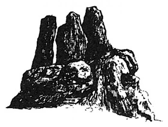
The impressive outer eastern rampart.

The outer eastern rampart, north of the clubhouse.

Looking across what would have been the eastern rampart at its southern end. The low remains of Willersey long barrow are in the centre of the picture, to the right of the tree.

The eroded rampart at the SE corner of the fort, near the hotel.
Leaving Kiftsgate Stone, the Way follows the Mile Drive, a broad, grassy path that would make for easy walking if less wet underfoot. At the end there are two fields of mud to cross (lovely), after which I take my main detour of the day, heading north alongside the Roman Buckle Street. My next site is one that I am not by any means hopeful about. Despite being a very decent-sized fort, Willersey Camp has had the misfortune of having a golf course dumped onto it, the construction of which, according to Pastscape, caused “considerable damage” to the fort. Approaching from the south, any views are obstructed by a thick screen of leylandii, that well-known native Cotswold species. A bit further along the road is the Dormy Hotel, built right on the SE corner of the fort. I walk up the drive towards the reception, hoping to get a bit of rampart action. The drive cuts through the bank and I manage to get a picture in. However, the CCTV signs don’t lie and it’s barely a minute before a uniformed functionary emerges to ask me if I need any “help”. I get the impression that the response “I’d like to have a look at the hillfort” would be as well-received as “I’ve come to steal your silver teaspoons”, so decline the offer and return to the road.
The road follows the old line of the eastern rampart, but apart from a bit of “rough” (in the golfing sense) there’s nothing to see here. A low mound can be seen silhouetted on the skyline in the middle of the course and I think this is probably the poor remains of the long barrow. Having been accosted once, I’m not keen to have another go, so I don’t follow Carl’s admirable example. In any case, I’m not acceptably attired for the course, wearing neither a turtleneck shirt, tailored shorts, or golf shoes. I imagine there would be a scene at such a blatant breach of the dress code. I carry on past the clubhouse.
As Carl said, the wooded area alongside the road is the place to come. There is indeed quite a bit of litter (tut) but the ramparts here are very impressive. The outer rampart is several metres high, with a slighter, inner rampart that hasn’t been encroached upon by the golf course. It’s a shame the rest of the fort has been so badly treated in comparison, because it must have been a fine site.
Visited 27.8.11
This proved to be far more productive to look for than the older Long Barrow which (just about) survives in its centre – along with the golf course!
There is plenty of room to park in the golf club overflow car park which is handy.
Just north of the club house the road on the western side is wooded – this is where you need to be.
Make your way through the trees and you will see the very large ditch/rampart of the Hillfort – approximately 5 metres deep (the golf course is on the inner side. The area is heavily wooded and overgrown with brambles / bushes etc (plus a fair bit of litter) but it is certainly still impressive.
Due to the proximity of the golf course this was the only side of the Hillfort I investigated.
Walking back to the car I had a look at the other side of the road. There is a huge ditch on this side – perhaps 8 metres deep and very wide. I wonder if this is a further ditch/rampart or a result of road building?
If it is part of the Hillfort’s defences then that would mean the road runs on top of the outer rampart.
A brief description of the fort dating from 1882.