
Wellpark stone ball area, hut removed, earthfast boulder pic from top of exposed hollow
Image credit: wideford
Wellpark stone ball area, hut removed, earthfast boulder pic from top of exposed hollow
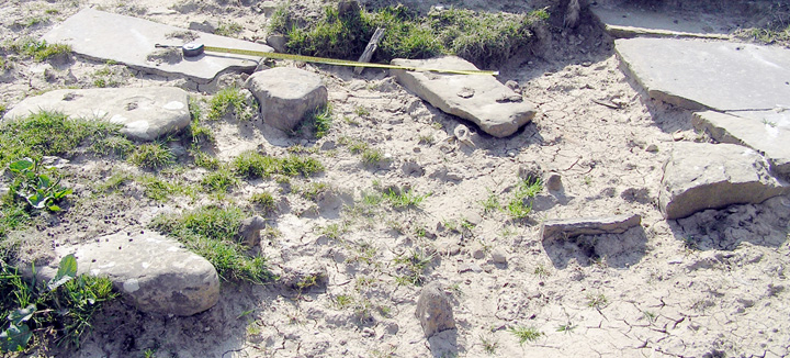
Wellpark stone ball area with possible notched cist slab top left

earthfast boulder from Wellpark stone ball area

Site of well beside which 1 of 4 carved stone balls found?

Hillhead with well.
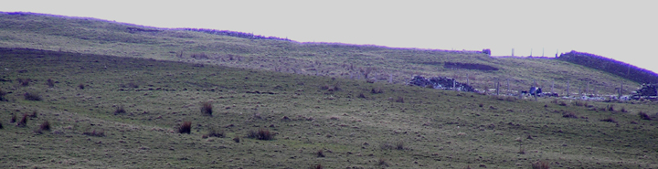
The Well Park
In the next farm along from Hillhead of Crantit a perforated macehead was found at Musterquoy {huntsearch.gla.ac.uk/cgi-bin/foxweb/huntsearch/DetailedResults.fwx?collection=all&SearchTerm=B.1914.643&mdaCode=GLAHM&reqMethod=Link&browseMode=on} so perhaps I have to take back what I said about Hillhead of Crantit not being the source of a stone ball.
Close by Hillhead of Crantit is Highland Park Distillery, where a microlith turned up whilst digging foundations some fifty years before 1986 – what later became the Meadow of Scapa was a freshwater loch in the Mesolithic. Can one dare hope that plans for new housing on the still damp brae (wonderful yellow flag flowers every abundantly summer) reveals faint traces or summat.
The 1882 map shows two Hillheads. The second, just before you come to Highland Park Distillery, is no longer extant. It was called Hillhead of Crantit (HY45090927). HY40NW 13 places two balls recovered here (though confusingly also naming it Hillhead House, which is simply Hillhead) The other side of the house boundary, at HY45090924, was a minor earthwork. Could this be the location of the ‘actual’ Crantit Souterrain?
RCAHMS NMRS No. HY40NW 6 at HY44720855.
1882 A large circular mound, uncultivatable because of stones.
1993 Fort. Spread over two fields (mostly that called ‘Well Park’), with many features lost to levelling i.e. no trace of entrance. Single earthen rampart encloses oval area roughly 75 yards north-south by 55 yards [boundary features uphill and downhill lost since 1882 ?].
1964 Enclosure. Now being ploughed out, the site on a western slope has a smaller earth bank inside the main one.
Of the carved stone balls found in Orkney a quarter came from this hillside. One of sandstone from this actual site was last seen in a collection (NMAS, HH417). Of two at HY40NW 13 one is in the Hunterian Museum (B.1914.356) whilst the whereabouts of one of diorite from Hillswick in Shetland are not known. Another was discovered by 1882 drain diggings in ‘Well Park’ a couple of yards from where a well/spring existed until a decade before (HY40NW 12 located at HY44730866 on the present well [though a dark triangle visible from the road below seems a likely issuance to me] ).
If these balls are truly associated with this site that would put it back at least as far as the Bronze Age. On the other hand, on the basis of the little I know presently, an archaeologist friend is inclined to put it much later and relates it to pre-broch Clickhimin or possibly The Howe 3/4 (even amorphous post-broch).
When I attended a talk on the Bu of Orphir it was revealed that geophysics in Orphir had shown a double ring of 70m diameter. If this site were originally more circular the dimensions are comparable – could there be a connection?