Looking south across the valley.
Image credit: A. Brookes (21.3.2009)
Looking south across the valley.

From the NE.

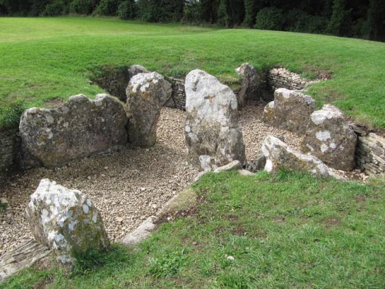
The SE end of the barrow.

Approaching from the south.
Failed to spot this one. I parked near the entrance to the golf course (very posh club house) and confidently walked up the drive past green jacketed club officials who were watching a competition. I expected to be stopped and questioned but despite a few odd looks managed to get by. I spent a long time trying to spot the barrow but with all the other man made golf bunkers etc I couldn’t. Well, I don’t think I did – but maybe I did without realising it?!!
Having failed to find Avening Burial Chambers, I left Avening and turned off onto the side road to Nag’s Head. A footpath heads north off this road, up a steep bank and then onto the golf course. Far too many Cotswold sites have become home to this pointless “sport”.
Luckily the footpath crossing the golf course goes straight past this barrow, which I imagine is simply an additional hazard. The barrow is quite large, topped with a few trees and surrounded by golf-related buildings, bits of machinery and a number of golfers who obviously thought I was some kind of weirdo, photographing a lump in the middle of the course.
If you can imagine the barrow in a pre-golf world (I know it’s difficult), it’s actually in a nice situation, overlooking the valley that Avening lies in. From here the footpath runs north, coming out onto the road near The Tinglestone long barrow, where I headed next.
Information on ‘Magic.gov.uk’ says that the mound is composed of small stones and is 2.5m high. An early illustration of the barrow in 1911 suggested it had two side chambers. Now there are two large depressions on the southern which could mark their positions.
The norns were the three fates in Norse myth. But one wonders whether this Norn isn’t more local?