Lidar showing clear ridge and furrow but no obvious defences
Lidar showing clear ridge and furrow but no obvious defences

a map of the settlement

hawksclough hillfort

possible enclosure below hawksclough hillfort
[visited 7/7/22] Two hours to kill whilst waiting for guides to finish falling into a lake so I fired up the trusty map and spotted this nearby. I’m trying to see a few of these iron age sites nearby to validate a possible site I found on a local golf course, so this looked a good bet.
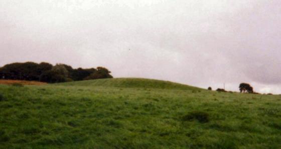
I headed up from the south through the lovely old wood and eventually found the site. I have to say I’m not convinced on the ground and checking the lidar, I’m even less convinced. The ditches around the edges seem natural with some possible modification, but I’d expect a bank along the top, even slight, which seemed to be completely absent.
There is obvious ridge and furrow across the top which you can see close up on the footpath and is picked out beautifully on the lidar, if I had to guess I’d presume the ditches at the foot of the slope were drainage for the mediaeval fields.
On the way back I got deliberately “lost” in the woods, completely empty at 8pm. Bliss.
Access pretty good from the south with only moderate rough ground and well maintained access roads and paths. Steep long grass at the site.
A bit of a strange one this in the middle of a public park and no-one seems to know much about it, as I havn’t really found many references to Hawksclough. Me and Rivington Pike (a fellow member of TMA) who also had vaguely heard of it decided to find it.
What we found does seem to be the site that’s on the map, its earthworks quite prominent, just no-one seems to know its there! This monuments purpose and meaning has been sadly forgotten but after all this time it still remains there on the hill for all to rediscover.