Overlay of the section showing the different materials present.
Image credit: Rivington Pike
Overlay of the section showing the different materials present.

Section of the bank looking North East showing the core and peat infill.

Section of the bank looking South West showing the core and peat infill.

“Bog oak?” and other wood timbers emerging through the eroding peat.

aerial photograph overlaying First edition O.S. map showing the “Fish pond” ?

First edition O.S. map showing the “Fish pond” ?
Note :- The exact location of this site cannot be guaranteed as it does not appear on any O.S. maps.
------------------------------------------------------------
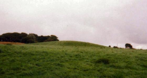
This strange linier feature is situated on the moor to the North of Great Hill.
The first edition O.S. map shows a feature called “Fish Pond” in the same location, but after today’s visit I’m not so sure!
The feature seems to consist of a banked earthwork that has been cut through by a stream producing a clear section as shown on the first photograph. From the stream bed to the top of the bank I would guess to be 20 to 30 ft. The section clearly shows a solid core to the bank a gravel infill at the sides that is topped off by peat.
The age of the site is difficult to estimate, but while walking around the top of the bank “bog oak” and other timbers could be seen emerging from the eroding peat.
One word of warning.
The surrounding area is extremely wet and boggy and care should taken approaching the site. One wrong step meant that I sank up to my waist in smelly brown stuff !
Perhaps good dendrochronological dating evidence could be gleaned from the ‘bog oak’? It would be interesting indeed, especially considering the definite Neolitihic/Bronze Age activity in this area.