The Modern Antiquarian. Stone Circles, Ancient Sites, Neolithic Monuments, Ancient Monuments, Prehistoric Sites, Megalithic MysteriesThe Modern Antiquarian


East Garston Ditch

Dyke

<b>East Garston Ditch</b>Posted by stoerImage © © Pete Wayne 2010
Nearest Town:Wantage (10km N)
OS Ref (GB):   SU365784 / Sheet: 174
Latitude:51° 30' 10.16" N
Longitude:   1° 28' 26.67" W


Discussion Topics0 discussions
Start a topic


Show map   (inline Google Map)

Images (click to view fullsize)

Add an image Add an image
<b>East Garston Ditch</b>Posted by stoer <b>East Garston Ditch</b>Posted by stoer <b>East Garston Ditch</b>Posted by stoer <b>East Garston Ditch</b>Posted by stoer <b>East Garston Ditch</b>Posted by stoer <b>East Garston Ditch</b>Posted by stoer <b>East Garston Ditch</b>Posted by stoer <b>East Garston Ditch</b>Posted by stoer <b>East Garston Ditch</b>Posted by stoer <b>East Garston Ditch</b>Posted by stoer

Fieldnotes

Add fieldnotes Add fieldnotes
The ditch varies from less than 1m deep to approximately 1.5m deep.
The feature sinuously runs towards the ridge and at the northern extent finishes at the '7' furlong marker alongside the fenceline. From the ground feature it would seem that this did continue into the field, but ploughing has removed all trace.
The downland here is very open and gives 360 degree views of rolling chalk hills.
Before leaving I repeated dowsing the feature, as I had done at various points along the ditch; I leave it to others to determine what response you see.
stoer Posted by stoer
1st March 2010ce
Edited 1st March 2010ce

Living locally and having seen this entry lacking for a long time I decided to tab out onto the Wessex Downland and see what I could find.
Looking at the OS 1:25000 map there was an intersection between a footpath and the feature so heading out from Jimmies Farm I soon came out onto the open downland and the "scars" of the horse gallops.
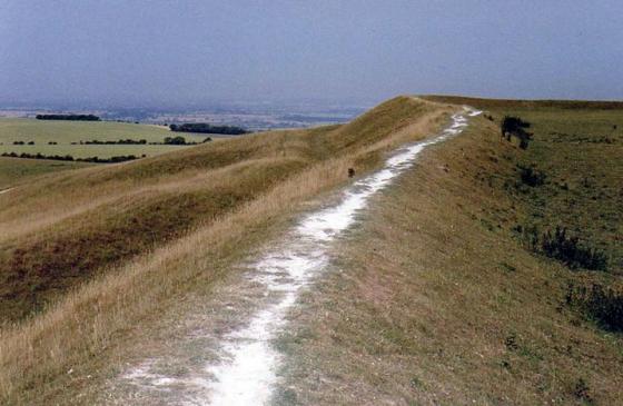
Finding the required footpath, I tabbed across the gallop; the feature is very obvious in the landscape due to the rough grass that is uncut compared to the gallops.
Looking south from the intersection, the feature becomes less clear and according to the map and Pastscape the feature ends in a series of banks which have been identified as later post-Medieval sheep compounds.
Looking north from here, the ditch can be clearly seen as a north-south running feature with an easterly bank which is higher, and better preserved, than the westerly bank, which seems to have suffered more erosion.
stoer Posted by stoer
28th February 2010ce
Edited 1st March 2010ce

Links

Add a link Add a link

Everytrail Record


Everytrail entry for East Garston Ditch with additional photos and GPS data.
stoer Posted by stoer
28th February 2010ce

Pastscape Monument #228927


EH Pastscape monument record for East Garston Ditch
stoer Posted by stoer
28th February 2010ce