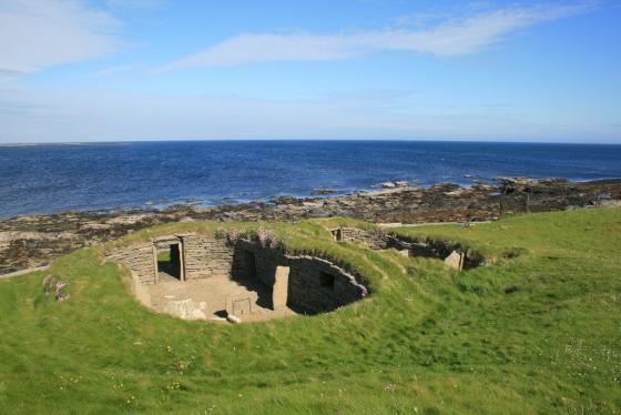
RCAHMS NMRS record HY44SW 8 , possible tri-partite or stalled cairn . At HY430449 OS shows a marker but RCAHMS NMRS record HY44SW 14 believes this cairn to be prehistoric .
Sites within 20km of Fitty Hill
-
Knowe of Skea
description 1link 1 -
Knowe of Skea
description 1link 1 -

Quoybirse
photo 4description 1 -

The Pierowall Westray Stone
photo 3description 2 -
Links of Noltland
description 9link 5 -
Knowe of Queen O’Howe
-

Knap of Howar
photo 13description 3link 4 -
Holm of Papa Westray Centre
-

Holm of Papa Westray
photo 16description 4 -
Holm of Papa Westray North
-

Loch of Wasbister
photo 4description 3 -

Yetnessteen
photo 4description 3 -

Scockness
photo 8description 2 -
Knowe of Lingro
-
Linkertaing
description 1 -
Quendal
description 1 -

Vinquoy
photo 6description 2 -

Huntersquoy
photo 4description 3 -
Whoom
description 1 -

Braeside
photo 3forum 1description 3 -

Stone of Setter
photo 10description 3link 1 -
North Howe
description 1 -

Broch of Midhowe
photo 14description 2 -

Midhowe
photo 12description 4link 1 -

South Howe
photo 1description 3link 1 -

Tammaskirk
photo 14description 1link 1 -

Calf of Eday Long
photo 1description 2 -

Calf of Eday NW
photo 3description 2 -

Knitchen Hill
photo 3description 1 -

Calf of Eday SE
photo 2description 2 -
Knowe Of Swandro
description 1link 2 -

Knowe of Rowiegar
photo 4description 1link 1 -

Eday Church
photo 1description 1 -
Westness
description 1 -

Cubbie Roo’s Burden
photo 4description 2 -

Knowe of Ramsay
photo 3description 1 -

Knowe of Yarso
photo 28description 5 -
Burn of Mussetter
-
Burn of Mussetter
-

Taversoe Tuick
photo 45description 4link 2 -

Knowe of Lairo
photo 12description 6link 2 -

Blackhammer
photo 23description 3link 1 -

Long Stone
photo 8forum 1description 3 -

Knowe of Burrian
photo 5description 1 -

Knowe of Hunclett
photo 6description 1 -

Eday Manse
photo 4description 2 -

Broch of Gurness
photo 37description 8link 2 -

Peterkirk
photo 5description 2 -

Broch of Burgar
photo 5description 1 -

Burgar
photo 10description 2 -

Knowe of Grugar
photo 12description 3 -
Lower Arsdale
description 2 -

Knowe of Stenso
photo 11description 2 -

Costa Hill
photo 2description 3 -

Ness of Woodwick
photo 10description 2 -

Southside Stone
photo 2description 1