The Modern Antiquarian
Log in
|
Register
Home
Latest Posts
Forums
Maps
Help
Browse Sites
News
Blog
Contributors
The Books
Select
-
Belgium
Denmark
Eire
France
Germany
Greece
Italy
The Netherlands
Norway
Portugal
Republic of Malta
Spain
Sweden
Switzerland
United Kingdom
England
Southern England
Hampshire
Tatchbury Mount
Hillfort
Tatchbury Mount (Hillfort) on The Modern Antiquarian, the UK & Ireland's most popular megalithic community website. 1 image, plus information on many more ancient sites nearby and across the UK & Ireland.
Image © Open Source Environment Agency LIDAR
Nearest Town:
Romsey (6km N)
OS Ref (GB):
SU330144 /
Sheet: 196
Latitude:
50° 55' 39.07" N
Longitude:
1° 31' 49.43" W
Added by
pure joy
Images (1)
Miscellaneous (1)
0 discussions
Start a topic
Show |
Hide
Web searches for Tatchbury Mount
Flickr
Google
Google Images
MAGIC
The Megalithic Portal
Bing
Stone Pages
Streetmap.co.uk
Wikipedia
Show map
(inline Google Map)
- Sites within 20 km -
-
Money Hills (1.39km W) (2 posts)
Testwood Lakes (3km ENE) (1 post)
Stagsbury Hill (4.76km W) (8 posts)
Malwood Castle (5.76km WSW) (1 post)
Ashurst Lodge (5.82km SSE) (8 posts)
Toothill Fort (6.59km NE) (4 posts)
North Yew Tree Heath Barrows (7.33km SE) (5 posts)
Black Bush Plain (8.28km W) (1 post)
Yew Tree Heath (8.48km SE) (1 post)
The Butt (Fritham) (8.59km WSW) (5 posts)
Chilworth Ring (8.67km ENE) (2 posts)
Dunwood Camp (8.76km NNW) (2 posts)
Marchwood Inclosure (9.01km ESE) (4 posts)
Dibden Bottom (9.86km ESE) (5 posts)
Dibden Inclosure (11.29km ESE) (2 posts)
The Butts (New Forest) (11.62km W) (1 post)
Lockerley Camp (11.78km NNW) (1 post)
Beaulieu Road (11.86km ESE) (5 posts)
Jacob's Barrow (12.17km W) (4 posts)
Bratley Plain (12.54km WSW) (6 posts)
Pudding Barrow (12.61km SSE) (5 posts)
Whitefield Moor (12.82km SSW) (2 posts)
Cold Pixie's Cave (12.92km SSE) (6 posts)
Hatchet Pond (12.99km SSE) (1 post)
Beaulieu Heath (13.28km SSE) (4 posts)
Holbury Purlieu (13.74km ESE) (1 post)
Ipers Bridge Road (13.92km ESE) (5 posts)
Castle Piece (14.17km WSW) (2 posts)
Moorgreen House (14.46km ENE) (1 post)
Monarch Way (14.46km ENE) (1 post)
Netley Hill (14.65km E) (1 post)
Setley Plain (14.78km S) (6 posts)
Dirty Mount (15.01km NNE) (4 posts)
Creek Bottom Barrows (15.04km SW) (1 post)
Merdon Castle (15.11km NE) (2 posts)
Collins Grave Bowl Barrow (15.15km SW) (1 post)
Holman's Bottom Barrows (15.28km SW) (1 post)
Setley Pond (15.35km S) (5 posts)
Longsdale View Barrow (15.48km SSW) (3 posts)
lbsley Common (16.03km WSW) (1 post)
Withering Corner Barrows. (16.05km NNE) (6 posts)
Shirley Holms (16.17km S) (3 posts)
Frankenbury Camp (16.27km W) (2 posts)
Farley Mount Enclosure (16.31km NNE) (9 posts)
Gorley Hill (16.8km WSW) (1 post)
Castle Hill (Burley Street) (16.83km SW) (8 posts)
West Wood (17.03km NNE) (7 posts)
Hamble Common camp (17.27km E) (1 post)
Burnt Axon (17.53km SW) (5 posts)
Slap Bottom (17.64km SW) (2 posts)
Vales Moor (17.66km SW) (8 posts)
Buckland Rings (17.66km S) (12 posts)
Elkham Grave Barrow (17.69km SSW) (1 post)
Texas Barrows (17.76km NE) (5 posts)
South Baddesley Stone (17.91km SSE) (5 posts)
Lower Exbury (18.02km SE) (4 posts)
St Mary's Church, Twyford (18.46km NE) (5 posts)
Oliver's Battery (18.56km NE) (7 posts)
The Giant's Chair (Downton) (18.64km W) (1 post)
The Turret (18.7km NNW) (2 posts)
Giant's Grave (Downton) (18.86km W) (2 posts)
Whiteshoot Hill (18.89km NNW) (2 posts)
Love Lane (18.93km ENE) (3 posts)
Twyford Pumping Station Barrows (19.52km ENE) (3 posts)
Breamore Down (19.71km W) (3 posts)
Giant's Grave (19.94km W) (6 posts)
- Add -
-
Add news
Add an image
Add fieldnotes
Add folklore
Add miscellaneous
Add a link
Add a nearby facility
Add an alternative name/spelling
Images
(click to view fullsize)
Add an image
Miscellaneous
Add miscellaneous
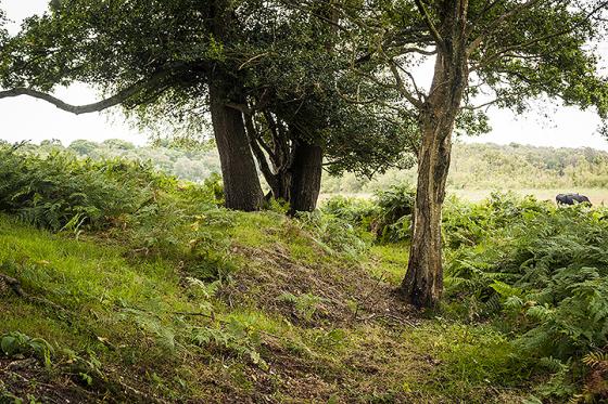
The excellent ‘Hampshire Treasures’ resource gives the following information – “Multivallate Hill Fort. Tatchbury Mount Hospital. Area built over by hospital buildings but outline can still be seen. O.S.A. No. SU31 SW1”
Comments (0)
|
Add a comment
|
Permalink
Posted by
pure joy
26th July 2003ce