The Modern Antiquarian
Log in
|
Register
Home
Latest Posts
Forums
Maps
Help
Browse Sites
News
Blog
Contributors
The Books
Select
-
Belgium
Denmark
Eire
France
Germany
Greece
Italy
The Netherlands
Norway
Portugal
Republic of Malta
Spain
Sweden
Switzerland
United Kingdom
County Cork
Oughtihery E
Stone Circle
Oughtihery E (Stone Circle) on The Modern Antiquarian, the UK & Ireland's most popular megalithic community website. 9 images, plus information on many more ancient sites nearby and across the UK & Ireland.
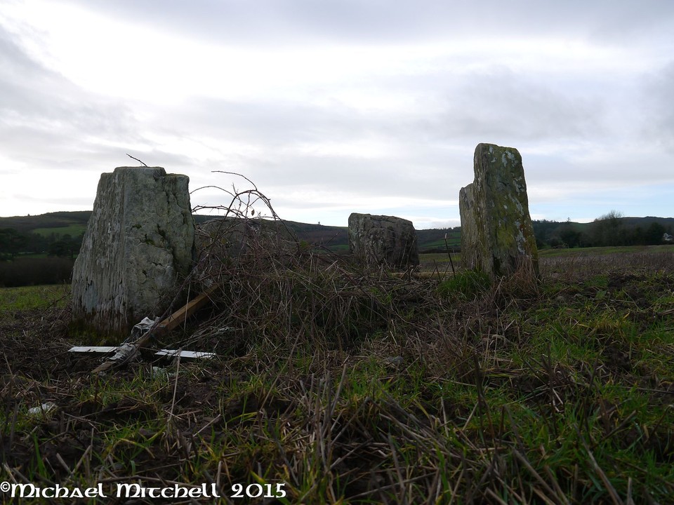
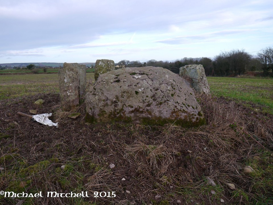
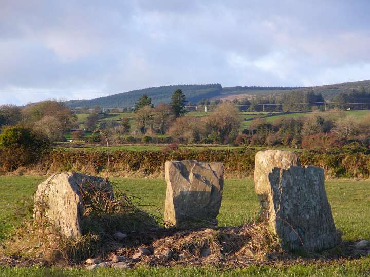
Image © Uwe Häberle 10/2008
Nearest Town:
Cookstown (15km SSE)
OS Ref (IE):
W415802 /
Sheet: 80
Latitude:
51° 58' 15.44" N
Longitude:
8° 51' 4.83" W
Added by
FourWinds
Images (9)
1 discussion topic
Start a topic
Show |
Hide
Web searches for Oughtihery E
Flickr
Google
Google Images
The Megalithic Portal
Bing
Stone Pages
Wikipedia
Show map
(inline Google Map)
- Sites within 20 km -
-
Rylane (2.54km ENE) (5 posts)
Rylane (2.85km ENE) (3 posts)
Maulmore (2.97km WNW) (8 posts)
Oughtihery W (3.05km WNW) (9 posts)
Laharankeal (3.6km SW) (1 post)
Kilmartin Lower (4.2km ENE) (1 post)
Laharankeal (4.25km SSW) (4 posts)
Kilberrihert large wedge tomb damaged (4.35km WSW) (2 posts)
Deelish (4.35km SSW) (4 posts)
Carrigagulla (5.06km W) (7 posts)
Carrigagulla NE (5.15km W) (10 posts)
Carrigagulla (5.51km WNW) (20 posts)
Caherbaroul (5.52km WSW) (7 posts)
Carrigagulla NE (5.59km WNW) (17 posts)
Knocknagappul (6km W) (3 posts)
Knocknagappul (6.1km W) (3 posts)
Knockagappul 1 (6.58km W) (5 posts)
Knocknagappul (7.51km W) (5 posts)
Stone Row, partially ruined (7.52km W) (5 posts)
Knockagappul 2 (7.62km W) (6 posts)
Bealick (8.28km SW) (0 posts)
Gowlane North (8.8km NE) (8 posts)
Knockavullig NE (9.8km SSE) (2 posts)
Knocknagappul (9.82km W) (2 posts)
Bealick (9.83km SW) (3 posts)
Lackaduv (9.91km WSW) (5 posts)
An Seisear (9.95km NE) (14 posts)
Rosnascalp (9.95km SSW) (4 posts)
Knockavullig SW (10.03km SSE) (4 posts)
Scrahanard (10.05km WSW) (15 posts)
Kilboultragh (10.39km WSW) (1 post)
Glandine (Monkey's Bridge) (10.82km NE) (15 posts)
Knockraheen (11.16km WSW) (19 posts)
Knocknakilla (11.96km W) (0 posts)
Cloghboola Beg (12.04km W) (12 posts)
Carriganimmy (12.41km W) (15 posts)
Knocknakilla (12.45km W) (24 posts)
Gortyleahy (12.51km SW) (4 posts)
Garrane (12.62km NNE) (7 posts)
Bweeng (12.84km NE) (6 posts)
Carrigonirtane (12.96km W) (6 posts)
Gortnalicky (13.44km WSW) (1 post)
Clashmaguire (13.52km WSW) (1 post)
Clashmaguire (13.56km WSW) (2 posts)
Cabragh (13.58km WSW) (4 posts)
Glantane East (13.64km W) (7 posts)
Cabragh N (13.65km WSW) (6 posts)
Cabragh (13.65km WSW) (4 posts)
Glantane East N (13.69km W) (14 posts)
Glantane East N (13.69km W) (5 posts)
Glantane East S (13.73km W) (16 posts)
Carrigaphooca (13.79km WSW) (7 posts)
Gneeves (13.82km NNE) (3 posts)
Glantane South (13.93km W) (8 posts)
Carrigonirtane (13.96km WSW) (4 posts)
Glenleigh (14.04km WNW) (3 posts)
Lissacresig 1 (14.7km WSW) (4 posts)
Gortdonaghmore (14.74km E) (4 posts)
Carrigcleena (14.75km NE) (3 posts)
Lissacresig 2 (14.79km WSW) (5 posts)
Lissacresig 3 (14.79km WSW) (4 posts)
Inchinlinane (15.2km WSW) (5 posts)
Lissacresig (15.35km WSW) (3 posts)
Cloghboola Beg (15.38km W) (0 posts)
Cloghboola More (15.38km W) (0 posts)
Currabeha (North) (15.79km SSE) (7 posts)
Clearagh (15.85km SSW) (2 posts)
Lios na Ratha/Loughane East (15.95km E) (4 posts)
Knockawaddra (Muskerry East By.) (16km SE) (9 posts)
Bellmount Upper NE (16.01km SSE) (9 posts)
Bellmount Upper SW (16.07km SSE) (9 posts)
Currabeha (South) (16.18km S) (7 posts)
Teergay (16.37km SW) (8 posts)
Nursetown Beg (16.45km NE) (6 posts)
Kylefinchin 2 (16.5km WSW) (5 posts)
Loughane East (16.74km E) (6 posts)
Kylefinchin (16.88km WSW) (1 post)
Rossnakilla (17.09km SSW) (0 posts)
Rossnakilla (17.09km SSW) (9 posts)
Knocknaneirk NE (17.41km S) (13 posts)
Ballyvoge 1 (17.48km WSW) (6 posts)
Laughtneill (17.51km SSE) (9 posts)
Barnadivane (17.64km SSW) (0 posts)
Knockane (17.87km SSW) (8 posts)
Knocknaneirk SW (18.02km S) (17 posts)
Cools (18.18km WSW) (3 posts)
Hornhill (18.3km SSW) (8 posts)
Hornhill (18.6km S) (5 posts)
Bengour East (18.69km S) (6 posts)
Garranereagh (18.71km SSW) (4 posts)
Kilmeedy E (18.95km W) (0 posts)
Claragh E (18.95km W) (2 posts)
Kilmeedy W (19.36km W) (0 posts)
Ballyknockane (19.68km ENE) (2 posts)
Claragh W (19.85km W) (2 posts)
Blarney's Dolmen (19.9km E) (3 posts)
Reanacaheragh (19.97km SSW) (0 posts)
- Add -
-
Add news
Add an image
Add fieldnotes
Add folklore
Add miscellaneous
Add a link
-
Add a site
Add a nearby facility
Add an alternative name/spelling
Images
(click to view fullsize)
Add an image
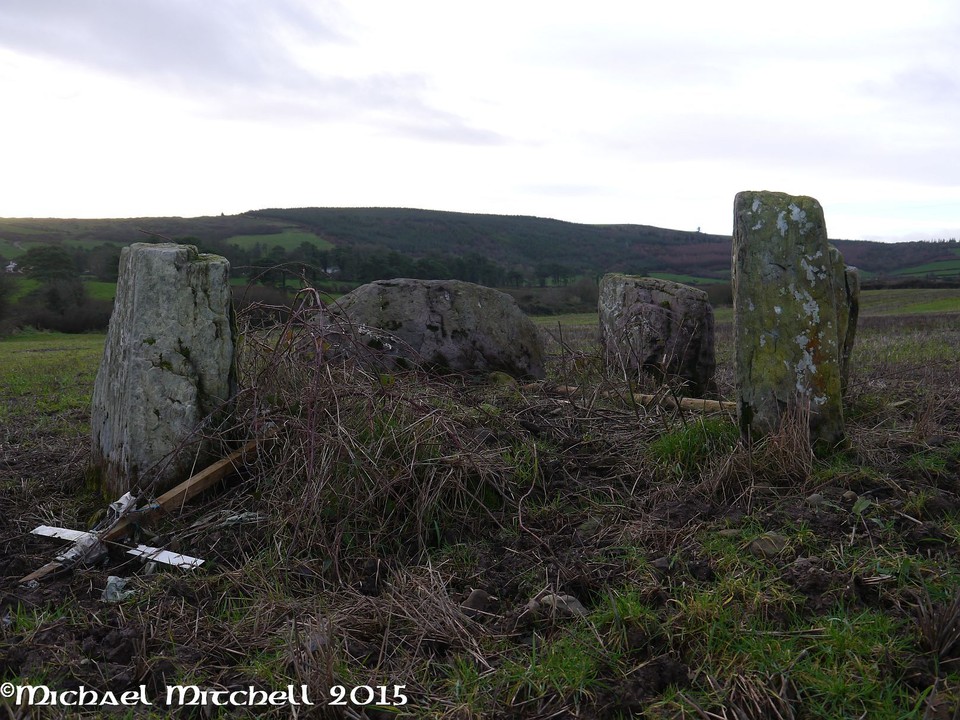
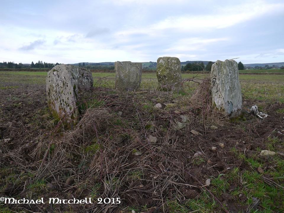
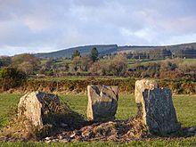 Image © Uwe Häberle 10/2008
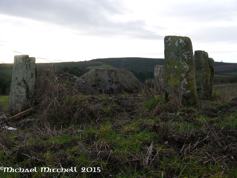
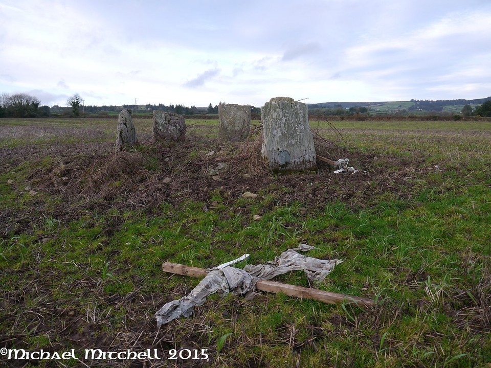