Green Island (Milton Loch) Earthwork viewed from W.
Image credit: Mark Johnstone
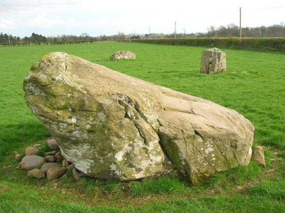
Green Island (Milton Loch) Earthwork viewed from W.

SW Arc of Ditch of Green Island (Milton Loch) Earthwork.

SE Arc of Rampart of Green Island (Milton Loch) Earthwork.

N Flank of Green Island (Milton Loch) Earthwork.

E Flank of Green Island (Milton Loch) Earthwork.

S Flank of Green Island (Milton Loch) Earthwork.

W Flank of Green Island (Milton Loch) Earthwork.

Entrance of Green Island (Milton Loch) Earthwork viewed from E.

Enclosure of Green Island (Milton Loch) Earthwork viewed from E.

Enclosure of Green Island (Milton Loch) Earthwork viewed from W.
Directions to Green Island, Milton Loch: Take the Park of Brandedleys turn off the A75 on the SW edge of Crocketford. Follow the road for c. 0.8 mile to Auchengibbert Farm. Bear left to Kirkgunzeon for c. 0.2 mile to a passing place on the left. Park up and follow a vague path along the margin of the field to the W bank of Milton Loch. My route is viewable on Milton Loch Crannogs.
Visited 22.06.23
There is a mysterious earthwork on Green Island, a promontory on the W bank of Milton Loch in Dumfries and Galloway. Milton Loch is c. 1 mile SE of Crocketford, near Dumfries.
The earthwork runs on a east-west axis along the promontory. The narrow boat shaped enclosure, measuring c. 246 feet east-west by 73 feet north-south according to Canmore ID 65045, is protected by a surrounding ditch and rampart defensive system. The rampart is c. 3 feet high and the surrounding shallow ditch 10-12 feet wide. The entrance to the enclosure is in the centre of the west flank, measuring c. 8 feet wide. The flat grassy enclosure is featureless.
There is some doubt as to the age and classification of the earthwork. C M Piggott thought it dated to the Dark Age or Medieval periods while A E Truckell stated it ‘seems a definitely Viking type of site.’ Atlas of Hillforts of Britain and Ireland has a description of the earthwork but notes that it ’ cannot be classified as a fort as such.‘