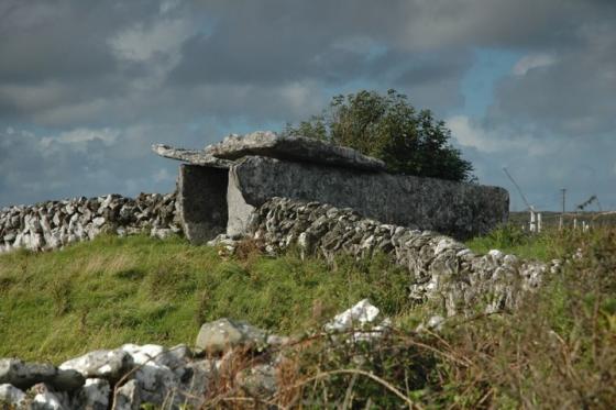
Typically the sun came out as we were leaving.
Image credit: ryaner
Typically the sun came out as we were leaving.

Looking east with the Slievecarran cairn visible in the distance.

Pano of the cliffed peak of Turlough Hill, so reminiscent of Mullaghfarna. The cairn is just beyond the lip of the plateau.

Looking south-west.

Pano looking north from the cairn over Galway Bay. Ucht Máma is to the right, Abbey Hill in the centre further away.

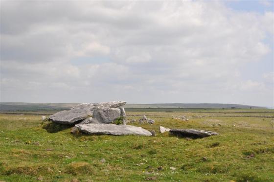
Our approach from the west slowly revealed an impressive structure. In the distance the cairn on Slievecarran is visible just to the right of this cairn.

The western profile has changed with excavation/robbery, exposing the internal structure, though not as far in as the centre.