Skip to content
Julian Cope
presents
The Modern
Antiquarian
Latest
Posts
Sites
Map
Blog
Forum
search
Search
⚠️
Sign in
more_horiz
Eire
County Kerry
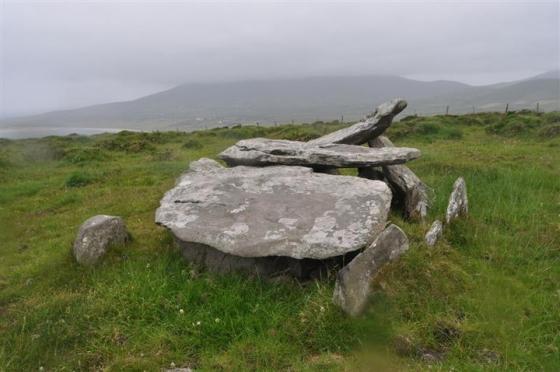
Dunmore
Standing Stone / Menhir
V306982
expand_more
Nearest town:
Cahershiveen (25km ESE)
OS reference:
V306982
OS sheet:
70
Latitude:
52° 6' 35.5 N
Longitude:
10° 28' 23.05 W
Added to TMA by
Meic
Images (5)
Add
content
Images
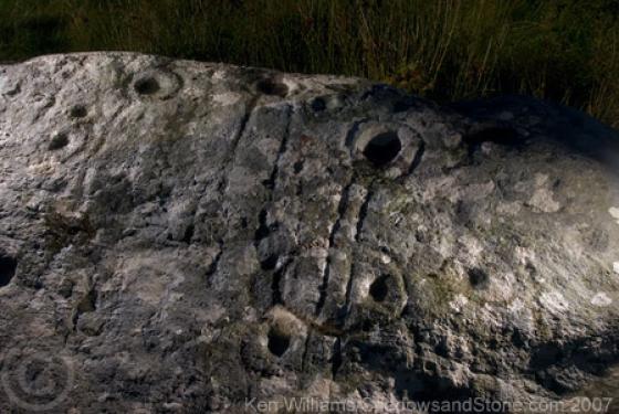
28th May 2019. Ogham stone
Image credit: Michael Mitchell
Meic
May 31, 2019
28th May 2019. Ogham stone
Image credit: Michael Mitchell
Meic
May 31, 2019
28th May 2019. Ogham stone
Image credit: Michael Mitchell
Meic
May 31, 2019
28th May 2019. Ogham stone
Image credit: Michael Mitchell
Meic
May 31, 2019
28th May 2019. Ogham stone
Image credit: Michael Mitchell
Meic
May 31, 2019
Sites within 20km of
Dunmore
Caher Conor
Stone Fort / Dun
•
3.65km E
photo
4
Dunbeg
Cliff Fort
•
4.38km E
photo
23
forum
2
description
3
Caherard
Wedge Tomb
•
8.9km ENE
photo
5
description
1
Ballinrannig
Standing Stone / Menhir
•
9.58km NE
photo
7
Caherdorgan North
Standing Stone / Menhir
•
11.88km NE
photo
1
Caherdorgan North
Stone Fort / Dun
•
11.94km NE
photo
5
description
1
Milltown
Standing Stone / Menhir
•
12.23km ENE
photo
3
description
1
Cnoc an Bhróigín Thiar
Cist
•
12.41km ENE
ondemand_video
1
Kilmalkedar
Standing Stone / Menhir
•
12.42km NE
photo
2
description
1
Kilmalkedar
Bullaun Stone
•
12.46km NE
photo
3
Fallen stones near Milltown Milestone
Standing Stones
•
12.63km ENE
photo
6
description
1
Milltown
Standing Stone / Menhir
•
12.68km ENE
photo
5
description
1
Milltown
Cup and Ring Marks / Rock Art
•
12.68km ENE
photo
3
forum
1
description
1
Corr Aille Spiral
Cup and Ring Marks / Rock Art
•
13.57km NE
photo
2
forum
1
description
1
link
1
Dingle
Bullaun Stone
•
14.21km ENE
photo
4
description
2
Gallaunmore
Standing Stone / Menhir
•
17.37km ENE
photo
2
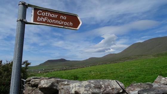
Cathair na bhFionnúrach
Stone Fort / Dun
•
17.59km NE
photo
5
description
1
Kinard East
Cup and Ring Marks / Rock Art
•
19.05km ENE
photo
2
Foheraghmore
Standing Stone / Menhir
•
19.62km ENE
photo
4
search
I’m looking for…
location_on
photo
ondemand_video
forum
description
link