Skip to content
Julian Cope
presents
The Modern
Antiquarian
Latest
Posts
Sites
Map
Blog
Forum
search
Search
⚠️
Sign in
more_horiz
United Kingdom
Scotland
Highland (Mainland)
Leathad An Daraich
Standing Stone / Menhir
NC71693494
expand_more
Nearest town:
Dornoch (47km SSE)
OS reference:
NC71693494
OS sheet:
16
Latitude:
58° 17' 4.45 N
Longitude:
4° 11' 18.84 W
Added to TMA by
thelonious
Images (1)
Add
content
Images
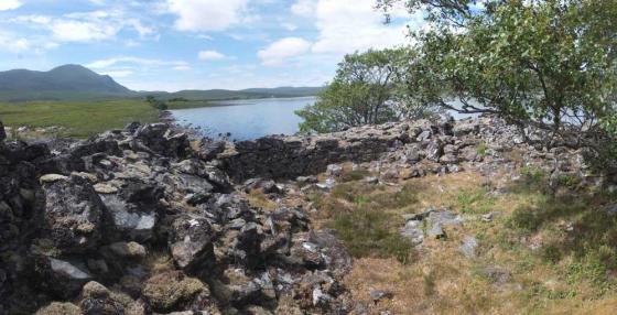
23/05/2019 – Standing stone 60m NW of stone rows.
thelonious
May 31, 2019
Sites within 20km of
Leathad An Daraich
Loch Rimsdale
Multiple Stone Rows / Avenue
•
0.11km SW
photo
4
description
1
Meall A Choire Bhuidhe
Kerbed Cairn
•
4.42km WNW
photo
3
description
1
Clach an Righ
Stone Circle
•
5.53km WNW
photo
10
description
3
Cnoc Molach, Badanloch Forest
Stone Row / Alignment
•
6.55km ENE
photo
16
description
2
Coill'ach a' Chuil
Broch
•
6.69km W
photo
7
description
1
Cnoc Bad A’ Ghille Dhuibh
Cairn(s)
•
7.48km ENE
photo
5
description
1
Carn Glas, Badanloch Hill
Kerbed Cairn
•
7.71km E
photo
9
description
1
Grumbeg
Cup Marked Stone
•
8.85km W
link
1
Grumbeg
Chambered Cairn
•
8.95km W
photo
6
description
2
Dun Chealamy
Broch
•
9.32km NW
photo
9
description
1
Langdale
Broch
•
10.29km NW
photo
8
description
1
Grummore
Broch
•
10.72km W
photo
8
description
1
Dun Creagach
Broch
•
11.2km W
photo
15
description
2
Kinbrace
Multiple Stone Rows / Avenue
•
11.3km E
photo
4
description
1
Ach'na H-uai'
Cairn(s)
•
11.46km E
photo
2
Skail
Chambered Cairn
•
11.93km NNW
photo
6
description
3
link
1
Carn Richard
Chambered Cairn
•
12.07km E
photo
14
description
1
Klibreck
Standing Stones
•
12.36km WSW
photo
5
Skail
Broch
•
12.46km NNW
photo
3
description
1
Harvieston
Ancient Village / Settlement / Misc. Earthwork
•
12.59km E
photo
8
description
1
Altanduin
Broch
•
12.87km ESE
Ben Griam Beg
Hillfort
•
12.92km ENE
photo
19
description
2
Feranach
Broch
•
14.78km E
photo
1
Creag Nan Caorach, Kinbrace
Chambered Cairn
•
15.67km E
photo
9
description
1
Kinbrace Hill
Chambered Cairn
•
16.47km E
photo
21
description
1
Dun Viden
Chambered Tomb
•
16.87km N
photo
4
description
1
Dun Viden
Broch
•
16.9km N
photo
7
description
1
Kinbrace Burn
Chambered Cairn
•
17.15km E
photo
4
description
3
Dun Carnachaidh
Broch
•
17.68km NNW
photo
6
description
1
Suisgill
Broch
•
19.49km E
photo
13
description
1
Achcheargary Burn
Cairn(s)
•
19.84km NNW
photo
4
description
1
Ben Loyal
Rocky Outcrop
•
19.85km WNW
photo
3
description
2
Achargary
Cairn(s)
•
19.91km NNW
description
1
search
I’m looking for…
location_on
photo
ondemand_video
forum
description
link