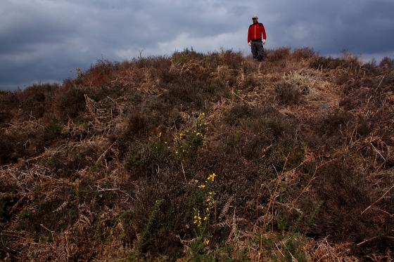
The Modern Antiquarian
Log in
|
Register
Home
Latest Posts
Forums
Maps
Help
Browse Sites
News
Blog
Contributors
The Books
Select
-
Belgium
Denmark
Eire
France
Germany
Greece
Italy
The Netherlands
Norway
Portugal
Republic of Malta
Spain
Sweden
Switzerland
United Kingdom
England
Southern England
West Sussex
Barkhale Wood barrow
Round Barrow(s)
Barkhale Wood barrow (Round Barrow(s)) on The Modern Antiquarian, the UK & Ireland's most popular megalithic community website. 2 images, plus information on many more ancient sites nearby and across the UK & Ireland.
Image © A R Cane
Nearest Town:
Arundel (7km SE)
OS Ref (GB):
SU980123 /
Sheet: 197
Latitude:
50° 54' 4.6" N
Longitude:
0° 36' 22.24" W
Added by
A R Cane
Images (2)
0 discussions
Start a topic
Show |
Hide
Web searches for Barkhale Wood barrow
Flickr
Google
Google Images
MAGIC
The Megalithic Portal
Bing
Stone Pages
Streetmap.co.uk
Wikipedia
Show map
(inline Google Map)
- Sites within 20 km -
-
Barkhale (0.56km WNW) (10 posts)
Glatting Beacon (1.68km WNW) (7 posts)
War Dyke (2.77km ESE) (8 posts)
Barlavington Down (3.58km NW) (2 posts)
Duncton Down (3.93km NW) (1 post)
Rewell Wood Barrow (3.94km SSE) (3 posts)
Lord's Piece (4.93km NNE) (11 posts)
Waltham Down (5.37km W) (7 posts)
Halnaker Hill (6.56km WSW) (7 posts)
The Burgh (6.87km E) (5 posts)
Burpham Camp (7km ESE) (6 posts)
Boxgrove (7.06km WSW) (11 posts)
Lavington Common (7.12km NW) (3 posts)
Rackham Banks (7.18km ENE) (9 posts)
Little Bury (7.51km WNW) (2 posts)
Springhead Hill (8.07km E) (5 posts)
Court Hill (8.41km W) (8 posts)
Gallows Hill (8.58km NW) (8 posts)
Heyshott Down (8.64km W) (5 posts)
Kithurst Hill (9.57km ENE) (10 posts)
Harrow Hill (10.33km E) (12 posts)
The Trundle (10.33km WSW) (23 posts)
Chantry Hill (10.57km E) (3 posts)
The Devil's Ditch (11.03km WSW) (8 posts)
Sullington Hill (11.36km E) (5 posts)
Sullington Warren (11.67km ENE) (8 posts)
Blackpatch Flint Mines (11.86km E) (5 posts)
Church Hill Flint Mines (13.75km E) (3 posts)
Highdown Hill (13.75km ESE) (19 posts)
Goose Hill Camp (15.05km W) (16 posts)
Bow Hill Camp (15.36km WSW) (4 posts)
Stoughton Down (15.65km W) (17 posts)
Stoughton Down (15.75km W) (2 posts)
Chanctonbury Ring (15.85km E) (40 posts)
Kingley Vale (16.1km WSW) (16 posts)
Iping Common (16.14km WNW) (24 posts)
The Devil's Jumps (16.33km W) (10 posts)
Cissbury Ring (16.51km E) (41 posts)
Hammer Wood (17.77km WNW) (1 post)
Steep Down (19.43km E) (5 posts)
Bevis's Thumb (19.48km W) (16 posts)
The Steyning Stone (19.75km E) (4 posts)
- Add -
-
Add news
Add an image
Add fieldnotes
Add folklore
Add miscellaneous
Add a link
Add a nearby facility
Add an alternative name/spelling
Images
(click to view fullsize)
Add an image