The Modern Antiquarian
Log in
|
Register
Home
Latest Posts
Forums
Maps
Help
Browse Sites
News
Blog
Contributors
The Books
Select
-
Belgium
Denmark
Eire
France
Germany
Greece
Italy
The Netherlands
Norway
Portugal
Republic of Malta
Spain
Sweden
Switzerland
United Kingdom
County Kildare
Curragh
Curragh
Artificial Mound
Curragh (Artificial Mound) on The Modern Antiquarian, the UK & Ireland's most popular megalithic community website. 1 image, plus information on many more ancient sites nearby and across the UK & Ireland.
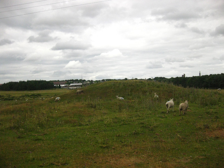
Image © ryaner
Nearest Town:
Kildare (5km WNW)
OS Ref (IE):
N777106 /
Sheet: 55
Latitude:
53° 8' 25.05" N
Longitude:
6° 50' 19.56" W
Added by
ryaner
Images (1)
0 discussions
Start a topic
Show |
Hide
Web searches for Curragh
Flickr
Google
Google Images
The Megalithic Portal
Bing
Stone Pages
Wikipedia
Show map
(inline Google Map)
- Sites within 20 km -
-
Curragh (Kildare ED) II (1.78km WNW) (4 posts)
Curragh (Kildare ED) I (1.83km WNW) (1 post)
Gibbet Rath (1.9km WNW) (7 posts)
Curragh (2.45km NNE) (1 post)
Curragh Racecourse (3.13km NW) (1 post)
Curragh Racecourse (3.41km WNW) (1 post)
Curragh (Kildare ED) (3.51km WNW) (2 posts)
Little Curragh Barrow VIII (4.01km WNW) (1 post)
Little Curragh VIX (4.09km WNW) (1 post)
Little Curragh X (4.25km WNW) (1 post)
Curragh (Kildare ED) (4.37km WNW) (7 posts)
Little Curragh Barrow IV (4.52km WNW) (4 posts)
Little Curragh Barrow VI (4.59km WNW) (5 posts)
Little Curragh Barrow III (4.66km WNW) (5 posts)
Little Curragh Barrow VII (4.71km WNW) (1 post)
Little Curragh Barrow V (4.71km WNW) (6 posts)
Little Curragh Barrow II (4.73km WNW) (3 posts)
Little Curragh Barrow I (5.01km WNW) (7 posts)
Kildare (5.09km W) (3 posts)
Dun Ailinne (5.59km ESE) (5 posts)
Old Kilcullen (6.39km ESE) (1 post)
Kilgowen (8.56km ESE) (12 posts)
Red Hill (8.57km W) (5 posts)
Chair of Kildare (8.85km WNW) (5 posts)
Hill of Allen (10.05km NNW) (7 posts)
Brewell's Hill (10.68km ESE) (3 posts)
Brewell's Hill (10.68km ESE) (1 post)
Kingsland (10.79km ESE) (5 posts)
Brewell's Hill (10.8km SE) (13 posts)
Grangebeg (10.86km WSW) (2 posts)
Ballybought (13.44km E) (3 posts)
Killeen Cormac (13.54km SE) (4 posts)
Rathangan (14.02km WNW) (8 posts)
Tornant Lower (14.04km ESE) (2 posts)
Ballybought (14.11km E) (5 posts)
Tornant Upper (14.47km ESE) (8 posts)
Craddockstown West (14.6km ENE) (9 posts)
Mullamast Rath (14.69km S) (6 posts)
Ballymore Eustace West (14.78km E) (5 posts)
Mullamast Barrows (14.79km S) (2 posts)
Crehelp II (14.85km E) (4 posts)
The Ring (14.85km ENE) (0 posts)
Longstone (14.89km E) (0 posts)
Punchestown (14.89km ENE) (6 posts)
Mullamast Long Stone (14.98km S) (5 posts)
Punchestown Standing Stone (15.14km ENE) (15 posts)
Kinsellastown (15.33km E) (3 posts)
Kinsellastown II (15.38km E) (2 posts)
Whiteleas (15.49km E) (11 posts)
Plezica (15.53km ESE) (9 posts)
Broadleas (15.55km E) (34 posts)
Bishopsland (15.59km E) (3 posts)
Crehelp (15.91km E) (1 post)
Crehelp (15.91km E) (6 posts)
Barretstown Hill (15.92km NE) (1 post)
Athgreany (16.98km E) (49 posts)
Scalp Rath (17.1km E) (2 posts)
St. Kevin's Bed (Hollywood) (17.11km E) (4 posts)
Scalp (17.19km E) (6 posts)
Baltracy (17.2km ENE) (1 post)
Athgreany Rath (17.52km E) (5 posts)
Athgreany standing stone (17.52km E) (5 posts)
Maudlings (17.55km NE) (4 posts)
Broomfields (17.56km ESE) (12 posts)
Blackmoor (18.02km ESE) (6 posts)
Firmount East (18.09km NNE) (1 post)
Blakestown Upper (18.15km E) (3 posts)
Forenachts (18.2km ENE) (3 posts)
Slievecorragh (18.23km E) (6 posts)
Lugnagroagh (18.23km E) (3 posts)
Kiernans Hill (18.3km E) (4 posts)
Broughills Hill (18.31km E) (11 posts)
Johnstown (18.37km E) (2 posts)
Johnstown Hut Site 1 (18.41km E) (2 posts)
Newtown Great (18.51km ENE) (0 posts)
Forenaghts Great (18.81km ENE) (8 posts)
Newtown Park (18.81km ENE) (4 posts)
Kilbaylet Upper (18.92km E) (4 posts)
The Dailteen Stone (19.13km E) (3 posts)
Clane (19.47km NE) (4 posts)
Church Mountain (19.54km E) (4 posts)
Kilbaylet Lower (19.6km ESE) (5 posts)
Kilbaylet Lower (19.66km ESE) (5 posts)
Toor (19.72km E) (0 posts)
- Add -
-
Add news
Add an image
Add fieldnotes
Add folklore
Add miscellaneous
Add a link
-
Add a site
Add a nearby facility
Add an alternative name/spelling
Images
(click to view fullsize)
Add an image
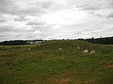 Image © ryaner