The Modern Antiquarian
Log in
|
Register
Home
Latest Posts
Forums
Maps
Help
Browse Sites
News
Blog
Contributors
The Books
Select
-
Belgium
Denmark
Eire
France
Germany
Greece
Italy
The Netherlands
Norway
Portugal
Republic of Malta
Spain
Sweden
Switzerland
United Kingdom
County Cork
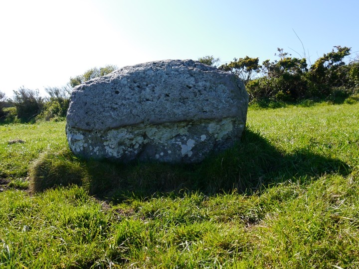
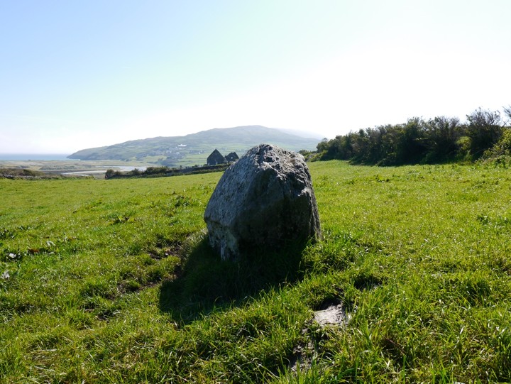
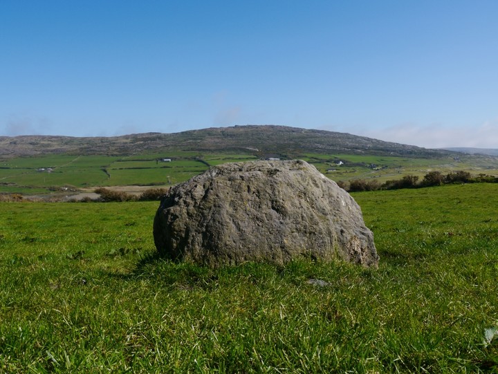
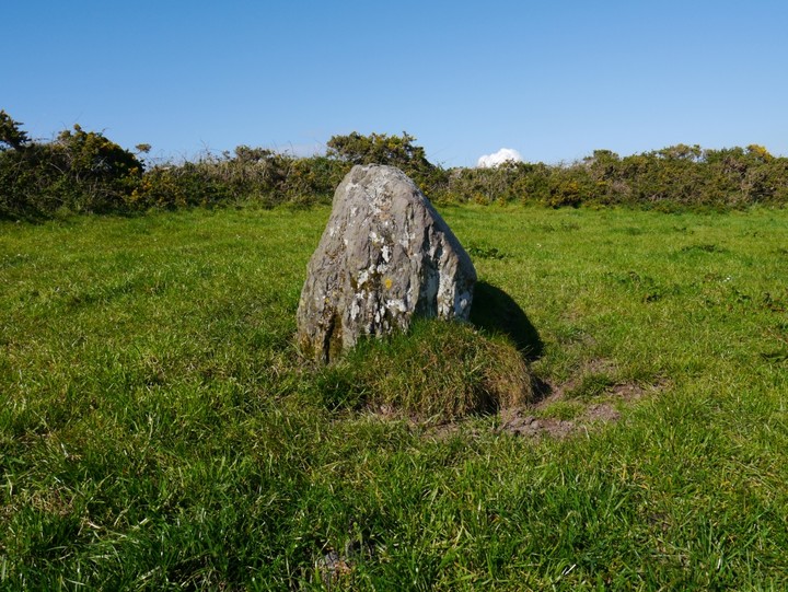
Lissagriffin
Standing Stone / Menhir
Lissagriffin (Standing Stone / Menhir) on The Modern Antiquarian, the UK & Ireland's most popular megalithic community website. 4 images, plus information on many more ancient sites nearby and across the UK & Ireland.
Image © Michael Mitchell
Nearest Town:
Goleen (4km ENE)
OS Ref (IE):
V772269 /
Sheet: 88
Latitude:
51° 28' 53.85" N
Longitude:
9° 46' 4.6" W
Added by
Meic
Images (4)
0 discussions
Start a topic
Show |
Hide
Web searches for Lissagriffin
Flickr
Google
Google Images
The Megalithic Portal
Bing
Stone Pages
Wikipedia
Show map
(inline Google Map)
- Sites within 20 km -
-
Ballyvoge Beg (0.92km E) (8 posts)
Dough (0.98km SE) (7 posts)
Mallavoge (3.08km SE) (4 posts)
Ballydivlin (5.75km ENE) (4 posts)
Caherurlagh (8.79km NNW) (6 posts)
Toormore (9.14km ENE) (15 posts)
Altar (9.27km ENE) (19 posts)
Dunmanus East (9.39km NE) (3 posts)
Dunmanus (10.5km NE) (3 posts)
Arderawinny (10.94km ENE) (10 posts)
Kilcrohane (11.48km NNE) (9 posts)
Peakeen (12.3km N) (6 posts)
Farranamanagh (12.64km NNE) (6 posts)
Farranamanagh (12.99km NNE) (2 posts)
Gorteanish (15.5km NE) (14 posts)
Skull Stone (16.86km ENE) (5 posts)
Rathcool (18.07km ENE) (6 posts)
Dunbeacon (19.73km NE) (20 posts)
- Add -
-
Add news
Add an image
Add fieldnotes
Add folklore
Add miscellaneous
Add a link
-
Add a site
Add a nearby facility
Add an alternative name/spelling
Images
(click to view fullsize)
Add an image
 Image © Michael Mitchell