The Modern Antiquarian
Log in
|
Register
Home
Latest Posts
Forums
Maps
Help
Browse Sites
News
Blog
Contributors
The Books
Select
-
Belgium
Denmark
Eire
France
Germany
Greece
Italy
The Netherlands
Norway
Portugal
Republic of Malta
Spain
Sweden
Switzerland
United Kingdom
County Tipperary
Townfields
Bullaun Stone
Townfields (Bullaun Stone) on The Modern Antiquarian, the UK & Ireland's most popular megalithic community website. 2 images, 1 fieldnote, plus information on many more ancient sites nearby and across the UK & Ireland.
Image © Bawn79 © 2007
Nearest Town:
Cloghjordan (3km ESE)
OS Ref (IE):
R955896 /
Sheet: 59
Latitude:
52° 57' 25.99" N
Longitude:
8° 4' 1.08" W
Added by
bawn79
Images (2)
Fieldnotes (1)
0 discussions
Start a topic
Show |
Hide
Web searches for Townfields
Flickr
Google
Google Images
The Megalithic Portal
Bing
Stone Pages
Wikipedia
Show map
(inline Google Map)
- Sites within 20 km -
-
Corravalley (4.21km WSW) (3 posts)
Middlewalk (4.84km S) (3 posts)
Gorraun (5.08km ESE) (7 posts)
Ardcroney (5.31km WSW) (12 posts)
Coolagorane Upper (5.49km WSW) (5 posts)
Whitstone (6.77km WSW) (4 posts)
Ardcroney (7.82km WSW) (7 posts)
Ashley Park (8.2km WSW) (3 posts)
The Commons of Carney (8.36km W) (3 posts)
Kilruane (8.47km SW) (3 posts)
Ashley Park (8.48km WSW) (21 posts)
Rathurles (10.12km SSW) (6 posts)
Rathurles (10.27km SSW) (9 posts)
Knigh Hill (10.53km WSW) (3 posts)
Rathfalla (10.78km SSW) (5 posts)
Rathurles (10.98km SSW) (2 posts)
Ballyquinlevan Upper (11.09km W) (3 posts)
Knockalton Lower (12.51km SSW) (1 post)
Bendubh (14.41km ESE) (3 posts)
Ballinlough (15.35km SE) (2 posts)
Ballinlough (15.35km SE) (1 post)
Lorrha (15.38km NNW) (4 posts)
Dermot and Gráinne's bed (15.39km WNW) (0 posts)
Borrisnoe (16.52km ESE) (2 posts)
Borrisnoe (16.52km ESE) (2 posts)
Borrisnoe (16.52km ESE) (5 posts)
Lissballyard (16.83km N) (2 posts)
Tullahedy (16.86km SW) (2 posts)
Creggane (17.14km SW) (2 posts)
Youghalvillage (17.58km WSW) (4 posts)
Kilcolman (17.63km SW) (2 posts)
Devilsbit Mountain (18.18km ESE) (6 posts)
Garranmore (18.71km WSW) (3 posts)
Knockanora (19.17km SE) (4 posts)
Cloneygowny (19.72km WSW) (2 posts)
Ballinacurra (20km S) (1 post)
- Add -
-
Add news
Add an image
Add fieldnotes
Add folklore
Add miscellaneous
Add a link
-
Add a site
Add a nearby facility
Add an alternative name/spelling
Images
(click to view fullsize)
Add an image
Fieldnotes
Add fieldnotes
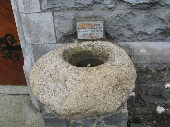
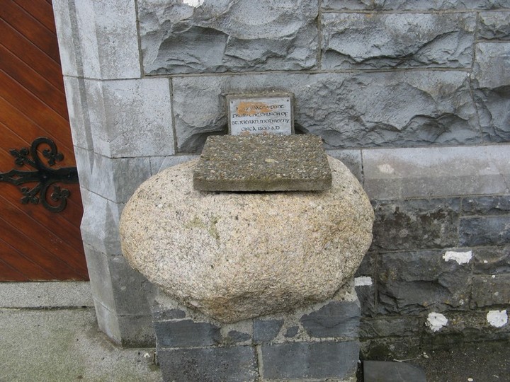
This bullaun was moved from Modreeny Churchyard just outside Cloughjordan but it is now used as the holy water font for the RC church in Cloughjordan village, OS Grid Ref R976879.
Comments (0)
|
Add a comment
|
Permalink
Posted by
bawn79
6th November 2007ce