Skip to content
Julian Cope
presents
The Modern
Antiquarian
Latest
Posts
Sites
Map
Blog
Forum
search
Search
⚠️
Sign in
more_horiz
Eire
County Carlow
Rathgeran Upper
Cup and Ring Marks / Rock Art
S793472
expand_more
Nearest town:
Borris (7km W)
OS reference:
S793472
OS sheet:
68
Latitude:
52° 34' 13.51 N
Longitude:
6° 49' 49 W
Added to TMA by
CianMcLiam
Images (3)
Add
content
Images
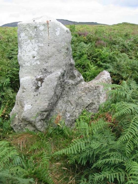
Image credit: Ken Williams/ShadowsandStone.com 2007
CianMcLiam
Nov 16, 2007
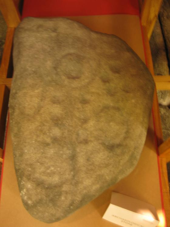
Image credit: Ken Williams/ShadowsandStone.com 2007
CianMcLiam
Nov 5, 2007
Image credit: Ken Williams/ShadowsandStone.com 2007
CianMcLiam
Nov 4, 2007
Sites within 20km of
Rathgeran Upper
Kilmissan
Standing Stone / Menhir
•
0.61km W
Rathgeran Hill
Enclosure
•
0.78km WNW
photo
7
forum
1
description
1
Rathgeran
Standing Stone / Menhir
•
0.82km ENE
photo
4
Rathgeran
Cup and Ring Marks / Rock Art
•
0.94km NW
photo
7
forum
1
Kilmissan
Cup and Ring Marks / Rock Art
•
1km WNW
Knockmore
Cup and Ring Marks / Rock Art
•
2.11km NW
photo
2
Kyle
Artificial Mound
•
2.65km W
Knockroe
Cup and Ring Marks / Rock Art
•
3.38km ENE
photo
5
description
1
Tinncarrig
Cup and Ring Marks / Rock Art
•
3.49km WSW
photo
4
forum
1
description
1
Knockroe
Portal Tomb
•
3.83km NE
photo
9
Gowlin
Cup and Ring Marks / Rock Art
•
4.33km SSW
Crannagh
Cup and Ring Marks / Rock Art
•
4.6km NNE
photo
3
Crannagh
Standing Stone / Menhir
•
4.84km NNE
Newtown
Bullaun Stone
•
5.18km WSW
photo
2
Spahill
Cup and Ring Marks / Rock Art
•
5.91km WNW
photo
2
forum
1
Knockscur
Standing Stone / Menhir
•
6.39km NNW
Killoughternane/
Knockscur
Hillfort
•
6.54km NW
photo
2
description
2
Killoughternane
Hillfort
•
6.54km NW
Aghnaglear
Cairn(s)
•
6.81km S
photo
2
description
1
Ullard
Bullaun Stone
•
6.96km W
photo
4
forum
1
description
1
Ballinasilloge
Portal Tomb
•
6.99km WNW
photo
10
forum
1
description
1
Slievebawn
Cairn(s)
•
7.7km N
photo
5
Mount Leinster
Cairn(s)
•
7.72km N
photo
4
description
1
The Nine Stones
Standing Stones
•
7.77km NNE
photo
3
forum
1
description
1
Carriglead
Artificial Mound
•
7.92km SW
Dranagh Cairn(s)
Cairn(s)
•
8.86km SSW
photo
1
description
1
Brandon Hill
Cup and Ring Marks / Rock Art
•
9.25km WSW
photo
2
Dranagh
Standing Stone / Menhir
•
9.31km SSW
photo
2
Dranagh
Cup and Ring Marks / Rock Art
•
9.36km SSW
photo
1
description
1
Dranagh Standing Stone 2
Standing Stone / Menhir
•
9.56km SSW
photo
3
description
1
Coolasnaghta
Cup and Ring Marks / Rock Art
•
9.6km N
photo
2
Rossard
Bullaun Stone
•
10.52km ENE
Ballinkillin
Cup Marked Stone
•
11km WNW
photo
3
St Mullin’s Well
Sacred Well
•
11.08km SW
photo
2
Ballyellin and Tomdarragh
Cairn(s)
•
11.16km W
photo
2
description
1
Tomdarrach
Standing Stone / Menhir
•
11.17km WNW
photo
2
Dranagh (now in St. Mullins)
Cup and Ring Marks / Rock Art
•
11.19km SW
photo
4
description
1
link
1
Ballinkillin
Hillfort
•
11.38km WNW
Brandon Hill
Cairn(s)
•
11.87km SW
Kilgraney
Chambered Tomb
•
12.08km WNW
photo
9
description
2
Curraun
Standing Stone / Menhir
•
12.14km SSW
photo
2
Ballinvarry Irish
Cup and Ring Marks / Rock Art
•
12.64km SW
description
1
Kilcruit
Cairn(s)
•
12.88km WNW
photo
2
Toberbride
Cairn(s)
•
12.93km NNW
Myshall
Bullaun Stone
•
13.17km NNE
photo
2
forum
1
description
1
Cullaun
Standing Stone / Menhir
•
14.39km SW
Knockbrack Cairns
Cairn(s)
•
14.87km NNE
Knockbrack
Cup and Ring Marks / Rock Art
•
14.97km NNE
photo
2
forum
2
Knockbarragh
Artificial Mound
•
15.5km NNE
Fenniscourt
Round Barrow(s)
•
15.72km WNW
photo
6
forum
1
description
1
Kildreenagh
Bullaun Stone
•
16.59km NNW
photo
4
description
1
Kildreenagh 2
Bullaun Stone
•
16.64km NNW
photo
2
Curraghacruit
Artificial Mound
•
16.7km NW
Dunleckny
Artificial Mound
•
17.23km NW
description
1
Robinstown Great
Standing Stones
•
18.06km SSE
photo
9
forum
1
description
2
Sragh
Cairn(s)
•
18.12km NNE
Clonegall
Bullaun Stone
•
18.22km NE
Commons or Newtown
Round Barrow(s)
•
18.76km S
photo
3
description
1
Lacken
Round Barrow(s)
•
18.86km S
Kilmurray
Round Barrow(s)
•
19.54km NNE
Rathwade
Artificial Mound
•
19.69km NW
Killabeg
Standing Stone / Menhir
•
19.84km E
photo
2
Scarawalsh
Standing Stone / Menhir
•
19.84km E
Killabeg Tumulus
Artificial Mound
•
19.94km E
photo
2
search
I’m looking for…
location_on
photo
ondemand_video
forum
description
link