The massive, 1.5 metre thick, capstone of the western tomb.
Image credit: ryaner
The massive, 1.5 metre thick, capstone of the western tomb.

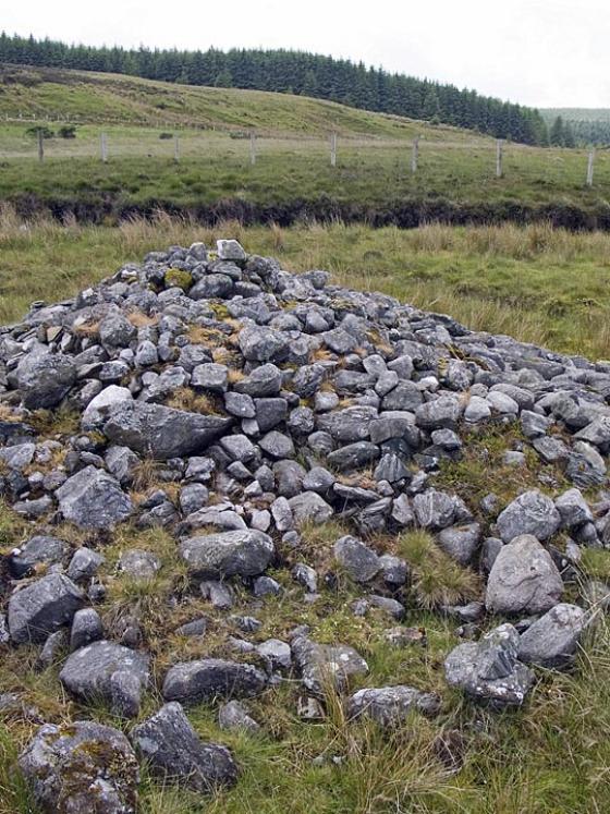
Some cairn material behind the western tomb.

The backstone of the western tomb looking east. The chamber is open after the removal of the southern sidestone.

The capstone of the collapsed eastern tomb is about 3.5 square metres.

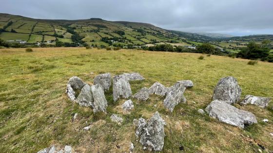
Looking west over the collapsed eastern chamber.

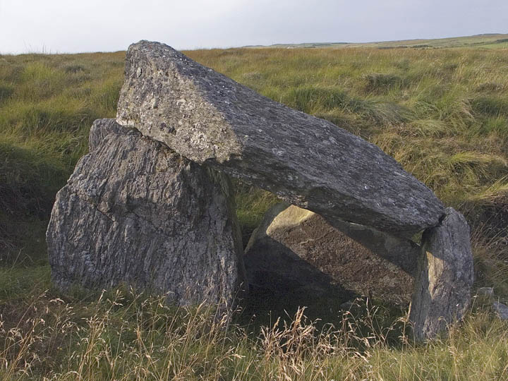
Amazing double dolmen, hidden from view until you are almost on top of it.

This little feature caught my eye on the way back to the car. there is a small pit about 1.5m in diameter behind this lintel-like stone, with numerous stones lying in front of it. I’d guess it was maybe some kind of cist burial, or the remains of a booley house?

Closeup of the huge fallen capstone, with its large seams of quartz.

The larger, collapsed tomb to the east.

View of the western tomb from SE. The massive capstone is about 2.5m square, with huge seams of quartz running through all the stones.
View from the south, showing the gap where the missing sidestone should be.

View of portals and doorstone from inside the chamber.

View towards the western (collapsed) tomb.
This is not the easiest site to access. I had Fourwind’s guidebook with me in the car but neglected to read his directions for no good reason other than being scatterbrained and convinced an approach from Ballycastle Forest car park would be best. We had been in the vicinity a week earlier and had scouted the area a bit and this seemed the best. There were a few fences to traverse but sure when has that ever stopped us?
A track heads east and then south from the car park and skirts the edge of the forest. As the track enters the trees we headed up east along the edge of the forest through a couple of rough pasture fields. The two-dimensionality of the maps and satellite photos never prepares you for what’s ahead so the clomp up the increasingly boggy terrain was challenging if not wholly surprising. Once we’d reached the ridge and traversed the last fence we turned south and headed towards the monument.
There was no immediate sign of the tomb from 150 metres away. The floor of the chambers of this double portal tomb is nestled 2 metres below the ground level of a peat bog. As we got nearer, the top of the western capstone appeared and then, closer in again, it becomes readily apparent that this is an extraordinary monument.
We first skirted around the western end where the better of the two chambers is. There’s not much room at the front of the chamber, sealed as it is with a half-height doorstone. The southern sidestone has been removed and the remaining 4 stones keep the massive capstone propped up, though it seems to have slipped a bit towards the rear.
The eastern tomb, 20 metres from the western, is completely flattened. The capstone, 3.5 metres square, rests on the collapsed chamber stones. Mooching around the place I wondered what direction was the eastern tomb aligned – in the same direction as the western? But that would mean the entrance faced into the cairn. Cairn material is visible between the two chambers. So did the eastern chamber entrance face east?
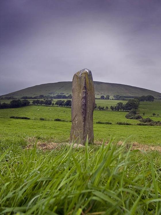
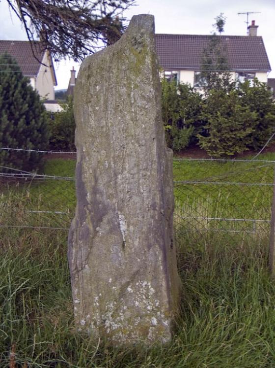
Of all the many monuments in the large townland of Ballyvennaght, this is the best. I can’t imagine you would ever meet anyone around here – even the sheep seem to give it a wide berth. There are two more portal tombs here, plus a wedge and a court and a nice standing stone. Visiting all of these in one day would be a serious challenge, but now that I’ve been to them all but one, I think I know the best way to attempt it.
Visited the site carrying a camera with full batteries this time, which was a good start. After a short steep climb and a close escape from personal injury on a barbed wire fence, (farmers in North Antrim don’t bother with stiles, they’re more likely to be seen on a tractor the size of a small planet.) and a further short wander across pretty unspoilt bogland, I spotted the gleaming capstone of the still-standing tomb peeking above the peat and rushes.
Two portal tombs lie just over 15m apart, oriented E-W. The larger tomb to the east has collapsed, and lies below the present ground level. The western tomb is pretty well preserved. All the stones contain large seams of quartz, and there are a jumble of assorted stones scattered between the tombs which i assume may be cairn material. The capsone of the collapsed tomb is truly massive, measuring 3.75x3.5m, and just over a metre thick. The intact tomb’s is slightly smaller, about 2.5m square.
The site would be even more incredible if the peat surrounding the tombs was lowered a little more, although i guess i should just be grateful there isn’t a fence and sign three feet from them.
I opted against climbing fences on my return to the forest drive carpark, walking down along the fence to the next gate. On the way down the sloping field by the river i noticed a distinctly man-made, but ancient stone structure. I uploaded a picture in case anyone with more knowledge could enlighten me as to what it could be.
p.s. i live nearby, and have never paid just to use the carpark, although the gates to it are rather zealously locked at 8pm during the summer. If you want to drive to the rather disappointing dual court tomb further along the ‘forest drive’ you will have to cough up.
This difficult to find tomb is at GPS coordinates D 20010 36753