The Modern Antiquarian
Log in
|
Register
Home
Latest Posts
Forums
Maps
Help
Browse Sites
News
Blog
Contributors
The Books
Select
-
Belgium
Denmark
Eire
France
Germany
Greece
Italy
The Netherlands
Norway
Portugal
Republic of Malta
Spain
Sweden
Switzerland
United Kingdom
County Tipperary
Waterloo Hill
Waterloo Hill
Rath
Waterloo Hill (Rath) on The Modern Antiquarian, the UK & Ireland's most popular megalithic community website. 1 image, plus information on many more ancient sites nearby and across the UK & Ireland.
Image © Bawn79 © 2007
Nearest Town:
Gorey (13km NW)
OS Ref (IE):
S239499 /
Sheet: 67
Latitude:
52° 35' 59.78" N
Longitude:
7° 38' 50.03" W
Added by
bawn79
Images (1)
0 discussions
Start a topic
Show |
Hide
Web searches for Waterloo Hill
Flickr
Google
Google Images
The Megalithic Portal
Bing
Stone Pages
Wikipedia
Show map
(inline Google Map)
- Sites within 20 km -
-
Waterloo Hill (0.14km WNW) (2 posts)
Knocknagapple (2.48km ESE) (0 posts)
Crohane Lower (5.09km ESE) (2 posts)
Derrynaflan (5.79km WSW) (4 posts)
Clonamondra (6.53km NE) (0 posts)
Foilacamin (6.71km NE) (2 posts)
Crab (6.8km NNE) (0 posts)
Buffanagh (7.86km SW) (2 posts)
Warhouse Hill (8.92km ENE) (2 posts)
Drangan (10.18km SE) (0 posts)
Ballinree (13.73km WSW) (2 posts)
Ballinree (13.73km WSW) (3 posts)
Ballinree (13.76km WSW) (1 post)
Cloran Old (15.43km SSE) (3 posts)
Borrismore Tomb (15.95km NNE) (0 posts)
Borrismore (16.34km NNE) (6 posts)
Corralough (17.34km WSW) (2 posts)
Rathealy (17.91km NE) (5 posts)
Clomantagh (Mountgarret) (18.18km NE) (7 posts)
Clomantagh (Mountgarret) (18.18km NE) (5 posts)
Rathealy (18.69km NE) (3 posts)
Ardmayle (18.74km WSW) (6 posts)
Spahill (18.94km NNE) (5 posts)
Rosegreen (19.02km SW) (4 posts)
Sheegouna (19.33km SE) (6 posts)
Rath na Drinne (19.53km SW) (4 posts)
- Add -
-
Add news
Add an image
Add fieldnotes
Add folklore
Add miscellaneous
Add a link
-
Add a site
Add a nearby facility
Add an alternative name/spelling
Images
(click to view fullsize)
Add an image
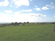 Image © Bawn79 © 2007

