Open Source Environment agency LIDAR
Image credit: © Environment Agency copyright and/or database right 2015. All rights reserved
Open Source Environment agency LIDAR

Looking down the line from one of the western barrows.

Poole Harbour, Bournemouth and Brownsea Island from the cemetery. Just below, but not visible, are the Rempstone Stone Circle, the Agglestone and Studland stone rows.

Looking east from the centre of the group. The Needles on the Isle of Wight is just visible in the top left corner.

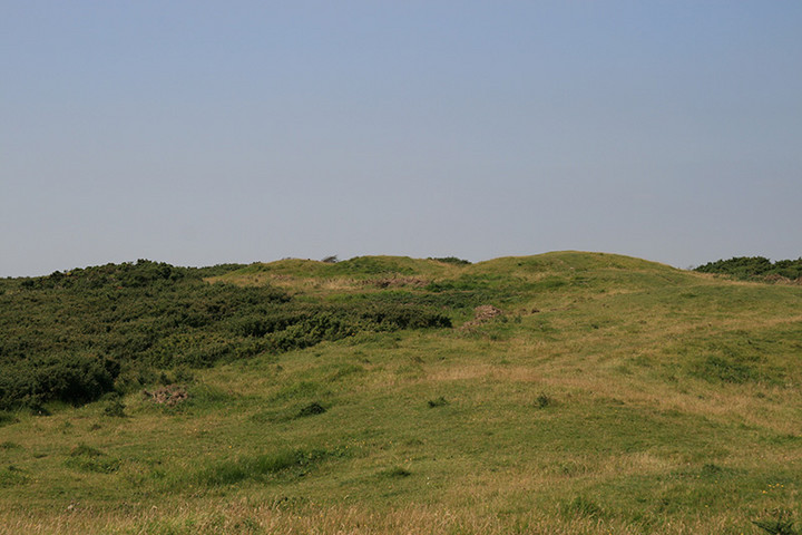
The ring ditch is just about discernible on this one.

The largest barrow in the group and Mrs Cane for scale (she casts a mighty shadow!)

Possible boundary markers just east of the barrow cemetery.

Two of the Nine Barrows from the barrow cemetery on the west of Godlingston Heath to the north.

Standing on one of the barrows trying not to be blown away!

Some of the group from the hill to the south.


Wide angle of the two largest round barrows in the cemetary.

One of the larger barrows.

Looking over the barrows.

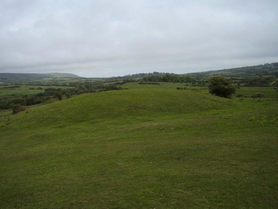
The cemetary as it first comes into view.

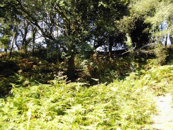
The Ancient woods leading upto Nine Barrows cemetary

nine barrows down just as the light was beggining to fade
Nine Barrow Down
Moving on from Rempstone Circle I climbed the steep slope leading to the Dorset Coastal Path. The stony path winds its way up East Hill through some beautiful woodland to the windblown summit of Nine Barrow Down, a complete contrast to the calm sheltered mystical stone circle below. From this high point an almost complete view of the Purbecks can be admired. Magnificent views across Poole Harbour to Poole and the Sandbanks peninsular, around to Swanage in the south east and the English Channel to the south.
On the ridge of Nine Barrow Down lie a group of 10 early Bronze Age round barrows of different sizes, the two largest surrounded by ditches. An earlier Neolithic long barrow sits with other round barrows on slightly lower ground towards the sea positioned to be seen from the valley settlements to the south. The strong penetrating north wind meant my visit to the site was a short one. I made a hasty retreat back down the hill to the calm of the valley and back to my motorbike parked beside the B3351.
A nice hike uphill through atmospheric ancient woodlands brings you out onto Nine Barrows Down Cemetery where you are greeted with stunning views of Purbeck and a stunning array of barrows in all shapes and sizes. There’re two large round barrows with ditches five smaller round barrows and one long barrow combine this with Rempstone Stone Circle and you’ve got a perfect day.
this barrow cemetary and rempstone stone circle are two of the closest places to where i live that i’ve visited. nine barrows down is signposted from the road and is situated in the field at the top of a really nice walk climbing up from the main road. there are a couple of small lay-by’s near by if you are travelling by car.
Visited 28/12/01CE
Lovely barrow cemetary on top of the hills on the edge of purbeck. Its about 1 mile straight up the side of the hill from Rempstone Stone circle so both can easily be visited in a visit.
Note the location of the barrows is to the west of “Nine Barrows Down” marked on the map.
The cemetary itself consists of one neolithic long barrow and 8 bronze age? round barrows. Two of the round barrows have clearly visible ditches and one of these is about 15-20ft high. The round barrows are spread in a line along the crest of the hill running west to east, seemingly getting larger the further east you go. The long barrow is located at the east end about 10 metres south of the line.
The views are as amazing as the earthworks. Poole harbour, wareham, poole and on a clear day bournemouth, to the north. Swanage and most of purbeck to the south. Also if you look west along the coast, you can see the distinctive outline of Golden Cap. I was at the cemetary for sunset but unfortunately the cloud cover was too dense to see much, but I imagine the sun sets pretty close to Golden Cap from that angle.
The nine barrows are said to be the graves of nine kings who fell in a great battle nearby. That must have been some battle for nine kings to be involved.
(mentioned in Grinsell’s ‘Ancient Burial Mounds of England’ 1936).
Details of barrows on Pastscape
A group of 18 Bronze Age bowl barrows (and one Neolithic long barrow, recorded separately as SY 98 SE 14) on Ailwood Down. The barrows form a fairly compact cluster within an area also containing a number of pit-like depressions. These latter may represent quarrying or could alternatively be natural features. The barrows vary in size, and only a few definitely have surrounding ditches. In one case the ditch is interrupted by four causeways. Only one episode of excavation is known (during the 19th century), one of the barrows containing a cremation. See descriptive text for details about each barrow. The cemetery was last visited by RCHME in 1986. All barrows in the group are scheduled.