Skip to content
Julian Cope
presents
The Modern
Antiquarian
Latest
Posts
Sites
Map
Blog
Forum
search
Search
⚠️
Sign in
more_horiz
Eire
County Cork
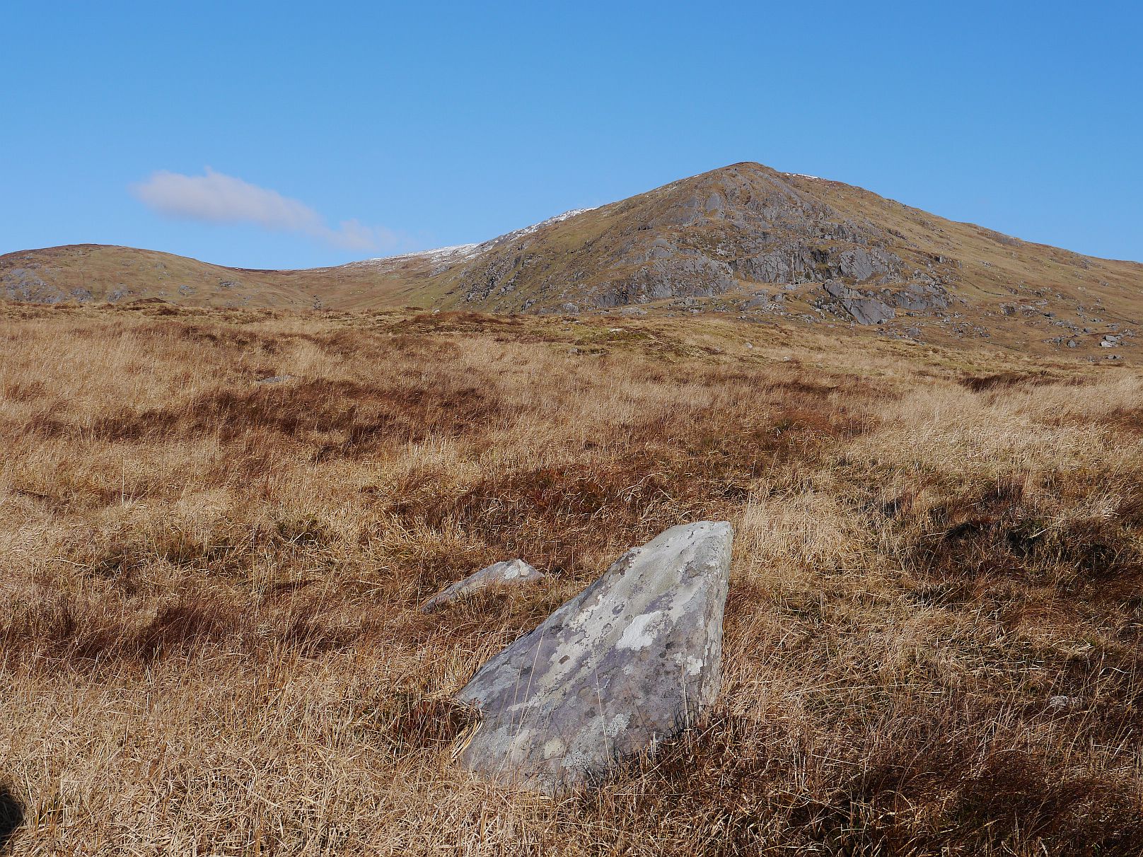
Rodeen 1
Standing Stone / Menhir
V695488
expand_more
Nearest town:
Sneem (18km NNW)
OS reference:
V695488
OS sheet:
84
Latitude:
51° 40' 35.92 N
Longitude:
9° 53' 12.74 W
Added to TMA by
Meic
Images (3)
Add
content
Images
February 2015
Image credit: Michael Mitchell
Meic
Feb 5, 2015
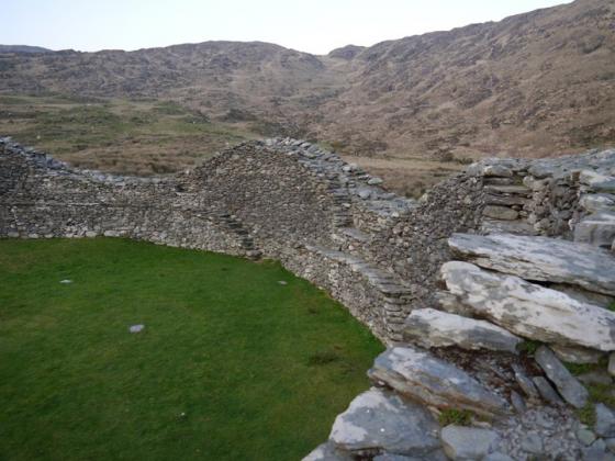
February 2015
Image credit: Michael Mitchell
Meic
Feb 5, 2015
February 2015
Image credit: Michael Mitchell
Meic
Feb 5, 2015
Sites within 20km of
Rodeen 1
Cloontreem
Wedge Tomb
•
0.14km WNW
photo
13
description
2
Rodeen 3
Standing Stone / Menhir
•
0.41km S
photo
4
Rodeen 2
Standing Stone / Menhir
•
0.63km SE
photo
5
Kilmackowen
Wedge Tomb
•
1.52km W
photo
16
description
1
Kilmackowen
Standing Stone / Menhir
•
1.65km W
photo
9
Derrymihin West
Dolmen / Quoit / Cromlech
•
2.23km S
photo
3
Derreenataggart West
Stone Circle
•
3.77km SW
photo
26
forum
2
description
5
Derreenataggart Middle
Standing Stone / Menhir
•
3.83km SW
photo
2
Ballycrovane
Standing Stone / Menhir
•
5.58km WNW
photo
16
description
2
Fanahy
Stone Row / Alignment
•
5.86km SW
photo
4
Coulagh
Standing Stone / Menhir
•
5.92km W
photo
1
Teernahillane
Standing Stone / Menhir
•
6.12km WSW
photo
4
Teernahillane
Wedge Tomb
•
6.21km WSW
photo
9
Teernahillane
Stone Row / Alignment
•
6.24km WSW
photo
3
Teernahillane
Dolmen / Quoit / Cromlech
•
6.24km WSW
photo
1
Coulagh
Stone Circle
•
6.34km W
photo
5
Ardgroom Outward
Stone Circle
•
6.6km N
photo
31
description
3
Hag of Beara
Natural Rock Feature
•
7.26km WNW
photo
5
description
4
Ardacluggin
Standing Stone / Menhir
•
7.48km WSW
photo
1
Knockoura
Stone Row / Alignment
•
7.58km SW
photo
1
description
1
Ardacluggin
Standing Stone / Menhir
•
7.58km W
photo
4
Gour
Standing Stones
•
7.88km SW
photo
9
description
1
Glashananinnaun
Stone Circle
•
8.05km NNE
photo
5
Coomgira
Standing Stone / Menhir
•
8.68km ENE
photo
6
Urhin
Standing Stone / Menhir
•
8.77km WSW
photo
5
Shronebirrane
Stone Circle
•
8.83km NE
photo
19
description
3
Kealoge
Standing Stones
•
9.94km WSW
photo
3
Kealoge
Standing Stone / Menhir
•
10.11km WSW
photo
6
Cashelkeelty NW
Stone Circle
•
10.2km NNE
photo
10
description
2
Cashelkeelty SE
Stone Circle
•
10.34km NNE
photo
12
description
1
Clogherane
Stone Row / Alignment
•
11.39km NE
photo
3
Clogherane
Standing Stone / Menhir
•
11.41km NE
photo
3
Reenkilla
Stone Circle
•
11.48km NE
photo
4
description
1
Cahermore
Standing Stone / Menhir
•
12.1km SW
photo
4
description
1
Kilcaskan
Stone Row / Alignment
•
12.74km ENE
photo
4
description
1
Cappaleigh North
Standing Stone / Menhir
•
12.76km ENE
photo
3
description
1
Drumlave
Stone Row / Alignment
•
12.84km ENE
photo
10
description
1
Kildromalive
Standing Stone / Menhir
•
13.21km ENE
photo
4
description
1
Killough West
Wedge Tomb
•
14.27km WSW
photo
8
description
1
Lehid
Wedge Tomb
•
14.33km NE
photo
2
Peakeen
Passage Grave
•
14.75km ESE
photo
6
Lehid
Standing Stone / Menhir
•
14.89km NE
photo
3
Ballynahowen
Wedge Tomb
•
15km ENE
photo
13
description
2
Lehid
Dolmen / Quoit / Cromlech
•
15.01km NE
photo
1
Drombohilly Wedge Tomb
Wedge Tomb
•
15.11km NE
photo
1
description
1
Caherurlagh
Standing Stone / Menhir
•
15.21km ESE
photo
6
Drombohilly
Stone Circle
•
15.27km NE
photo
27
forum
3
description
5
Leitrim Beg
Standing Stone / Menhir
•
15.47km ENE
photo
19
description
1
link
1
Staigue Bridge
Cup and Ring Marks / Rock Art
•
15.77km WNW
photo
10
description
2
link
1
Staigue
Standing Stone / Menhir
•
15.86km WNW
Killenough
Standing Stone / Menhir
•
16.24km ENE
photo
4
description
1
Farranamanagh
Stone Row / Alignment
•
16.6km ESE
photo
5
description
1
Staigue Cashel
Stone Fort / Dun
•
16.72km NW
photo
21
Farranamanagh
Standing Stone / Menhir
•
16.79km ESE
photo
2
Loughane More
Stone Fort / Dun
•
16.95km WSW
photo
6
Kilcrohane
Stone Row / Alignment
•
17.01km ESE
photo
9
Caherdaniel
Stone Fort / Dun
•
18.28km W
photo
3
description
1
Coomnahorna East
Standing Stones
•
18.3km WNW
Gorteanish
Stone Circle
•
18.78km E
photo
11
description
2
link
1
Darrynane More
Standing Stone / Menhir
•
18.86km W
photo
7
description
1
Uragh West
Stone Circle
•
19.2km NE
photo
9
description
3
Uragh
Stone Circle
•
19.97km NE
photo
33
description
5
search
I’m looking for…
location_on
photo
ondemand_video
forum
description
link