Drive north a short distance from Carragh an Tarbert stone and you will come to a sharp left bend in the road. If you can force yourself to look left towards the Paps of Jura you will see these in the foreground. As with so many of the sites on Gigha if you visit the island later than the start of May you will find them already covered with the annual vegetation.
Latest Posts
May 28, 2025
May 27, 2025
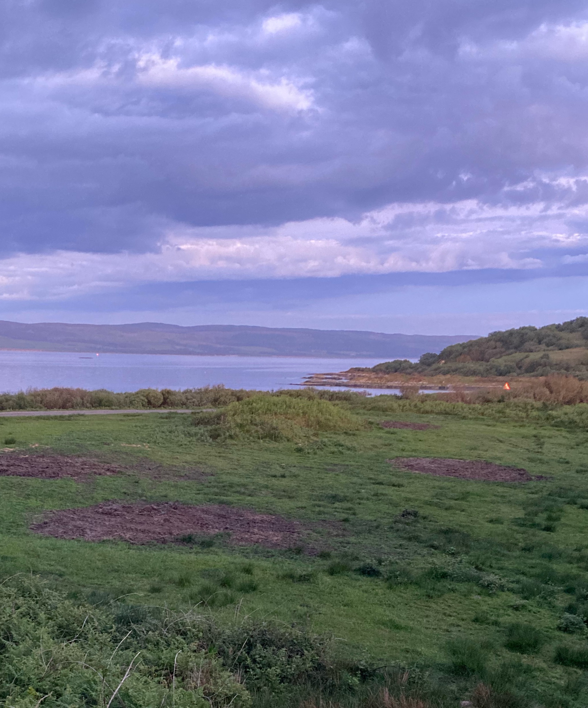
The two cairns with East Tarbert Bay beyond, and beyond that the Sound of Gigha and the Kintyre mainland. A twenty minute ferry trip from Tayinloan to another world: Colonsay in miniature.
Image credit: Mike Purslow

Not hard to spot, this… on the other side of the road from near the entrance drive to the delightful Achamore Gardens, a ‘must see’ if you visit the island. That description can hardly be applied to the dun though. According to Canmore very little remains… a low stretch of what was the north wall and a little bit on the west side. I didn’t wander over and my life doesn’t feel the poorer. Interesting stones at a mound north of it though… perhaps I’ll look next time, touch wood. Yes, this is an island to return to. The sides of the knoll on which the dun sits are thought by the most recent surveyor to have been shaped… I thought so too.


At Cultoquhey there is a small camp, in which urns and ashes have been dug up, and this, probably, was connected with the great camp at Fendoch. Tradition says that here Cmohal Cult, the father of Fingal, fought with the Romans and lost the battle.
From the Strathearn Herald, 13th May 1933. This is kind of ambiguously worded? The father of Fingal would naturally be found at an Iron Age fort like Cultoquhey. (The camp at Fendoch is Roman).
Queries. 11. Holed Stone at Claverton Down.
In the field called Bushey Norwood, on Claverton Down, is an upright stone with a hole in it. As this has been and may be again taken for a holed stone of prehistoric origin, such as the Cornish Men-an-Tol and others of like nature, it may be well to know its origin. The hole in the stone is obviously due to the limestone weathering when the stone was recumbent on its bed. I have heard two accounts of its origin, firstly that it was erected to commemorate the fatal duel between Viscount du Barri and Count de Rice, and more prosately that it commemorates a favourite horse. Can anyone give accurate information on this point? – A.T.W., Monkton Combe. (Bath Chronicle, 1st July 1933.)
Some years ago I asked a friend the history of this stone, and was told that it was a rubbing post for horses or cattle. They were tethered to it – a rope being passed through a hole in the stone, and that such stones were not uncommon. I do not know if this is correct. M.A., Bath. (Bath Chronicle, 29th July 1933)
Mr Gerald Grey writes, “I know the stone of old. There were many like it when first I knew Bushey Norwood. They were lying on the surface. The late squire, Mr Henry Duncan Skrine, had this particular stone raised upright to mark the spot where he had one or two favourite horses buried. The rest of the stones were used in the Bath Botanical Gardens and the Clifton Zoo for making rockeries. The site of the Du Barri duel was on the boundary of Claverton and Hampton Downs [...]” – A.T.W., Monkton Combe. (Bath Chronicle, 5th August 1933)
Like all such exchanges things get shirty after a bit, and on the 12th August K.E.S from Exmouth writes to say everyone’s wrong (“The response to the inquiry for exact information has been far from exact”). I would type it all out but I didn’t like his righteous tone. “There can be little doubt that these stones were connected with the religious rites of Ancient Britons, and they were probably deliberately cast down either in military attack or to end, by forcible means, the religious practices of the Priests of the Sun.”
Queries. 27 – Stones on Charmy Down.
Various references are made in local histories to “Druidical” stones in the field north-west of Charmy Down Farm. The earliest I have seen is in Tunstall’s “Rambles, 3rd ed. 1851. The most authoritative is in a reminiscence addressed to Mr. R.E.M. Peach, and incorporated by him in his “Annals of Swainswick,” 1890. From internal evidence it may have been written by a Fellow of Oriel about 1877. He says: “In the field on the north of the farm may still be seen some Druidical stones, but they were much more conspicuous in my childhood.”There is a single low weathered stone still standing at what I have been told is the site. In 1927 I met an old man who knew the Down well, and he remembered more stones and their arrangement. I think there must still be men living who can remember these stones, and I should be glad to hear how many these were and how they were arranged. For purposes of record I give the following data for the site of the existing stone: Lat. 51 deg., 25min. 12 sec. Long. 2deg. 20min. 17 1/2sec.
A.T.W., Monkton Combe.
From the Bath Chronicle of 22nd July 1933. The coordinates seem to be at the south end of the down, across from Solsbury Hill. Who knows if they were prehistoric, but it’s fun to think they might have been. There were certainly barrows up here.

From ‘Cycling’, 5th October 1895. (Tip for cyclists in the accompanying article: “Besides the ancient temple at Callanish, there is a modern inn which produced capital oatcakes and butter”.)


From the Illustrated London News, 24th September 1864.

Also called “Kilander’s Stone”. Drawing accompanying an article in the Dundee Evening Telegraph, 12th December 1900.

With trees, in an article in the Dundee Evening Telegraph, 12th December 1900. (It looks a bit pointy? But is labeled Clachan-Iobairt, Bruar. So I assume just a different viewpoint?)
Druidical Pilgrimage to Stanton Drew.
On Wednesday the brethren of the Mona Lodge, No. 10, and Royal Arch Chapter, No. 2, of Ancient Druids, paid a pilgrimage – the first, we believe, that has been paid for over thirty years – to the Druidical remains at Stanton Drew. [...] Upon an application being made to the owner of the property, P. Eaton Coates, Esq., for his permission, it was kindly and courteously conceded by that gentleman, who only attached one condition to the concession, that it should not be extended beyond Druids and their friends, and that no public announcement should be made in the newspapers. We believe that the promise was religiously kept by the brotherhood, but, as to carry out the necessary arrangements with perfect secrecy was a matter of impossibility, tidings of the contemplated ceremony got abroad in the villages, and the consequence was a very considerable gathering.
There’s a list of the procession, including various people in costumes with wands, and (curiously) a number of people bearing bibles on velvet cushions.
[...] Truth compels us to say that the procession did not appear to impress the rustic population in the way that had been probably anticipated. Their ignorance of the rites and solemnities of Druidism caused them to laugh at many of its mystic ceremonies, while they were perverse in assigning to some of the principal officers characters not at all pertinent to them. For instance, the ‘Guardian’ who wore a hairy cap of exceedingly antique mould, and a petticoat of curious plaid, and who bore a huge knotted club, was supposed by many of them to be an embodiment of Robinson Crusoe. The master of the ceremonies, with his dazzling crimson collars, cocked hat, and colossal silver badges, [was set down as] the Lord Mayor of London’s state footman.
There was a dinner afterwards in a decorated barn and also a band of blind musicians played for dancing: “the company tripped it on the light fantastic toe with a vigour that one would scarcely have expected, with the thermometer standing at 81 in the shade.” A fun day out reported in the Bristol Mercury, 26th July 1856.
Perhaps this is sheer poppycock (after all, it was published in the Silly Season in the Daily Mail, and does read rather like fiction). But it surely captures the romance of such an area. And it’d be fun to think it were a true experience. I notice it’s peculiarly geographically specific for just a story. And personally, I’d be in an altered state fit to hallucinate if I’d just hiked up a hill.
Scottish ‘wraith’ stories are perhaps a little played out, writes Mr James A. Pickop, to the editor of the London ‘Daily Mail,’ but I cannot refrain from sending you an account of my extraordinary experience during the past week in the Highlands, in the hope that some of your readers can throw some light on the matter.
During the course of a short walking tour in the Highalnds I arrived on the evening of Thursday, August 18, on the road between Ardfern and Ford, in the valley of the River Barbreck (Argyllshire). Though I wished to get to Ford by nightfall, the beauty of the sunset enticed me to mount a hill on the left of the road overlooking the grounds of --- House and commanding a splendid view of the loch (Craignish) and islands.
Just before I reached the summit I was startled to see a figure on a rock above me. I had been looking straight before me and could not imagine how I had escaped seeing the man or woman approach. On drawing nearer I saw the figure to be that of a very tall girl. She wore apparently a short skirt and a plaid or golf cape of some darkish brown or green tartan. Her long hair was blowing wildly round a face the features of which I was not near enough to remark, but which I could see to be of extraordinary whiteness. She appeared at first as though she neither heard nor saw me; the next moment she beckoned to me wildly, ran to the rock’s edge, and was gone.
I ran to the spot and looked over. There was hardly cover for a rabbit on the hillside, which sloped extremely steeply to the woods round --- House. I was so bewildered by the swiftness of her disappearance that it was some minutes before I decided that I must investigate the matter more fully. I descended the hill, calling all the time, and finally went through the wood at the foot to --- House to inquire if any of the house party had lost their way or been hurt on the hill.
On inquiry I found that --- House is at present let to an eminent London physician. Upon my inquiry he became exceedingly interested, and told me that several of his house party had been much disturbed by the sight of this same figure, a tall girl. I was introduced to a sufficiently typical and phlegmatic young Englishman, who gave me very tersely what was in all respects a replica of my own experience, except that in his case the figure had simply run a few paces downhill and then vanished into thin air. He could offer no explanation, and added that he and others in the party had heard cries which seemed to be those of pain or anger on the summit of this hill.
Another member of the party had seen the figure of a tall pale woman nearer the house, and had been much startled. There are other families of English tenants near by in lodges on the Barbreck who have seen the figure, but I have not heard their account. Many legends are connected with this valley, and the ghillies and shepherds have, I hear, many circumstantial stories of the ‘hooded maiden of Barbreck.’ Time alone forbade me from searching the valley for further evidence.
From inquiries made by the --- House party and others it is made perfectly certain that no girl in the very least answering to this description lives in the scattered community of this thinly-populated district. I may add that I have never before had any occult or psychic experience whatever.
As reprinted in the Grimsby Daily Telegraph, 27th August 1910.
At the northern extremity of the island, on the top of a hill, there is a circular heap of stones, called Carn-na-faire, or Watch Cairn, 53 feet diameter. It seems to have been a place of some strength, and intended, as the name implies, to give the alarm in case of an invasion, for it commands a very extensive view of the sea from S.W. by N. to S.E.
From volume 7 of the New Statistical Account of Scotland (1845).

Rubbing of the rock art on the cist cover (in low resolution, sorry, but you can see what it’s getting at). From ‘Further excavations of cairns at Poltalloch, Argyll’ by J. Hewat Craw. PSAS vol. 65 (1931).

“A striking feature of the monuments in the Poltalloch district is the great size of slabs used as standing stones and as the covers and side-slabs of cists. At many places in the neighbourhood can be seen outcrops of rock where such slabs could be got with little labour. One of the most striking of these is shown in fig.13 at Torbhlaren Hill near Kilmichael Glassary. By the process of denudation the slabs stand out isolated from the face of rock, merely requiring to be broken off. Others that have fallen away lie ready for carrying off, on the steep slope below.” from ‘Further excavations of cairns at Poltalloch, Argyll’ by J. Hewat Craw. PSAS vol. 65 (1931).
May 26, 2025

The N side of this badly degraded dun, top centre, seen from the minor road near Torblaren standing stone. Note the three equally spaced stones lying below and to the left which I think require investigation.
Image credit: Mike Purslow


Looking S towards the dun at R, top
Image credit: Mike Purslow


