Latest Posts

All posts 3,701-3,725 of 163,020 posts

May 30, 2025

Image of Port Sgibinis Raised Beach (Natural Rock Feature) by spencer

Port Sgibinis Raised Beach

Natural Rock Feature

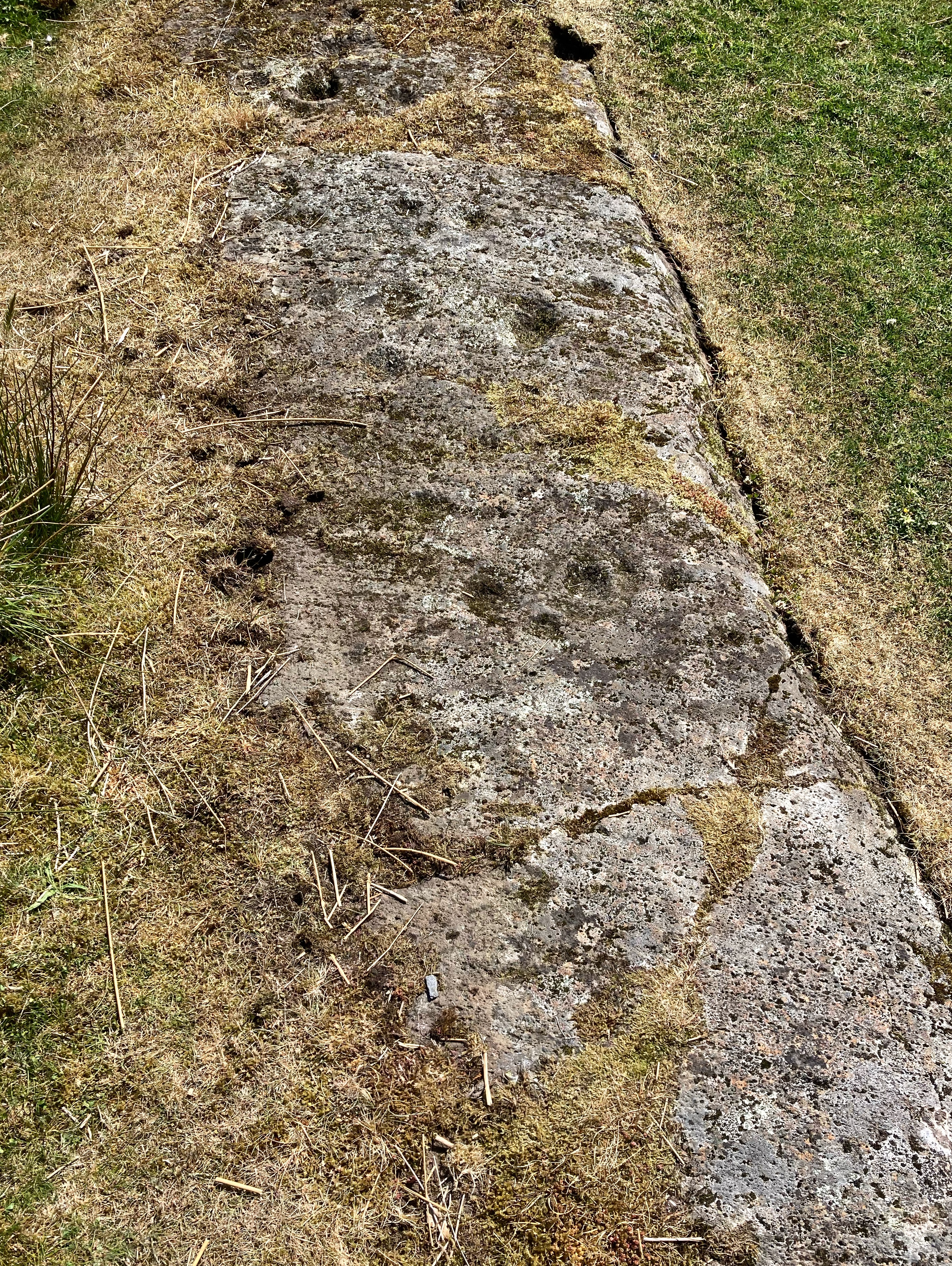
The highest, tenth, level of the raised beaches here, 130’ above present sea level. Kiloran Bay beyond, and beyond that Uragaig raised beach. Dun Tealtaigh sits to its right.. and, further to the right, the undercut cliff and raised hillock which give Dun Uragaig its shelter from the north winds.. I found it calm there, even on a blowy day.

Image credit: Mike Purslow
Image of Dun Tealtaig (Promontory Fort) by spencer

Dun Tealtaig

Promontory Fort

The embarkation point is on the east side.. the Ross of Mull and Isles, an easy sail, on the horizon.
The calls of two corncrakes will have to be visualised. As will the midgies.

Image credit: Mike Purslow

Achaleven

A glorious day, filling in time waiting for the Colonsay ferry departure from Oban, with the great Dun Chathach already under our belts. I was only using an old OS49 map and hadn’t referred to Canmore so it wasn’t initially easy to spot.. but once you do you can’t miss it. Just look for the only tree in the field to your left when you take the Achaleven road. It is atop it. In May this wild apple(?) was a delight. A fine sight. And a damn sight more easy to find than all those cairns and sites around North Connel which defeated me, being behind housing. A better map needed for those…

Image of Achaleven (Cairn(s)) by spencer

Achaleven

Cairn(s)

The first view of the cairn that you will see, in the distance to your left after taking the Achaleven road from the A82 and driving under the railway bridge. W side.

Image credit: Mike Purslow

May 29, 2025

Folklore

Dunadd Stone
Standing Stone / Menhir

An ancient standing stone of a slab form, about 12 or 13 feet high, 4 broad and about 10 inches in thickness. The Country tradition is, that it is a momento over the ashes of some ancient hero.

If you read that in 21st century English you get the impression the writer wasn’t that interested, complete with shrug. But perhaps it’s literally what the country people told him, in which case fair enough. Recorded in the Argyll Ordance Survey Name Books (1868-78).

Folklore

Maun’s Stone
Cup Marked Stone

Maun’s Stone.
Applies to a large stone of a roundish shape, built on an old fence, forming a side of the public road leading from New Deer to Brucklay Castle. Tradition asserts that it has been the putting stone of a Giant in ancient times. There are several holes in the stone, said to be the finger marks of the Giant.

From the Aberdeenshire Ordnance Survey Name Book, vol. 65 (1865-71). A map of the time shows it here, though Scotland’s Rock Art Project visited in 2018 (according to the details on Canmore) and only found a hawthorn hedge and some barbed wire. One can only hope that it’s still in the bank somewhere? Perhaps the finger marks are cup marks.

Folklore

Wormy Hillock
Henge

Wormy Hillock.
This is an exiguous or small mound, situated at the Southern base of the Hill of Finglenny, and overlooking the Ellachie Burn. Tradition hath it that a Hydra, which sprung, not from the Swamps of Lund as some people think, but from the flats of Morayshire, and among other notable exploids bit its way through Balloch Hill, and thus opened up the passage of “Glacks of Balloch,” from Mortlach to Cabrach.

From what Hercules it received its death wound, or by what destiny this monster met its fate, on the Ellachie Burn, tradition saith not, but merely that here the monster’s course was arrested. A worm of the same genus named the Python, perished by Apollo’s shafts.

I don’t know how he knew it was in the same genus but it was an opportunity to show off a bit of classical education I suppose. Anyway, then there’s some notes in a different hand (James McDonald), and you can’t say he didn’t look into it properly, having ‘dug all over the place’. But it’s interesting if the henge was indeed an adaptation of an naturally existing landscape feature.

“Note: I examined this hillock and believe it is simply a “round” for the protection of a few sheep during snow storms. It has been originally a naturally formed Knoll and a deep trench has been dug out round the base, the material being used to form the circular dyke. On digging here and there over the centre mound there was no evidence of the ground ever having been disturbed. It is no doubt possible that an urn containing bones was deposited here but I dug pits all over the place and found nothing but a natural layer of gravel. A fort it never could have been. An enemy might have climbed the hill beside it and pelted the ‘garrison’ with stones until they were glad to flee for their lives. I would leave the name Wormy Hillock and cut out tumulus. I believe in the Dragon story but not about the Danes!”

(The ‘tumulus’ actually seems to refer to somewhere else nearby, maybe the cairn near Rhynie).

From the Aberdeenshire Ordnance Survey Name Books (1865-1), volume 78.

Folklore

Auchmachar
Stone Circle

Mr Hunter says there is an old story about [the Bridge of Tillypestle] being the scene of a fight between two giants. Mr Hunter says they killed each other and were buried on two hills close by, one on Knapperty Hill, and the other on Cairndale hill, and he says that two cairns were erected to commemorate the affair. The cairn on Knapperty Hill is still to be seen but Cairndale Hill can boast of but slight traces of the cairn that stood on it.

From the Aberdeenshire Ordnance Survey Name Books (1865-71).

Tillypestle Bridge is about half way between Knapperty Hill (the site of Auchmachar cairn and circle) and Cairndale hill. The large cairn on Cairndale Hill “was removed by the farmer at Coilsmore, for the purpose of building dykes on this farm.”

Colmeallie

I drove my car right up to the The Bothy and parked beside plenty of other cars. In the distance I could hear shooting so it was reasonable to assume another ‘pheasant shoot’ was finishing.

The gathering clouds I’d spied in the North East on the Hill of Edzell had ventured south to add the perfect covering of snow at the stone circle. It must have been thirty years since my last visit, another winter’s day, it was good to be back – almost nothing had changed including the snow.

No going over the Cairn O’ Mount for me on the way home, the snow gates had been closed.

Visited 04/01/2025.

Carn Liath, Trantlemore

Trantlemore is an isolated crofting township in the far N of the Scottish mainland. It is accessed via the A897 running 40 miles from Helmsdale to Melvich. The A897 is a single track road with passing places. It is a scenic route up to the N coast of Scotland with 16 Brochs included in the 32 sites on or near the A897 listed in TMA. That is 0.8 sites per mile!


Directions to Carn Liath (Trantlemore): Take the A897 Melvich turn off the A9 in Helmsdale. Follow Dunrobin St for c. 0.2 mile to a roundabout. Take a right turn onto the A897 Melvich. Follow this narrow road for 31.6 miles to a sharp cut-back left turn signed for Trantlemore. Follow the narrow lane for c. 0.1 miles to a car park beside Trantlemore Cemetery. Walk c. 100 yards W then turn right up a grassy bank to a gateway into rough pasture. Carn Liath (Trantlemore) is c. 50 yards NW of the gateway. My walking route is viewable on Carn Liath (Trantlemore).

Hill of Edzell 2, 3, 4 & 5

NO 57808 70052 – Edzell 5

This cairn is south west of the trig and slightly downhill. At one time this must have been impressive, sadly like most of the sites on the hill it has taken some severe punishment, it has been houked and field clearance dumped on top. Like the cairns nearer Laurencekirk the majority of stones appear to be pebbles. Still, it survives at almost 7m wide and is 0.3m high.

NO57863 69957 – Edzell 4

Continuing south west to the next cairn. Weirdly the next three cairns all appear to very similar in size being over 8m and 0.3m high. More pebbles are mixed in with the cairn material which also has seen field clearance dropped on top.

NO57575 69845 – Edzell 3

Similar in size to its near neighbour, Edzell 4, it is 8m wide 0.3m high. It might have been larger going by the size of the footprint. Canmore says irregular shape, perhaps for a square, it looks reasonably circular to me and seems to have less field clearance thrown on top. Stunning views north, to the north east many miles away cloud was building up.

NO57520 67696 – Edzell 2

Several kerbs remain in place, at the this the furthest south west of the cairns. I normally have a go at people who put fences through the middle of sites, here they deserve some applause as the fence is at least a couple of metres away from the west side – so fair play. These ancient people must have only had a tape measure that went to 8m, as yet again the site is that width and is 0.3m, as usual, high. Look closely and small ditch marks the east edge.

There appears to nothing be ‘that special’ about any of these sites but given the location and the fact that there are quite a few sites on the ridge that has superb all round views perhaps it was a significant place.

On my way down I headed back up to the trig then followed a track on the east side of a Christmas Tree wood that would head, south, back to the road near Edzell Castle. I’d also hoped to have a look at the ground north of the castle to see if there were any hints or remains of a fort. A good idea – except the people with red flags and their pals with guns were shooting at birds in the area.

Back to the car, time to go visit an old friend.

Visited 04/01/2025.

Folklore

Achnacree
Chambered Tomb

This magical sounding spot is on the slopes of Beinn Lora above the cairn, less than half a mile away. So I thought you might like to hear about it. On the 1870s map it seems to be at NM 91892 37029.

It’s recorded in the Ordnance Survey Name Books for Argyll, collected 1868-78 (you can see the nice handwritten entry online at Scotlands Places.)

There’s Tobar Bial na Buaidh, the well of the virtuous water: “a small spring on the hill side to the north of Achnacreemore. It was much frequented in old times, even in the memory of some yet living, on account of the supposed virtues of its waters in curing disease.”

And Craobh Bial na Buaidh, the tree of the virtuous water: “a tree which stands near the above well. In the trunk of this tree there is a large hollow into which it was considered necessary for any person either drinking or taking away any of the water of the well to deposit something lest they should incur the displeasure of the spirit who was supposed to keep watch over it (the well).”

Image of Ballymeanoch Henge by spencer

Ballymeanoch Henge

Henge

The central cist, part of the northern arc of stones beyond, and, in the distance (not that diminutive – phone cameras, eh?) the four and two stone rows.

Image credit: Mike Purslow