
Mr Cole’s thoughts and writings including a picture on page 65.
Latest Links
May 2, 2009
A good source for sites in Norway. Norwegian text only.

PDF file containing plan diagrams and textual info from digs. M Avery, 1982?
April 30, 2009

The ‘unadorned’ side of this with location (site also shown supermposed on O.S.)
April 29, 2009
April 28, 2009
More interesting stuff from Tim! He has plenty to deal with in this area!!
All the information needed. I’m glad to say that the field clearance has been removed the centre of the circle!

Paul Nash painted the site more than once. This link is to a watercolour held by the Tate. There’s also an oil painting on this link which could be the one owned by the Whitworth Art Gallery in Manchester.
April 27, 2009
More details about Auchmachar which is also known as the “Clump”.
The most recent photos I’ve seen complete with the fence. Good to hear that the locals stood firm against ASDA!
April 26, 2009
Gough (in ‘Britannia’, above) describes the horse as 100 feet long and 100 feet from eartip to toe – but this is nothing like he drew it (see the link for the strangely distorted animal) – you can tell that he drew it from above the horse because its body is much bigger than its legs... I think we can conclude that it’s bloody difficult to draw an upside down horse whilst allowing for massive foreshortening. I’m even inclined to think this could also account for the wavy tail and that it’s facing the opposite way to today’s reality. The HFH charitably suggests that a printer error might have reversed the image.
(I’ve seen quite a few versions of this Gough drawing – I’d like to know which is the Real One!)
April 24, 2009
A couple of years back a cursus was discovered and partially excavated very close by. You’d have been able to see it from up here on the hill. This webpage seems a bit confused and calls it an oval shape, but I’m sure that can’t be right? Apparently it runs for at least 750m (east from the sewage works!) pretty impressive.
It does make you wonder whether the cursus was positioned in relation to the Ivel river, and also this hill (this part of Bedfordshire otherwise being quite flat).
I wonder if all traces of it would have gone by the time the forts were built?
April 22, 2009

Photo of the site by Olaf Tausch.
April 21, 2009


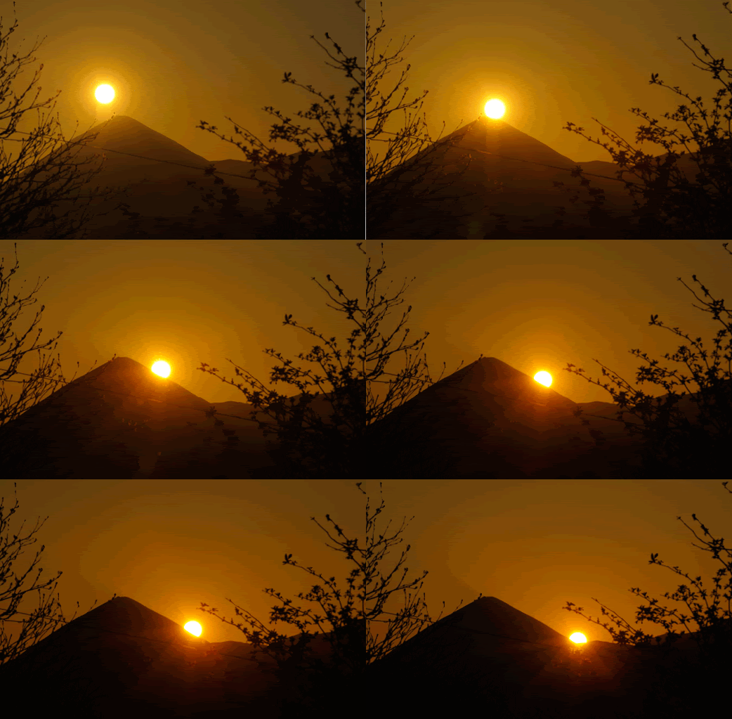
Animated GIF of the ‘Rolling Sun’ on 18th April 2009
April 19, 2009
Describes the crags on the west side of the hill.
Some photos.
April 17, 2009


Posted by Neil Rigiani
Length of route: 13 km (8 mi)
Suitable for: Walking
“A circular walk that starts at Amesbury and includes a fantastic view of Stonehenge as you reach the brow of a hill. Almost no roads involved. ”
Haven’t walked this, but it looks straight forward enough. You could even visit the Friar Tuck too.
April 16, 2009
April 15, 2009
Web site on Alexander Thom’s Megalithic yard with detailed plans of Woodhenge.
Digital reconstructions and fly throughs of Woodhenge
April 14, 2009
Details of this site at Keys to the Past