Showing 1-50 of 506 posts. Most recent first | Next 50  
|

|
   
|
  
|

|

|
      
|
Note
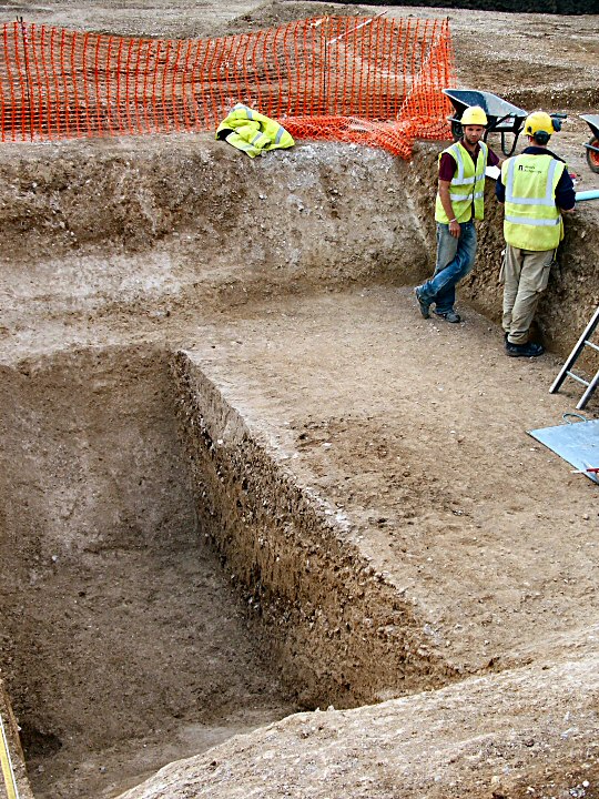
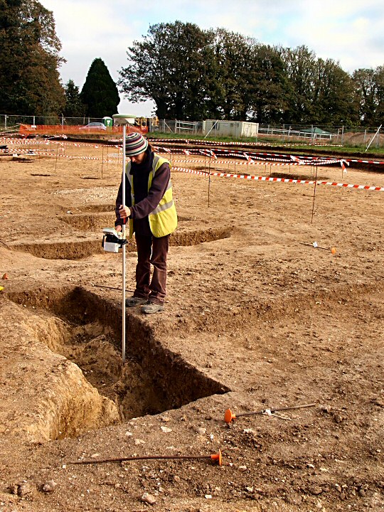
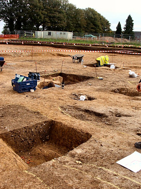
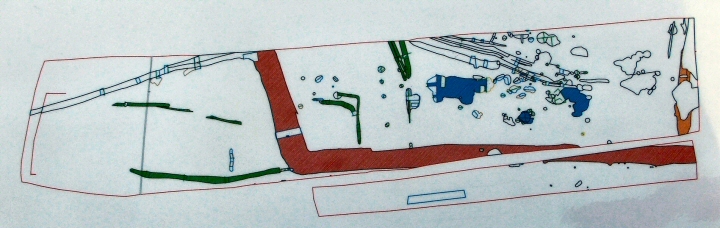
"This is one of the most confusing digs I have seen. Wessex Archaeology is still evaluating the meaning of the various excavations and finds, therefore any comments I make are entirely provisional! More of the site to the east will be excavated within the next year or two. With thanks to the WA guides."
(See plan for current details)
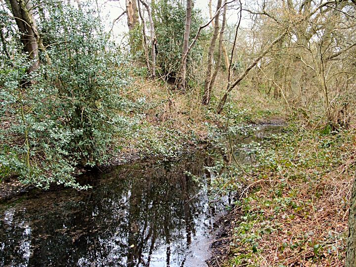
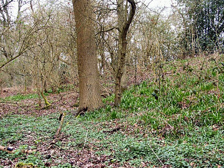
The site is on the cusp of the TMA remit being late IA early Romano/British. Neolithic artifacts have been found but so far no trace of any houses etc.
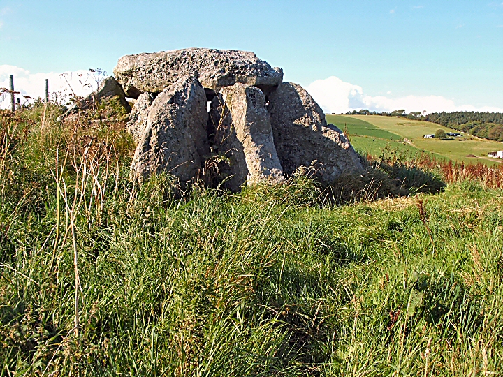
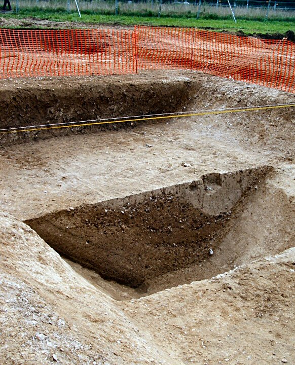
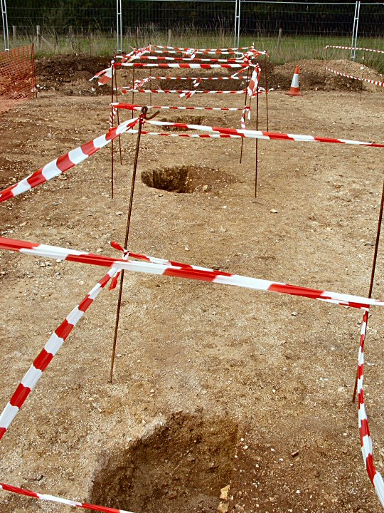
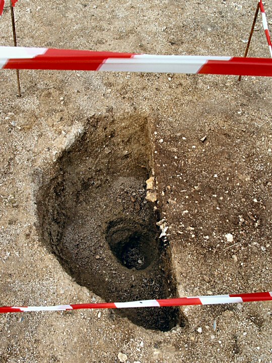
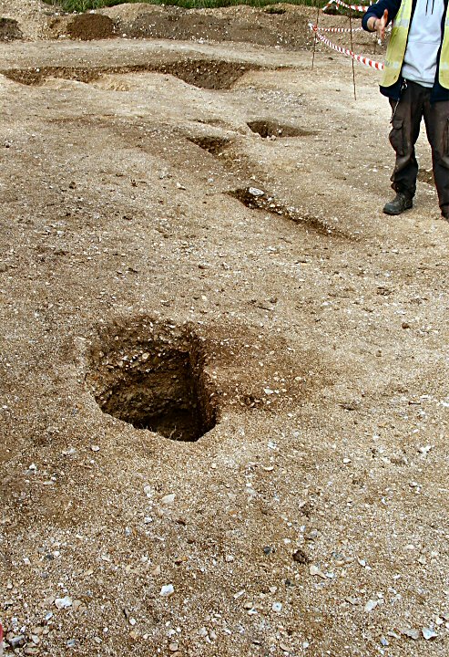
A large ditch and bank were constructed in a (assumed) square or rectangular shape and several parallel drainage (?) ditches led to the lowest part of the site. Another, smaller, ditch was constructed with an "entrance" to the W. Outside this 5 or 6 postholes have been found. They don't seem to suggest a building, might they have been "totemic" in function?
The most obvious features of the site are the numerous "quarry pits". There seems, at present, no obvious explanation for them. What were the inhabitants digging for? Clay, flints, gravel or sand are possibilities as they appear to follow "seams" and were backfilled as soon as they were exhausted as there is no sign of weathering. Geofiz seems to be of little use as the underlying geology brings up too many anomalies.
Some cremation deposits have been found within the perimeter of the site which suggests native customs as the Romans usually had separate cemeteries outside.
The area seems to have abandoned for a considerable time (100years?) but re-occupied in later Roman times.
The former MOD buildings to the E (hence the site name) are being removed and excavations will re-commence when the site is cleared, these may discover the main settlement.
The whole site is to be developed as a housing estate, Avon Fields.
Access
Guided tour only. Consult Wessex Archaeology for details.
|

|
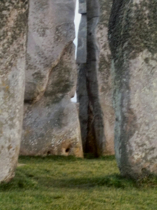
Archaeoastronomy at Stonehenge
An informative PDF explaining the various movements of the sun and moon as seen from the circle.
|
   
|
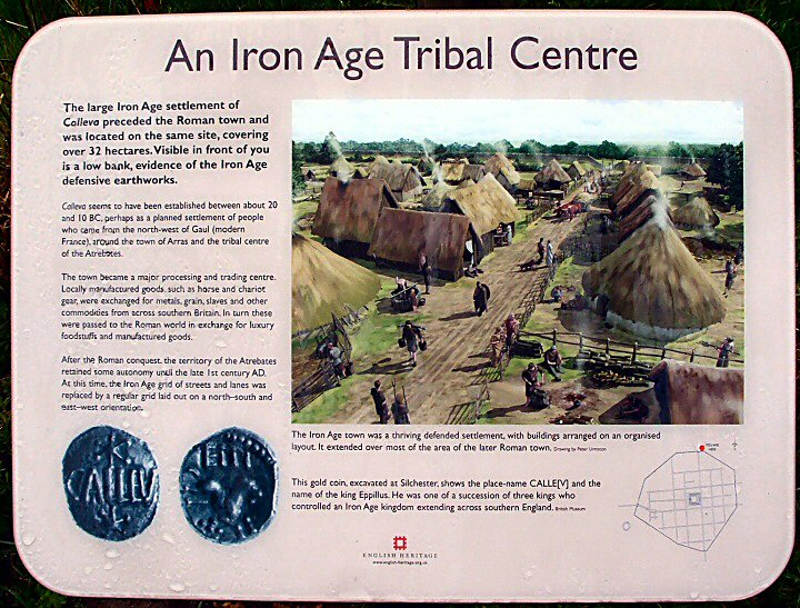
With the risk of criticism from some quarters, I think that this site should be included as its early history certainly falls within the TMA remit.
The late IA town's defensive earthworks covered almost as much area as the later (and more famous) Roman town. They are best seen on the N side by the car park where the ditch and bank are well preserved.
http://www.silchester.rdg.ac.uk/guide/preroman
The Atrebates who lived here were a sophisticated lot who traded extensively with the Roman Empire and their "Kings" minted coins to claim their authority.
Passing over the later period, which of course is of more interest to Romanophiles, we come to the problem of why it was abandoned.
It had great trade and road links, a fertile hinterland which was well watered and a presumably stable and integrated population. Why didn't it become another Winchester?
The later pages of the University of Reading's website addresses these problems.
http://www.silchester.rdg.ac.uk/guide/end
Access
For such a famous site the access and information is rather poor.Go slowly down the narrow roads as the signs suddenly spring up and the car park on the N is very easy to miss. There are pamphlets available there.
|
           
|
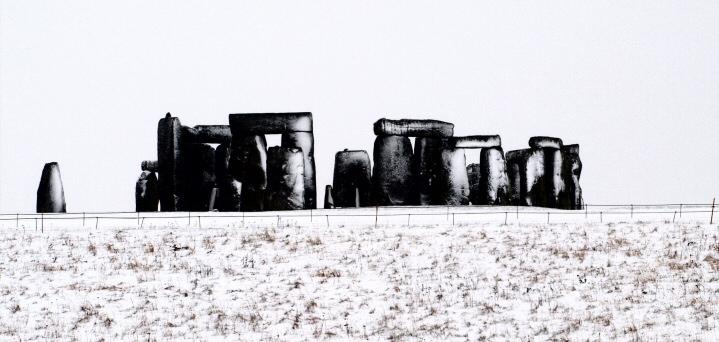
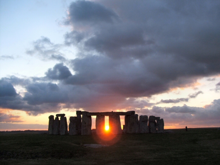
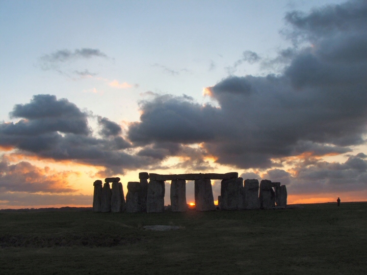
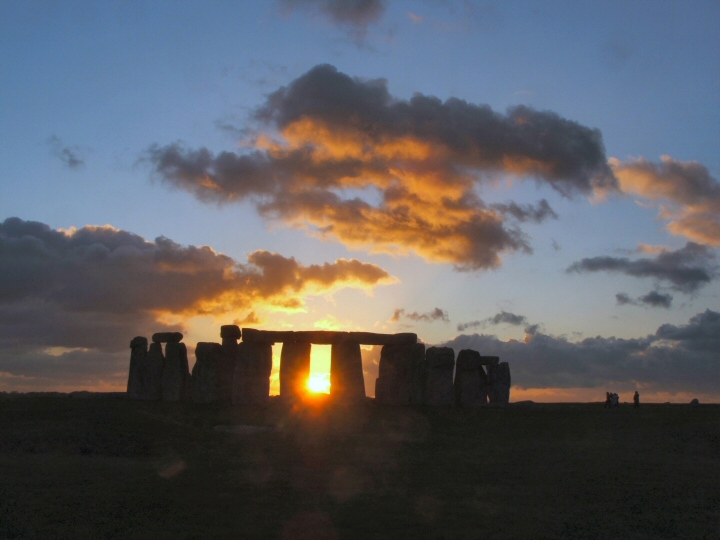
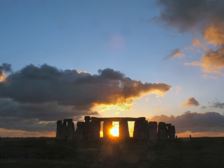
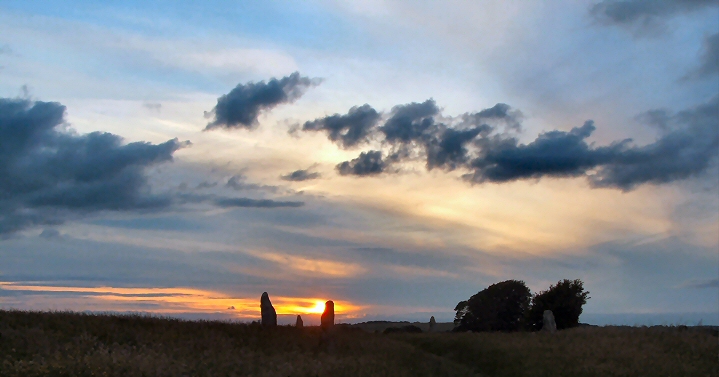
I looked carefully at the weather forecast and decided that it might be a reasonable sunset at the (near) solstice.
There was a marquee in the car park with an exhibition about astromony with telescopes looking at the sunspots. Sheltering from the bitter Arctic wind, I got into a long and very interesting conversation with an archeaoastronomer (Simon Banton) about various alignments in the area.
(He reckons that when the new visitor centre is built with its twin "pavilons" the sun will appear to rise between them at some date in the year! A new legend in the making?)
Paid my entrance fee and joined about 15 other people by the Heel Stone. The sunset didn't disappoint. Dramatic clouds with the sun appearing and disappearing every few minutes, a wonderful half hour. I hope my "duplicate" photos don't offend but the ambiance changed so quickly.
While chatting to the people there I found out that there were to be talks given by three experts within the circle after the general public had left. They might have a couple of spare spaces! Blagged my way in after a warming hot chocolate and mince pie!
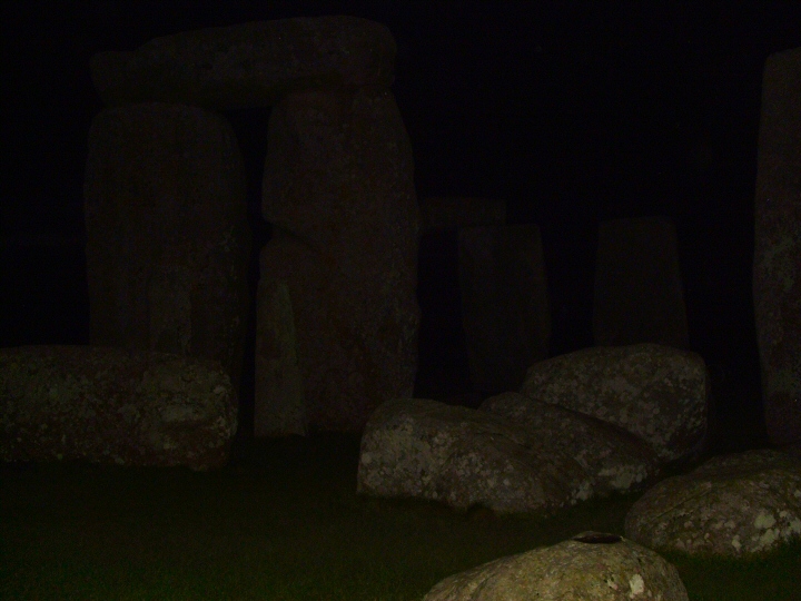
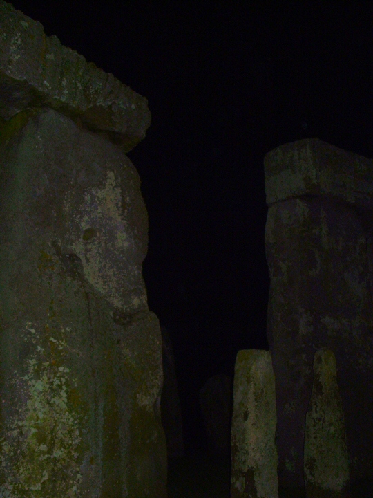
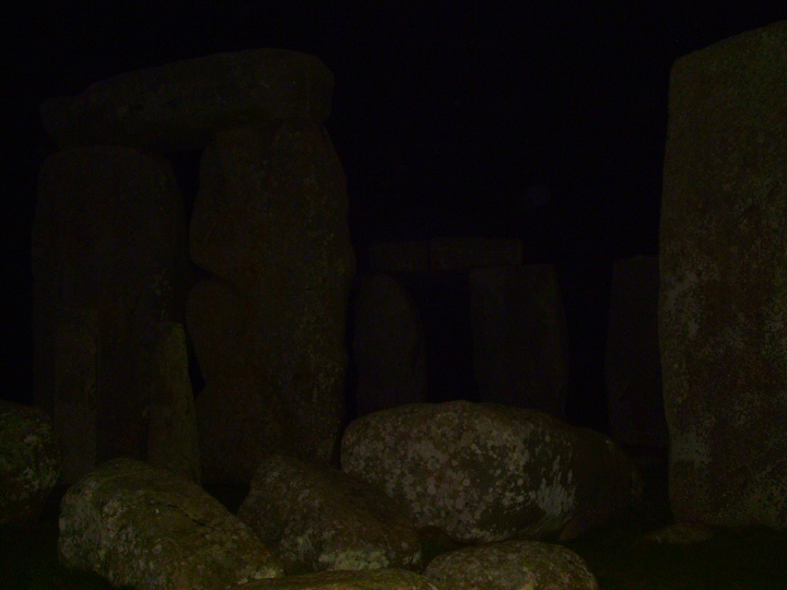
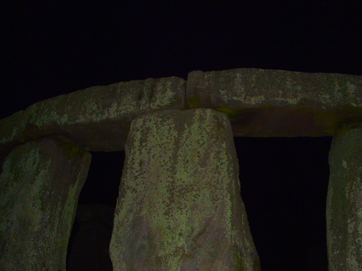
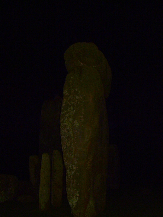
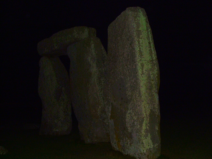
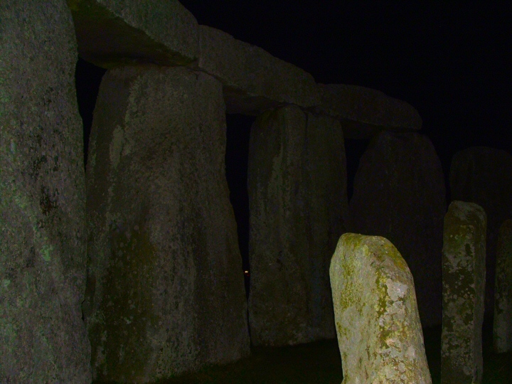
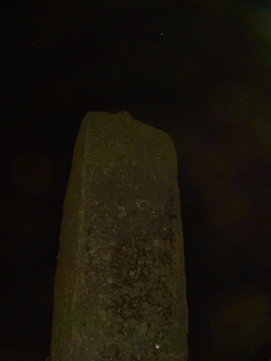
Listened to a short talk by a chap from the Armagh Observatory(?) about Comets and the Zodaical Light and then went into the circle. I missed out on the other two lectures as I was fascinated by the way the stones took on a strange and mysterious presence in the pitch dark. The pictures I've added to the "Artistic/Interpretive section might give a flavour of the feeling.
By this time the extreme cold was beginning to get to me and I made a strategic retreat to a warm car.
A memorable experience.
Jim.
|
        
|
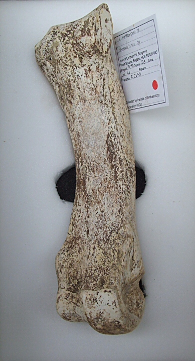
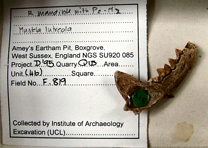
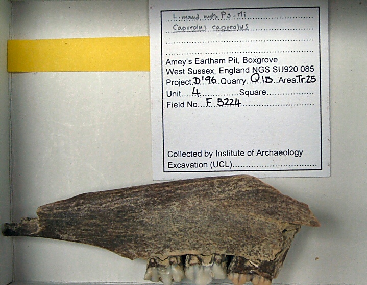
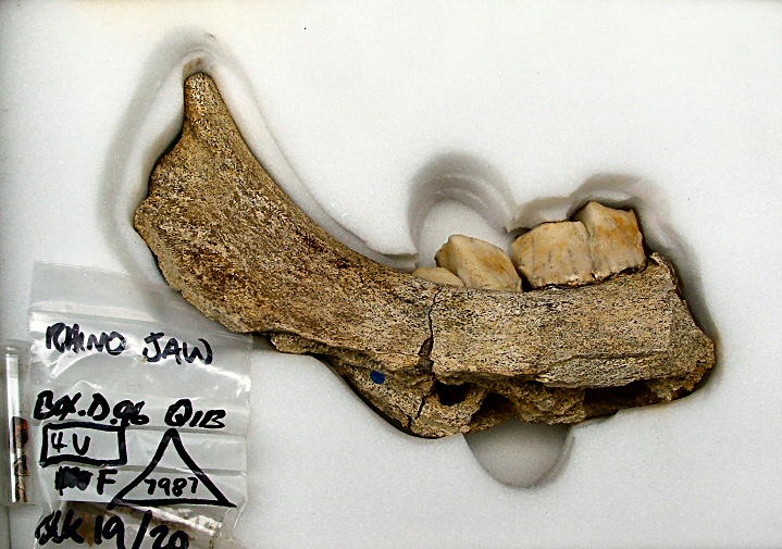
Boxgrove is almost certainly the oldest site to be added to TMA.
About 480,000 years ago, groups of homonids were here slaughtering and butchering some of the large game which came to a small lake fed by springs at the foot of a cliff. The fresh water lured prey and hunter alike.
The climate of southern Britain at this time was similar to the present but the topography was vastly different. A very wide land bridge existed between the proto-North Sea and the proto-western English Channel. Most of the present flora and fauna was present but many large herbivores/carnivores crossed the bridge and included rhino, bears, huge extinct lions, hyenas and wolves. The countryside was more open than thought a few years ago and appeared more like a cool savannah due to the heavy grazing.
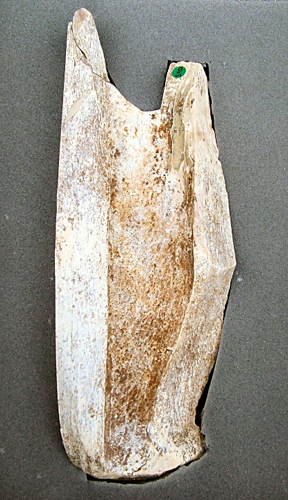
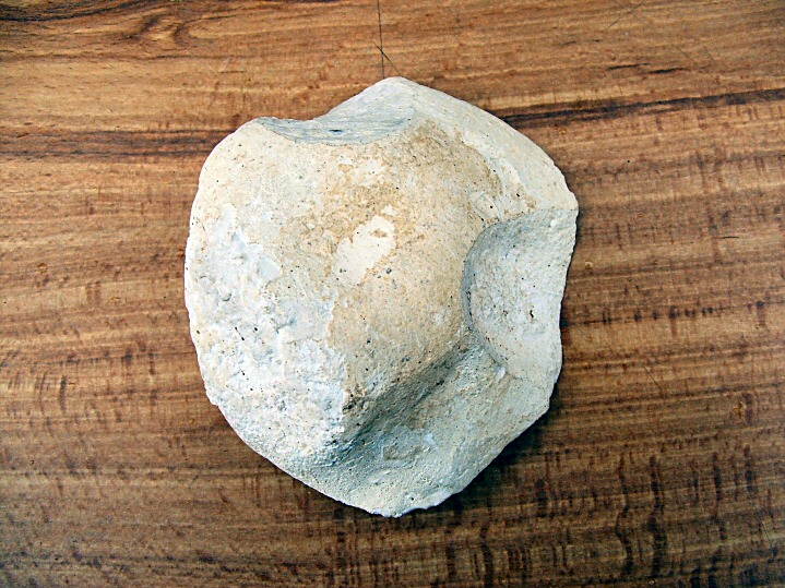
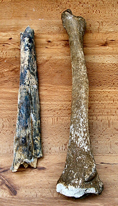
Boxgrove Man, of whom a tibia and two teeth have been found, was a sturdy, athletic and tall (6ft) individual. He was not a modern human but of a species called Homo heidelbergensis, who were descendants of Homo ergaster who had left Africa about a million years previously.
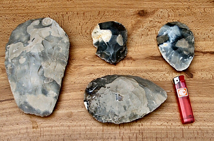
Prey animals seem to have been killed with wooden spears and butchered on the spot and eaten raw, no evidence for fires has been found. Large bones were split for their marrow.
The cutting tools seem to have been made quickly on the spot and then discarded. Too heavy to carry by nomadic hunter gatherers?
Various groups must have returned again and again as about 450 hand axes/knives have been found.
Boxgrove Man might have come to a sticky end as his tibia was found to have been chewed at each end by (possibly) a wolf. Whether he was predated or scavenged after death, who can tell?
It all came to an end with the onset of the Anglian Glaciation when severe tundra conditions prevailed. Meltwater outwash created new valleys and also covered and preserved this site.
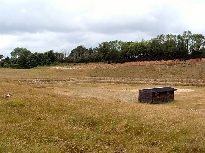
As with most excavated sites there is almost nothing to see above ground.
Thanks are due to WARG, the local Winchester society for archaeology and history, for finding me a slot in the very limited numbers allowed to be present.
Very especial thanks go to Mark Roberts who, as the project director for the UCL excavations here and elsewhere, was an astounding guide to the geology/history of this remote period. He also provided the genuine finds from the site (apart from the tibia) for us to handle and marvel at.
The pictures have a few more detailed notes
The English Heritage/UCL website is here for more info on the excavations...... http://matt.pope.users.btopenworld.com/boxgrove/boxhome.htm
Access
No public admittance. Old quarry is being infilled and regraded. Private land.
|

|
Showing 1-50 of 506 posts. Most recent first | Next 50
The pic should be interpreted correctly!!! It's a game played in our local to show how experienced cavers, myself included, can crawl through tight spaces. As the pub has a distinct lack of thick limestone in it, bar stools have to do. Honest.....
TMA re-kindled my interest in ancient history when I got my first PC and went on line early in 2002.
Other interests; architecture, natural history ( I'm a Landscape Gardener), parachuting (I used to be an instructor), and chatting in pubs.
|
| |