Showing 1-50 of 388 posts. Most recent first | Next 50  
|

|
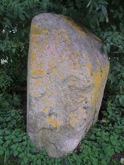
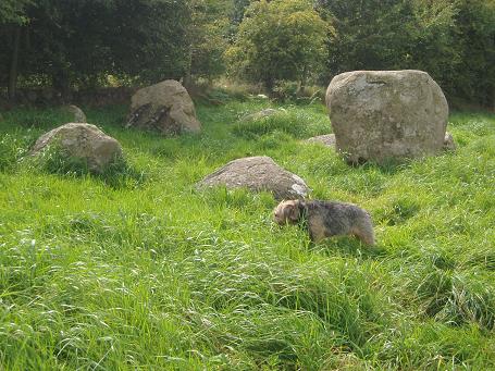
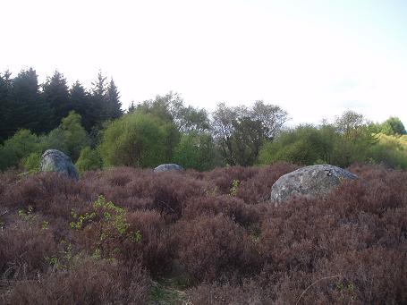
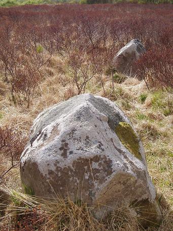
Jan 2012. Since I last visited this site, it has become quite overgrown and the 3rd stone was almost impossible to see beneath the brambles. A shame, because it makes it difficult to get a real sense of the site and impossible to photgraph!
Hopefully they will be cleared again soon and the site will open itself up to us, as it really is quite beautiful when you can see all 3 stones exposed.
Lots of other interesting stones lying around - makes you wonder why they stopped at 3 and didn't shift some more into position.......
|
 
|
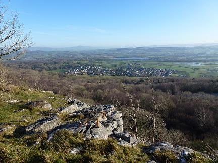
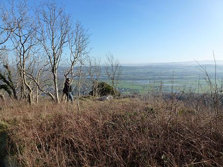
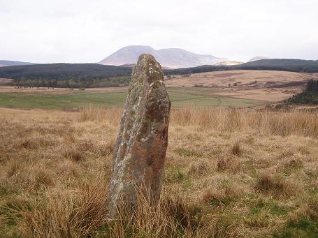
Visited January 2012. It is very hard to get a real feel for this site due to the tree cover but it is very, very flat at the top and there are stones littered everywhere. I have enver visited in summer but assume it is even harder to make any real sense of the remains. What is astonishing though are the views from here - across to Ingleborough in the east and Morecambe Bay & the Lakeland hills to the west.
There are a number of routes to the top, but the easiest and most interesting is through Strickland Woods (as described below by Hob). Definitely worth a walk up here on a clear, sunny day.
|
  
|
 
|
 
|
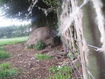
Our last site of the day was to be Holme Head; one I knew could be difficult to access due to the railway line being in the way! What I can't even begin to explain is this; how have Vicky and I, who have spent the last 25 years whizzing up and down this line to each other's houses, managed to miss these huge, hunk of stone, sitting right by the side of the line? We must have both passed it hundreds of times!! Anyhoo, we tried to get a decent picture of it from the "wrong side of the tracks" and then we attempted to get to it through the filed on the other side – this would be quite easy if a) there wasn't barbed wire on the gate and b) it hadn't been full of cows who seemed very curious. This is not usually an issue for me but I had a train to catch and didn't really have the time to dodge playful bullocks and barbed wire. This is now firmly on my list for "next time".This post appears as part of the blog post " Prehistory & Pies in Penrith" |
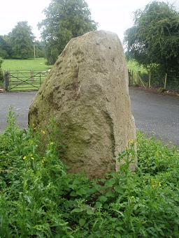
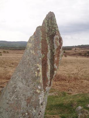
This really whetted our appetite for more, so we set off to the next site – the standing stone at Sewborwans. There is a handy wee layby right by the fence into the field, so we pulled in and hopped over the gate. As we approached this lovely, big stone - again, sturdy & squat just like the other 2 we had seen today, and sitting on a raised piece of land – we noticed 2 smaller stones in the hedgerow. These weren't the scattered, fallen stones Fitz had mentioned but were still upright. Our minds went into overload at this point, with Vicky convinced that they were just missing the recumbent stone lying between them and me wondering if they had been some kind of entrance stones? One of the things I love most about prehistory is that, a lot of the time, we just don't know the answers so you are able to make things up, argue with yourself, talk yourself out of said theory and then change your mind again and decide you were right all along! This stone reminded me of the Googleby Stone at Shap but that may have been the setting and the fact that it was standing in bright sunlight, with a dazzling blue sky – the exact same conditions when I first saw the Googleby Stone? The strewn large stones in the bank behind are interesting and Vicky decided that this had once been a magnificent circle of stone, standing on the plateau, linked to the henges at Eamont by large processional stones; it certainly has some credibility, with the references to stone avenues in the area. It is also of note that there are 3 cairns within spitting distance of this site at Mossthorns and this site would be visible from there. We had a quick peek at these from the roadside but didn't attempt to get to them, as our heads were already overflowing with stones and the fields were rather inaccessible. Another time.This post appears as part of the blog post " Prehistory & Pies in Penrith" |
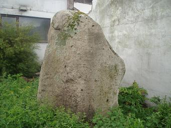
Heading back towards Penrith, we soon found ourselves pulling into a weird little industrial site just off the A66. We followed Fitz's instructions, and right enough, there was our 2nd upright stone of the day! What a strange situation and how lucky that the stone survived the industrial units being built all around it. Similar in size and shape to the one at Winderwath and no longer sitting amongst some bushes, this has the air of abandonment about it – only nettles and thistles were in the way today. As we were poking around, the local farmer came over and stared chatting; he said there had been a 2nd stone close by that had been cleared some time ago and mentioned that the original roadway had run from Eamont Bridge (where Mayburgh & Arthur's henges are) following the watercourse and came out here. This started lots of ideas whizzing round our heads, wondering if this roadway had followed an ancient route, marked by these lovely big monoliths??? Vicky and I love theorising about such things and often convince ourselves of stuff that we have no evidence of – and here we were again – we got out the map and starting trying to find an obvious route, linking various sites in the area. Oh, what fun we can have with a little knowledge and such fertile imaginations!This post appears as part of the blog post " Prehistory & Pies in Penrith" |
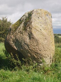
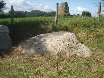
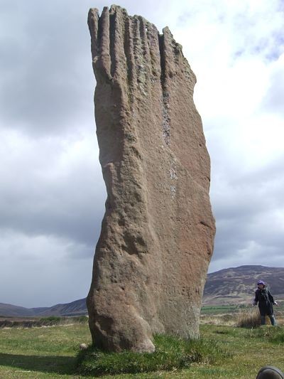
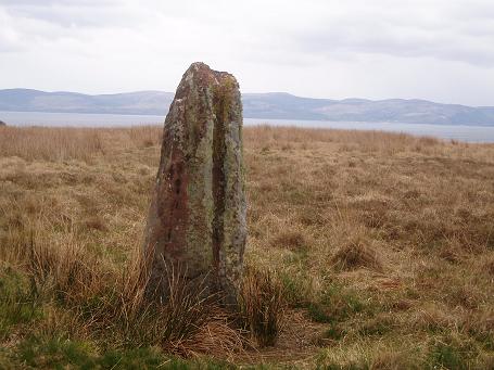
Our first stop was east of Penrith at Winderwath, to check out the 2 stones on the road to Winderwath Gardens. The first stone is unmissable, lying on the roadside and what a fine piece of stone it is. Sturdy and magnificent, it sits proudly on the side of the road, emerging from the hedge as you approach. However, had Fitz not mentioned the 2nd stone lying in the field behind we would never have realised it was there, so thick was the hedgerow! We tried and tried to find a place to peek through and see it clearly but in the end I had to crawl through some nettles and brambles, poke my camera through the fence, point it in the general direction and just hope something came out! Luckily it did, but we couldn't see enough of this 2nd stone to tell how similar (or otherwise) it may have been to the one still standing. However, the weather had cleared, the sun was shining and we were starting to get stone-fever, so we continued on to the next site.This post appears as part of the blog post " Prehistory & Pies in Penrith" |

|
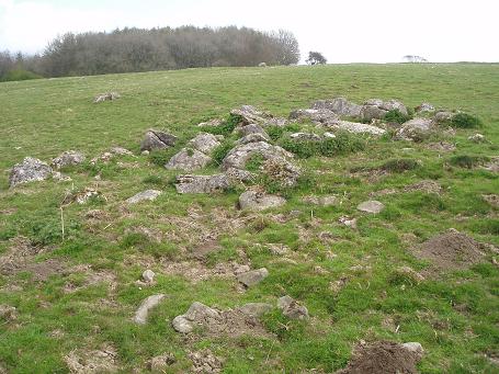
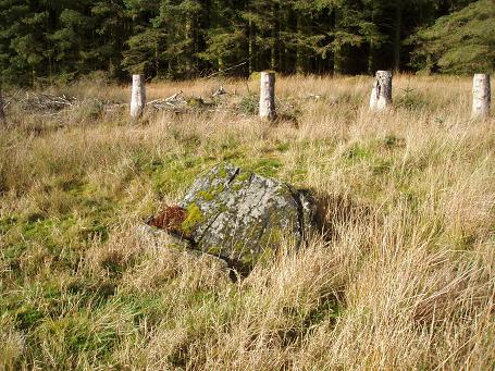
I visited this site as part of a Field Surveying course I was taking at Lancaster University.
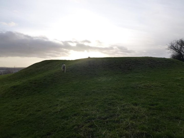
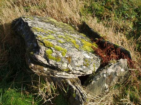
We carried out a very brief survey of the site, which consists of a large elliptical bank and ditch earthwork (approx 100m x 50m) with the remains of 3 large sets of stones, now scattered. There appear to be 2 entrances at the top (W) and bottom (E) of the bank, measuring 4m & 12m, although the Easterly one is somewhat degraded. Current thinking is that the bank/ditch is probably late Neolithic and the stones are the possible remains of Bronze Age cairns. I believe the site will be fully surveyed this year. Unusually, it sits on sloping grassland and faces towards the Langdales.
|

|
 
|
|
By the time we reached the layby, the sun was blazing and we didn't even need our coats. I love an unseasonably warm autumn day in Scotland! On the map, the burial site is shown to be in plantation but this has fortunately been cut back, so we set out through the rather bleak landscape until we found the obligatory interpretation board. I love the fact that a circle of trees had been planted around the site and then cut at such a height that identifies the site, as it would be pretty hard to spot otherwise! Sadly, this once enormous cairn (said to have been in a cruciform shape) was robbed of all of its stones many years ago and all that remains is the small cist. However, it is a lovely site, with fabulous views across the surrounding hills and an amazing echo, which made our voices ring out across the land. The remaining woodland was boggy and overgrown but we thought we could make out a possible large, moss-covered stone about 50m from the site of the cist. However, we were not properly attired (our wellies were packed and in my car back in Langholm) so we couldn't check it out....so we headed back to the car, pleased we had made it here after all and (almost) completed the Eskdale Prehistoric Trail. We now plan to return in the Spring and visit all the sites again to see how they look and feel in a different season.
|
  
|
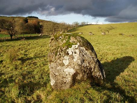
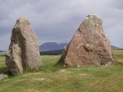
Oh my! What a lovely pair of circles these are. We are parked at the layby for the Loupin Stanes and set out across the field. As we came across the stones, I felt a sense of elation; iron age hillforts are all well and good, but give me an upright stone in a field and I am a very happy girl. This is a lovely compact set of stones, slightly raised but with a sense of isolation which suits the location perfectly. We then set off for the Girdle Stanes, expecting more of the same.
What we weren't expecting is one of the most beautiful and mesmerising circles we have ever seen! We were completely blown away by it all; the fact that it must've been HUGE when complete (although Vicky has her own theory that it was only ever a half circle.....that was something we pondered later over a couple of bottles of wine!), the fact that it reminded us both of Athgreany Circle in Co Wicklow and the fact that it was just bloody marvellous! I really wasn't expecting to feel so enthused by this place and I have a sneaking suspicion that the Girdle Stanes have just crept into my Top 10 Circles of all time list. The whole of this river valley reminded us both of Kilmartin and we wondered what other monuments must have existed here; surely this couldn't be it? As you stand in the valley and look around, it feels like there must be so much more just waiting to be discovered – or possibly ruined and now lost to us. We walked up to the road from here and spent ages just looking back down at this circle, completely in love with the whole place. Fabulous.
Pebs had mentioned that it has rained every time she has visited these stones but I am happy to report that the sun was hovering in the sky, albeit amongst some rather grey looking clouds and we were once again thankful that the weather seemed to be on our side. The ground between the 2 circles was very boggy and it took some time to navigate our way between the two. I definitely would advise walking from the Loupin Stanes to the Girdle Stanes across the fields (there is a wooden sign post showing the way) and then walking back along the road, as it gives you a real sense of how beautiful this valley is.
|

|
|
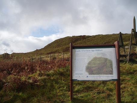
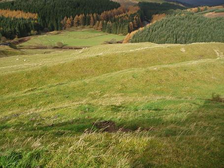
We got out of the car and set off up the wee track, just as the heaven's opened and a deluge of rain and hail came down. We ran back to the car and sat there for 10 minutes until it slowed down a wee bit and then Vicky decided to take the Forestry Commision on single-handedly, by driving up the path and onto the F.C. road which runs below the hillfort! We parked at the base and set off up the steep pathway, feeling rather rebellious and relieved that the rain had stopped and that our walk up had been reduced by her daring actions. Ha ha ha. Oh my, what a site this is! Another great interpretation board and leaflet and even more spectacular views of the valley below. We tried to get our bearings by working out the position of the sun, which was just starting to peek through the grey clouds (being the great explorers that we are) and we were truly impressed with the sheer size of this site. This is said to be the most spectacular of the remaining forts in the area and it is easy to imagine just how impressive it would have been. Weather aside, this is a great time of year to visit these sites as the colours are breathtaking, the bracken has died back and there is a wonderful sense of isolation as you get the whole place to yourselves.
|

|
The weather was still a bit dodgy so the thought of heading up not one but three hillforts in an afternoon was seeming far less likely. However, we got to Bailiehill Fort and parked by the interpretation board. A very friendly, local fisherman came over for a chat and explained the field below was known as the "Handfasting Field"; I think it is the point where the 2 tributaries of the river meet, which seems rather beautifully symbolic. After chatting with him we felt more enthused about attempting the steep climb up to Bailehill so, with wellies and waterproofs on, we set off. Now, wellies are not really the best footwear for walking up steep inclines but it was pretty boggy and we eventually got to the interesting bits, albeit slightly out of breath - but what a view!
Although the skies were still heavy with rain and grey we could see straight across the valley and the colours on the hillsides were stunning. We could also make out a number of other hill fort sites on the surrounding hills as we pottered around. This site has some great thunking ramparts and I was staggered to read that is has never been excavated, so we tried to do a bit of our own "digging", poking around in some of the exposed holes but it proved unfruitful. Bah.
After a good time spent doing our usual "oooh, look at this" and "do you think this is...." and after considering the theory that these were not defensive locations at all but more a case of local one-upmanship and status ("look how high up my house is!") we rather carefully descended the saturated hillside and were ready for more
|
 
|
Having visited this site today I would add the following tip: DO NOT visit when it has rained solidly for days on end and there is little or no sunlight to cast any kind of shadow!
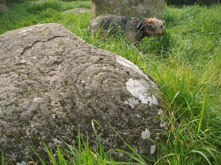
We clambered onto the very slippy rocks and both nearly met our maker at various points!
Ramsey, however, enjoyed drinking rain water out of the more defined cup marks!
|

|
Good Heavens ... astronomer bids to rejuvenate stone circle
http://www.heraldscotland.com/news/home-news/good-heavens-astronomer-bids-to-rejuvenate-stone-circle-1.1032060
It was created in the late 1970s to mirror the rise and fall of the moon and sun across Glasgow on a site of ancient astronomical interest.
Now efforts are being made to rejuvenate the Sighthill Stone Circle, created by amateur astronomer and science writer Duncan Lunan, who brought Britain's first authentically alligned stone circle in more than 3000 years to Glasgow's inner city.
More than 30 years later, Lunan hopes to revive interest in the stone circle, which was built by the Glasgow Parks Astronomy Department using funds from the former Jobs Creation Scheme.
When money for the project was abruptly scrapped by the then prime minister Margaret Thatcher, four pieces of stone never made it to the circle and are now stashed under a nearby bush in Sighthill Park. It is hoped the circle can now be completed as Lunan intended.
At the stones yesterday, Lunan said: "There is still nothing up here to say who built the circle, who it was built for or how it works. I have been told that nowadays children are afraid of it, that they think it is linked to black magic, that sort of thing. That is something I want to change."
The site of the stones may not at first seem a likely spot of spiritual significance given that they are surrounded by 1960s tower blocks, acres of plain parkland and a belching incinerator.
Built on a hilltop with dramatic views across the city, they incorporate the line of the midsummer sunset across the city, which is historically mapped by Dobie's Loan from the neolithic site, where Glasgow Cathedral now sits, to Summerhill.
It was here where midsummer parties were held to celebrate the sun at its highest and most powerful, where bonfires were lit to hail the light and ward off evil spirits believed to roam freely as the sun turned southwards again. The Pagan-style parties continued until the 17th century, when they were halted by the church.
Lunan would like to revive the celebrations of the midsummer sunset at Sighthill, with a
gathering planned for the night of June 21.
Whereas in Neolithic times stone circle creators would take 100 years to observe the movement of the moon, the earth and the light of the sun, Lunan had a matter of months to work out the necessary co-ordinates on his New Stone Age calendar.
"Getting the precision right was the really hard part. And the winters of 1978 and 1979 were really terrible too, you could hardly see a thing," he said.
Photographs and astronomical graphs gave Lunan and his colleagues the necessary guide with the last of the 17 stones lowered into place by an RAF helicopter from HMS Gannet.
"The moon stones were too big to be brought by helicopter so it was the sun stones and the star stones that came by air. That was a hell of a day," he said.
At first the project was to build a replica Stonehenge and Callanish Stones using modern materials, but given the significant astronomical setting it became a true stone circle of which Lunan remains proud.
He built it in tribute to four academics at Glasgow University who are responsible for the promotion and understanding of ancient astronomy; Professor Archie Roy, Dr Ewan McKay, Professor Alexander Thom and his son, Dr Archie Thom. "It started with Alexander Thom who, between the two world wars, was inspired by the falling moon over the Callanish Stones," Lunan said.
"He became convinced that they used astronomy and mathematics on an advanced scale."
The work was continued by his son and explored further by McKay and Roy.
"This was at a time when most archaeologists wouldn't go near this stuff, claiming that primitive society was not capable of such understanding. It is very fitting that this stone circle is in Glasgow, as a tribute to them."
Lunan would ultimately like the stone circle to be a key feature of a city-wide astronomy map, with the entire solar system represented on the correct scale within the city limits. If the stone circle represented the sun, Pluto would be at Cathkin Braes, Lunan said.
An illustrated talk on the Sighthill Stone Circle will be held at the Ogilve Centre, St Aloysius Church, Rose Street, Glasgow, on Monday June 21, followed by a visit to the circle for midsummer sunset from 9.30pm to 10pm.
|

|
 
|
 
|

|
Yes, it is right by the road and we did know this, but.....we still seemed to manage to walk straight past it. Sometimes I think we should concentrate a wee bit more.
We parked at the car park and set off up the left hand track but missed the little footpath to the circle and so had to double-back on ourselves. By the time we saw it, we were so pleased that we trotted straight into a very boggy bit and sank up to our calves. Take care.
This is a strange place; overgrown and boggy and yet with the traffic whizzing by it feels very odd. We had been to Giant's Graves and East Bennan earlier and this felt like a bit of a letdown after such amazing sites.
|
 
|
We initially started to walk to this site from the main stones at Machrie Moor but after about 15 minutes of negotiating boggy peatland and peaty bogland, we headed back and decided to drive instead!
We parked at the rather awful Balmichael visitor centre and set off walking along the roadside. We got confused by the Scottish Water building which wasn't on our map and after much fannying around, realised that the circle was now behind this monstrosity!
This had now become personal! We had already spent about an hour of our time trying to reach this site and nothing was going to hold us back. So, we hopped over the gate, ran across the forecourt and over another gate into a field. A combination of dead heather, gorse and bracken meant that we wandered around for another 15 minutes before FINALLY finding this diminutive circle but boy, were we happy!
The views across to Machrie Moor were spectacular and you can see the main standing stones from here. We had no idea what the circle was called but we named it the Magic Water Cuckoo Stones as we seemed to follow the sound of a cuckoo the whole time we were looking and it finally led us to our destination!
Definitely worth coming here, if only for the aspect, as you can only wonder about what this landscape must've looked like, littered with these stunning monuments, 5000 years ago. Fab.
There is another small, ruined 4 Poster close by - only 2 stones now remain.
|

|
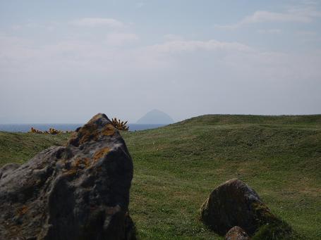
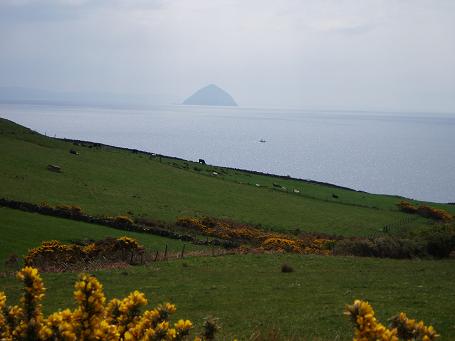
Another site with cracking views across to Ailsa Craig. However, this one had less of a pull for me than East Bennan and you have to wonder why this one was "chosen" to be signposted and looked after, when other, possibly more deserving, sites aren't?
Still, it is a lovely walk through the woods and the views are wonderful.
|
Showing 1-50 of 388 posts. Most recent first | Next 50
A recent move to a bizarre coastal village which gets cut off by the tide twice daily has meant my stone-hunting has become less frequent and also necessitated us selling the VW campervan (boo!) but.....I am still attempting to discover everything within my natural hunting grounds (N Lancs/Cumbria) and I keep being drawn further north to Scotland.......a recent trip to Aberdeenshire has helped develop a healthy obsession with RSCs!
|
|